TopoQuest Logo
Do you find TopoQuest useful?
Help keep TopoQuest running and adding new maps/features by donating!
Bitcoin:  19c7KJd3qBynnjoSw5npx9KScwjBe4ifkT
Litecoin:  LXs6TkuXGGXo1vDsWCkWVdjQX94eUKd6ui
Home View Maps Find Maps Find Places Resources & Links


Savage SE, Montana Topographic Map

USGS Map Title: Savage SE, MT
USGS Map MRC: 47104C3
DRG (GeoTIFF) Download: o47104c3.tif


Neighboring USGS Topographic Map Quads:


  Knife River Mine, MT  
47104D4
 

  Savage, MT  
47104D3
 

  Skaar NW, MT  
47104D2
 

  Savage SW, MT  
47104C4
 

  Savage SE, MT  
47104C3
 

  Parson Creek, MT  
47104C2
 

  Cluster Buttes NW, MT  
47104B4
 

  Cluster Buttes, MT  
47104B3
 

  Odland Dam NW, MT  
47104B2


Map MRC Location:

N48°
W105°
N48°
W104°
H8 H7 H6 H5 H4 H3 H2 H1
G8 G7 G6 G5 G4 G3 G2 G1
F8 F7 F6 F5 F4 F3 F2 F1
E8 E7 E6 E5 E4 E3 E2 E1
D8 D7 D6 D5 D4 D3 D2 D1
C8 C7 C6 C5 C4 C3 C2 C1
B8 B7 B6 B5 B4 B3 B2 B1
A8 A7 A6 A5 A4 A3 A2 A1
N47°
W105°
N47°
W104°

Savage SE, MT USGS 1:24K Topographic Map Preview:
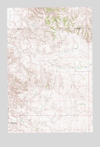
Savage SE, MT USGS Topographic Map
Click on map above to begin viewing in our Map Viewer.

This topographic map contains these locations and features:
Feature Name Type Latitude Longitude GNIS ID View Map
17N58E09BABA01 WellWellN47.2525°W104.3338°821702View Map
18N58E01CCC_01 WellWellN47.3395°W104.2763°822310View Map
18N58E02DADD01 WellWellN47.3433°W104.2777°822338View Map
18N58E08DABA01 WellWellN47.3320°W104.3447°822270View Map
18N58E14CDBB01 WellWellN47.3139°W104.2927°822141View Map
18N58E15BDAC01 WellWellN47.3197°W104.3119°822182View Map
18N58E21CDDD01 WellWellN47.2975°W104.3313°822044View Map
18N58E27BAAD01 WellWellN47.2956°W104.3094°822014View Map
18N58E32BADD01 WellWellN47.2783°W104.3530°821895View Map
18N58E34DCCD01 WellWellN47.2675°W104.3074°821824View Map
Castle CreekStreamN47.2620°W104.3641°769654View Map
Dry Creek School (historical)SchoolN47.3186°W104.2569°1696544View Map
North Fork Dry CreekStreamN47.3203°W104.3083°774741View Map
Smith Creek Grazing District DamDamN47.3400°W104.3355°796263View Map
Temple DamDamN47.2750°W104.3255°796243View Map
Valentine FlatFlatN47.3683°W104.3741°777970View Map

Note: Coordinates in the location and feature list above are referenced to NAD83 datum.


Copyright (C) 2008-2024 Ryan Niemi / Sunset Dynamics ... All Rights Reserved