TopoQuest Logo
Do you find TopoQuest useful?
Help keep TopoQuest running and adding new maps/features by donating!
Bitcoin:  19c7KJd3qBynnjoSw5npx9KScwjBe4ifkT
Litecoin:  LXs6TkuXGGXo1vDsWCkWVdjQX94eUKd6ui
Home View Maps Find Maps Find Places Resources & Links


Saxapahaw, North Carolina Topographic Map

USGS Map Title: Saxapahaw, NC
USGS Map MRC: 35079H3
DRG (GeoTIFF) Download: o35079h3.tif


Neighboring USGS Topographic Map Quads:


  Burlington, NC  
36079A4
 

  Mebane, NC  
36079A3
 

  Efland, NC  
36079A2
 

  Snow Camp, NC  
35079H4
 

  Saxapahaw, NC  
35079H3
 

  White Cross, NC  
35079H2
 

  Crutchfield Crossroads, NC  
35079G4
 

  Silk Hope, NC  
35079G3
 

  Bynum, NC  
35079G2


Map MRC Location:

N36°
W80°
N36°
W79°
H8 H7 H6 H5 H4 H3 H2 H1
G8 G7 G6 G5 G4 G3 G2 G1
F8 F7 F6 F5 F4 F3 F2 F1
E8 E7 E6 E5 E4 E3 E2 E1
D8 D7 D6 D5 D4 D3 D2 D1
C8 C7 C6 C5 C4 C3 C2 C1
B8 B7 B6 B5 B4 B3 B2 B1
A8 A7 A6 A5 A4 A3 A2 A1
N35°
W80°
N35°
W79°

Saxapahaw, NC USGS 1:24K Topographic Map Preview:
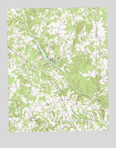
Saxapahaw, NC USGS Topographic Map
Click on map above to begin viewing in our Map Viewer.

This topographic map contains these locations and features:
Feature Name Type Latitude Longitude GNIS ID View Map
B Everett Jordan Elementary SchoolSchoolN35.9065°W79.3006°1007114View Map
Bethlehem ChurchChurchN35.9532°W79.2597°981223View Map
Bethsada ChurchChurchN35.9990°W79.2639°981242View Map
Burnetts ChapelChurchN35.8776°W79.3650°982284View Map
Cane CreekStreamN35.8835°W79.2550°1023876View Map
Cane CreekStreamN35.9096°W79.2683°982591View Map
Cedar Cliff ChurchChurchN35.9640°W79.3611°982804View Map
Chatham ChurchChurchN35.8782°W79.3097°983060View Map
Concord ChurchChurchN35.9021°W79.2895°983435View Map
Eli WhitneyPopulated PlaceN35.9068°W79.3072°1020119View Map
Eli Whitney Volunteer Fire Department Station 5BuildingN35.9065°W79.3069°2639547View Map
Haw CreekStreamN35.9937°W79.3517°986513View Map
Marys CreekStreamN35.9243°W79.2989°989426View Map
Maxwell ChapelChurchN35.9382°W79.3542°989492View Map
Meadow CreekStreamN35.9746°W79.3453°989673View Map
Middle SchoolSchoolN35.9068°W79.3000°989796View Map
Moores ChapelChurchN35.9407°W79.3242°990195View Map
Moores Chapel CemeteryCemeteryN35.9378°W79.3416°990197View Map
Motes CreekStreamN35.9426°W79.3156°990296View Map
OaksPopulated PlaceN35.9535°W79.2572°1021710View Map
Parrish ChapelChurchN35.9621°W79.3222°991893View Map
Pine BranchStreamN35.8788°W79.3278°992229View Map
Saint Mathews ChapelChurchN35.9607°W79.3222°994045View Map
Salem ChurchChurchN35.9740°W79.3111°994176View Map
SaxapahawPopulated PlaceN35.9474°W79.3220°994404View Map
Saxapahaw Census Designated PlaceCensusN35.9490°W79.3210°2402827View Map
Saxapahaw Post OfficePost OfficeN35.9477°W79.3213°2774351View Map
Sellers Manufacturing Company DamDamN35.9485°W79.3264°999791View Map
Sellers Manufacturing Company LakeReservoirN35.9548°W79.3306°999790View Map
South Fork Cane CreekStreamN35.8832°W79.3284°995143View Map
Spring ChurchChurchN35.9024°W79.3259°995331View Map
SutphinPopulated PlaceN35.8893°W79.3467°1022852View Map
Swepsonville Volunteer Fire Department Station 10BuildingN35.9970°W79.2953°2639076View Map
The Duchy AirportAirportN35.9825°W79.2738°2679133View Map
Township 8-NewlinCivilN35.8926°W79.3495°1026350View Map
Township 9-ThompsonCivilN35.9855°W79.3046°1026351View Map
Varnals CreekStreamN35.9862°W79.3511°1024377View Map

Note: Coordinates in the location and feature list above are referenced to NAD83 datum.


Copyright (C) 2008-2024 Ryan Niemi / Sunset Dynamics ... All Rights Reserved