TopoQuest Logo
Do you find TopoQuest useful?
Help keep TopoQuest running and adding new maps/features by donating!
Bitcoin:  19c7KJd3qBynnjoSw5npx9KScwjBe4ifkT
Litecoin:  LXs6TkuXGGXo1vDsWCkWVdjQX94eUKd6ui
Home View Maps Find Maps Find Places Resources & Links


Efland, North Carolina Topographic Map

USGS Map Title: Efland, NC
USGS Map MRC: 36079A2
DRG (GeoTIFF) Download: o36079a2.tif


Neighboring USGS Topographic Map Quads:


  Burlington NE, NC  
36079B3
 

  Cedar Grove, NC  
36079B2
 

  Caldwell, NC  
36079B1
 

  Mebane, NC  
36079A3
 

  Efland, NC  
36079A2
 

  Hillsborough, NC  
36079A1
 

  Saxapahaw, NC  
35079H3
 

  White Cross, NC  
35079H2
 

  Chapel Hill, NC  
35079H1


Map MRC Location:

N37°
W80°
N37°
W79°
H8 H7 H6 H5 H4 H3 H2 H1
G8 G7 G6 G5 G4 G3 G2 G1
F8 F7 F6 F5 F4 F3 F2 F1
E8 E7 E6 E5 E4 E3 E2 E1
D8 D7 D6 D5 D4 D3 D2 D1
C8 C7 C6 C5 C4 C3 C2 C1
B8 B7 B6 B5 B4 B3 B2 B1
A8 A7 A6 A5 A4 A3 A2 A1
N36°
W80°
N36°
W79°

Efland, NC USGS 1:24K Topographic Map Preview:
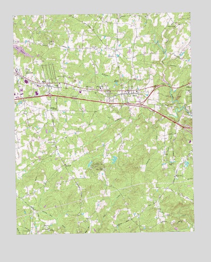
Efland, NC USGS Topographic Map
Click on map above to begin viewing in our Map Viewer.

This topographic map contains these locations and features:
Feature Name Type Latitude Longitude GNIS ID View Map
Allens ChapelChurchN36.0446°W79.1450°980119View Map
Calvary ChurchChurchN36.0821°W79.1250°982458View Map
Camp Chestnut RidgeLocaleN36.0393°W79.1945°982514View Map
Cheeks CrossroadsPopulated PlaceN36.0704°W79.2253°1024880View Map
Chestnut Ridge ChurchChurchN36.0368°W79.1889°983130View Map
Cooper Grove ChurchChurchN36.0904°W79.2145°983506View Map
County Home CemeteryCemeteryN36.1043°W79.1781°983607View Map
Crabtree CreekStreamN36.0599°W79.1525°983695View Map
Cross Roads CemeteryCemeteryN36.0299°W79.1295°983785View Map
Cross Roads ChurchChurchN36.0321°W79.1367°983786View Map
Crystal LakeReservoirN36.0872°W79.2023°983815View Map
Dry RunStreamN36.1024°W79.1433°984369View Map
EflandPopulated PlaceN36.0813°W79.1692°984667View Map
Efland Census Designated PlaceCensusN36.0806°W79.1718°2628622View Map
Efland MillpondLakeN36.0857°W79.1778°984668View Map
Efland Post OfficePost OfficeN36.0809°W79.1708°2774117View Map
Efland Volunteer Fire DepartmentBuildingN36.0808°W79.1780°2639505View Map
Efland-Cheeks SchoolSchoolN36.0829°W79.1892°984669View Map
Fairfield ChurchChurchN36.1235°W79.1747°984902View Map
Faith TabernacleChurchN36.0838°W79.1997°984965View Map
Fellowship LakeReservoirN36.0401°W79.1964°999955View Map
Fellowship Lake DamDamN36.0401°W79.1964°999956View Map
Flying Elephant RanchPopulated PlaceN36.0188°W79.1572°1002513View Map
Garland AcresPopulated PlaceN36.0368°W79.1256°1002505View Map
Harvest ChapelChurchN36.0388°W79.1392°986478View Map
Holly MeadowsPopulated PlaceN36.0749°W79.2289°1002507View Map
Jordan OakPopulated PlaceN36.1090°W79.1739°1002509View Map
Lake MichaelReservoirN36.1085°W79.2497°1000086View Map
Lake MichaelLakeN36.1053°W79.2450°989758View Map
Lake Michael DamDamN36.1085°W79.2497°1000087View Map
Larry F Warren FieldAirportN36.0892°W79.1701°2770355View Map
Lebanon ChurchChurchN36.1099°W79.2242°988269View Map
McGowan CreekStreamN36.0865°W79.1447°989584View Map
MilesPopulated PlaceN36.0862°W79.2264°989850View Map
Oak Grove ChurchChurchN36.0029°W79.2275°991390View Map
Orange Crossroads ChurchChurchN36.1163°W79.1356°991674View Map
Orange-Alamance LakeReservoirN36.0851°W79.1414°1000042View Map
Orange-Alamance Lake DamDamN36.0851°W79.1414°1000041View Map
Perry HillsPopulated PlaceN36.0982°W79.2092°1002508View Map
Rivins LakeReservoirN36.0401°W79.1297°999954View Map
Rivins Lake DamDamN36.0401°W79.1297°999953View Map
Rocky RunStreamN36.0654°W79.1361°993626View Map
Rosewood CemeteryCemeteryN36.0807°W79.1253°993719View Map
Seven Mills FarmsPopulated PlaceN36.0404°W79.1353°1002512View Map
Sevenmile CreekStreamN36.0696°W79.1325°994515View Map
Smiths LakeReservoirN36.0435°W79.1781°999963View Map
Smiths Lake DamDamN36.0435°W79.1781°999964View Map
Stagecoach ForestPopulated PlaceN36.0926°W79.1595°1002510View Map
Sugar RidgePopulated PlaceN36.0063°W79.1808°1002511View Map
Sunset RidgePopulated PlaceN36.1079°W79.2409°1002506View Map
The Peoples ChurchChurchN36.0924°W79.2406°996002View Map
Township of CheeksCivilN36.0857°W79.1968°1027014View Map
White Cross ChurchChurchN36.1054°W79.1933°997136View Map

Note: Coordinates in the location and feature list above are referenced to NAD83 datum.


Copyright (C) 2008-2025 Ryan Niemi / Sunset Dynamics ... All Rights Reserved