TopoQuest Logo
Do you find TopoQuest useful?
Help keep TopoQuest running and adding new maps/features by donating!
Bitcoin:  19c7KJd3qBynnjoSw5npx9KScwjBe4ifkT
Litecoin:  LXs6TkuXGGXo1vDsWCkWVdjQX94eUKd6ui
Home View Maps Find Maps Find Places Resources & Links


Scenery Mountain, Montana Topographic Map

USGS Map Title: Scenery Mountain, MT
USGS Map MRC: 48115D6
DRG (GeoTIFF) Download: o48115d6.tif


Neighboring USGS Topographic Map Quads:


  Pulpit Mountain, MT  
48115E7
 

  Turner Mountain, MT  
48115E6
 

  Gold Hill, MT  
48115E5
 

  Kootenai Falls, MT  
48115D7
 

  Scenery Mountain, MT  
48115D6
 

  Libby, MT  
48115D5
 

  Crowell Mountain, MT  
48115C7
 

  Treasure Mountain, MT  
48115C6
 

  Little Hoodoo Mountain, MT  
48115C5


Map MRC Location:

N49°
W116°
N49°
W115°
H8 H7 H6 H5 H4 H3 H2 H1
G8 G7 G6 G5 G4 G3 G2 G1
F8 F7 F6 F5 F4 F3 F2 F1
E8 E7 E6 E5 E4 E3 E2 E1
D8 D7 D6 D5 D4 D3 D2 D1
C8 C7 C6 C5 C4 C3 C2 C1
B8 B7 B6 B5 B4 B3 B2 B1
A8 A7 A6 A5 A4 A3 A2 A1
N48°
W116°
N48°
W115°

Scenery Mountain, MT USGS 1:24K Topographic Map Preview:
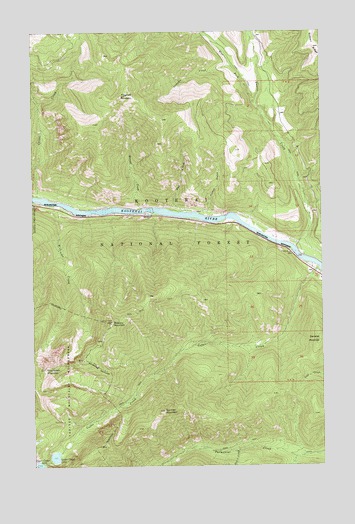
Scenery Mountain, MT USGS Topographic Map
Click on map above to begin viewing in our Map Viewer.

This topographic map contains these locations and features:
Feature Name Type Latitude Longitude GNIS ID View Map
30N31W09CAA01_ WellWellN48.3763°W115.6893°1635194View Map
31N32W24DAAC01 WellWellN48.4336°W115.6263°1635534View Map
Bob C CreekStreamN48.3797°W115.6621°780178View Map
Burrell CreekStreamN48.4491°W115.7035°780657View Map
Cedar CreekStreamN48.4322°W115.6268°781094View Map
China CreekStreamN48.4527°W115.7491°781233View Map
Dad CreekStreamN48.4480°W115.6854°782031View Map
Flagstaff MountainSummitN48.4813°W115.7124°783486View Map
Grambauer MountainSummitN48.4030°W115.7457°784153View Map
Hunter GulchValleyN48.4486°W115.6746°1782398View Map
Lamoka CreekStreamN48.4905°W115.6646°785940View Map
Lower Cedar LakeLakeN48.3777°W115.7421°786663View Map
Norman MountainSummitN48.3908°W115.6943°788057View Map
Quartz CreekStreamN48.4383°W115.6379°789270View Map
Rankin (historical)LocaleN48.4319°W115.6302°1782435View Map
Samater MountainSummitN48.4108°W115.6268°789983View Map
Scenery MountainSummitN48.4166°W115.7166°790107View Map
Scenery Mountain Lookout Station (historical)LocaleN48.4161°W115.7174°794387View Map
West Fork Quartz CreekStreamN48.4791°W115.6541°793062View Map
Williams CreekStreamN48.4502°W115.7413°793319View Map

Note: Coordinates in the location and feature list above are referenced to NAD83 datum.


Copyright (C) 2008-2024 Ryan Niemi / Sunset Dynamics ... All Rights Reserved