TopoQuest Logo
Do you find TopoQuest useful?
Help keep TopoQuest running and adding new maps/features by donating!
Bitcoin:  19c7KJd3qBynnjoSw5npx9KScwjBe4ifkT
Litecoin:  LXs6TkuXGGXo1vDsWCkWVdjQX94eUKd6ui
Home View Maps Find Maps Find Places Resources & Links


Turner Mountain, Montana Topographic Map

USGS Map Title: Turner Mountain, MT
USGS Map MRC: 48115E6
DRG (GeoTIFF) Download: o48115e6.tif


Neighboring USGS Topographic Map Quads:


  Sylvanite, MT  
48115F7
 

  Flatiron Mountain, MT  
48115F6
 

  Pink Mountain, MT  
48115F5
 

  Pulpit Mountain, MT  
48115E7
 

  Turner Mountain, MT  
48115E6
 

  Gold Hill, MT  
48115E5
 

  Kootenai Falls, MT  
48115D7
 

  Scenery Mountain, MT  
48115D6
 

  Libby, MT  
48115D5


Map MRC Location:

N49°
W116°
N49°
W115°
H8 H7 H6 H5 H4 H3 H2 H1
G8 G7 G6 G5 G4 G3 G2 G1
F8 F7 F6 F5 F4 F3 F2 F1
E8 E7 E6 E5 E4 E3 E2 E1
D8 D7 D6 D5 D4 D3 D2 D1
C8 C7 C6 C5 C4 C3 C2 C1
B8 B7 B6 B5 B4 B3 B2 B1
A8 A7 A6 A5 A4 A3 A2 A1
N48°
W116°
N48°
W115°

Turner Mountain, MT USGS 1:24K Topographic Map Preview:
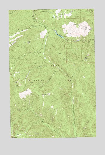
Turner Mountain, MT USGS Topographic Map
Click on map above to begin viewing in our Map Viewer.

This topographic map contains these locations and features:
Feature Name Type Latitude Longitude GNIS ID View Map
Back Side of the Moon Ski TrailTrailN48.6050°W115.6305°1782461View Map
Big Foot CreekStreamN48.5838°W115.6999°779785View Map
Big Red Ski TrailTrailN48.6050°W115.6305°1782466View Map
Boulevard Ski TrailTrailN48.6050°W115.6305°1782468View Map
Boundary Run Ski TrailTrailN48.6050°W115.6305°1782458View Map
Chans Run Ski TrailTrailN48.6050°W115.6305°1782472View Map
China LakeLakeN48.5040°W115.7415°781236View Map
China MountainSummitN48.5008°W115.7499°769845View Map
Cornices Ski TrailTrailN48.6050°W115.6305°1782469View Map
Elk Basin Ski TrailTrailN48.6050°W115.6305°1782459View Map
Far North Ski TrailTrailN48.6050°W115.6305°1782463View Map
Flattail CreekStreamN48.6244°W115.7157°783527View Map
Hennesey CreekStreamN48.5583°W115.6627°784779View Map
Holes Hell Ski TrailTrailN48.6050°W115.6305°1782462View Map
Huson PeakSummitN48.5544°W115.7202°785181View Map
Jeep Road Plus Ski TrailTrailN48.6050°W115.6305°1782478View Map
La Foe LakeSwampN48.6180°W115.6846°785868View Map
Little Tom MountainSummitN48.5816°W115.6805°786385View Map
Loon LakeLakeN48.5999°W115.6777°786564View Map
Loon Lake Recreation SiteLocaleN48.5980°W115.6716°794385View Map
Loon PeakSummitN48.5936°W115.7232°786565View Map
Lost Fork CreekStreamN48.6108°W115.7035°786593View Map
Lower Mambo Ski TrailTrailN48.6050°W115.6305°1782474View Map
Main Ski TrailTrailN48.6050°W115.6305°1782480View Map
Mixing Bowl Ski TrailTrailN48.6050°W115.6305°1782481View Map
Mount TomSummitN48.5763°W115.6402°792259View Map
Near South Ski TrailTrailN48.6050°W115.6305°1782471View Map
NoGo Ski TrailTrailN48.6050°W115.6305°1782460View Map
North Ski TrailTrailN48.6050°W115.6305°1782464View Map
O'Brien MountainSummitN48.5511°W115.7429°788362View Map
Pig Chute Number One Ski TrailTrailN48.6050°W115.6305°1782477View Map
Pig Chute Number Two Ski TrailTrailN48.6050°W115.6305°1782476View Map
Pneumonia Ridge Ski TrailTrailN48.6050°W115.6305°1782470View Map
Powder Mills Ski TrailTrailN48.6050°W115.6305°1782475View Map
Power Dive Ski TrailTrailN48.6050°W115.6305°1782467View Map
Quartz MountainSummitN48.5424°W115.7004°789279View Map
Ransome CreekStreamN48.5663°W115.6760°789384View Map
RunOut Ski TrailTrailN48.6050°W115.6305°1782457View Map
Seventh Heaven Ski TrailTrailN48.6050°W115.6305°1782465View Map
Sun Dance Bowl Ski TrailTrailN48.6050°W115.6305°1782479View Map
Turner MountainSummitN48.6100°W115.6507°792472View Map
Turner Mountain Ski AreaLocaleN48.6050°W115.6305°799358View Map
Upper Mambo Ski TrailTrailN48.6050°W115.6305°1782473View Map

Note: Coordinates in the location and feature list above are referenced to NAD83 datum.


Copyright (C) 2008-2025 Ryan Niemi / Sunset Dynamics ... All Rights Reserved