TopoQuest Logo
Do you find TopoQuest useful?
Help keep TopoQuest running and adding new maps/features by donating!
Bitcoin:  19c7KJd3qBynnjoSw5npx9KScwjBe4ifkT
Litecoin:  LXs6TkuXGGXo1vDsWCkWVdjQX94eUKd6ui
Home View Maps Find Maps Find Places Resources & Links


Schram Lake, New Mexico Topographic Map

USGS Map Title: Schram Lake, NM
USGS Map MRC: 33103G6
DRG (GeoTIFF) Download: o33103g6.tif


Neighboring USGS Topographic Map Quads:


  San Juan Mesa East, NM  
33103H7
 

  Elida, NM  
33103H6
 

  Badger Lake, NM  
33103H5
 

  Kenna, NM  
33103G7
 

  Schram Lake, NM  
33103G6
 

  Elida SE, NM  
33103G5
 

  Lone Wolf, NM  
33103F7
 

  Button Mesa North, NM  
33103F6
 

  Button Mesa NE, NM  
33103F5


Map MRC Location:

N34°
W104°
N34°
W103°
H8 H7 H6 H5 H4 H3 H2 H1
G8 G7 G6 G5 G4 G3 G2 G1
F8 F7 F6 F5 F4 F3 F2 F1
E8 E7 E6 E5 E4 E3 E2 E1
D8 D7 D6 D5 D4 D3 D2 D1
C8 C7 C6 C5 C4 C3 C2 C1
B8 B7 B6 B5 B4 B3 B2 B1
A8 A7 A6 A5 A4 A3 A2 A1
N33°
W104°
N33°
W103°

Schram Lake, NM USGS 1:24K Topographic Map Preview:
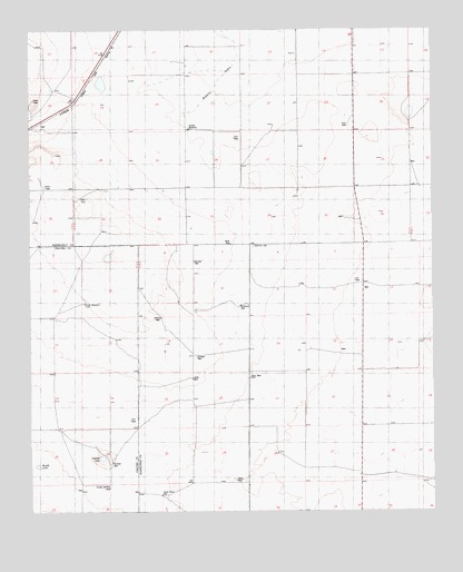
Schram Lake, NM USGS Topographic Map
Click on map above to begin viewing in our Map Viewer.

This topographic map contains these locations and features:
Feature Name Type Latitude Longitude GNIS ID View Map
06096 Water WellWellN33.8362°W103.7444°936082View Map
06099 Water WellWellN33.8251°W103.7463°934769View Map
06109 Water WellWellN33.8693°W103.6650°936242View Map
06110 Water WellWellN33.8493°W103.6977°936244View Map
06111 Water WellWellN33.8504°W103.6719°936245View Map
06112 Water WellWellN33.8515°W103.6294°936246View Map
06113 Water WellWellN33.8343°W103.7200°936078View Map
06114 Water WellWellN33.8340°W103.6675°936077View Map
06115 Water WellWellN33.8320°W103.6641°936258View Map
06116 Water WellWellN33.8265°W103.6500°936264View Map
06160 Water WellWellN33.7973°W103.7477°934782View Map
06161 Water WellWellN33.7970°W103.7316°934750View Map
06164 Water WellWellN33.8201°W103.7033°934772View Map
06165 Water WellWellN33.7984°W103.7025°934785View Map
06166 Water WellWellN33.7973°W103.6833°934751View Map
06168 Water WellWellN33.7887°W103.6800°934789View Map
06169 Water WellWellN33.7854°W103.6966°934744View Map
06171 Water WellWellN33.7576°W103.6461°934731View Map
06172 Water WellWellN33.7631°W103.6716°934800View Map
06173 Water WellWellN33.7565°W103.6838°934729View Map
06174 Water WellWellN33.7568°W103.6805°934730View Map
Berry WellLocaleN33.7581°W103.6863°886257View Map
Daniels WellLocaleN33.8151°W103.6994°888197View Map
Double WindmillLocaleN33.8493°W103.7008°888489View Map
Dunn WellLocaleN33.7851°W103.6819°888578View Map
Hardin WellLocaleN33.8006°W103.7097°889766View Map
Hardt WellLocaleN33.8195°W103.6880°889771View Map
Home Place WellPopulated PlaceN33.7543°W103.7100°899674View Map
Jones WellLocaleN33.7845°W103.7002°890556View Map
McArthur WellLocaleN33.8037°W103.6850°891709View Map
Rickard WellLocaleN33.7901°W103.6986°893888View Map
School Section WellLocaleN33.7562°W103.7261°894640View Map
Schram LakeLakeN33.7640°W103.7284°894662View Map
Schram WellLocaleN33.7629°W103.7252°894663View Map
Smith WindmillLocaleN33.8040°W103.7336°894957View Map
Spillman CemeteryCemeteryN33.8190°W103.6808°895235View Map
Woods LakeLakeN33.7620°W103.7484°896759View Map

Note: Coordinates in the location and feature list above are referenced to NAD83 datum.


Copyright (C) 2008-2025 Ryan Niemi / Sunset Dynamics ... All Rights Reserved