TopoQuest Logo
Do you find TopoQuest useful?
Help keep TopoQuest running and adding new maps/features by donating!
Bitcoin:  19c7KJd3qBynnjoSw5npx9KScwjBe4ifkT
Litecoin:  LXs6TkuXGGXo1vDsWCkWVdjQX94eUKd6ui
Home View Maps Find Maps Find Places Resources & Links


Scipio South, Utah Topographic Map

USGS Map Title: Scipio South, UT
USGS Map MRC: 39112B1
DRG (GeoTIFF) Download: o39112b1.tif


Neighboring USGS Topographic Map Quads:


  Williams Peak, UT  
39112C2
 

  Scipio North, UT  
39112C1
 

  Hells Kitchen Canyon SW, UT  
39111C8
 

  Scipio Pass, UT  
39112B2
 

  Scipio South, UT  
39112B1
 

  Hayes Canyon, UT  
39111B8
 

  Coffee Peak, UT  
39112A2
 

  Scipio Lake, UT  
39112A1
 

  Redmond Canyon, UT  
39111A8


Map MRC Location:

N40°
W113°
N40°
W112°
H8 H7 H6 H5 H4 H3 H2 H1
G8 G7 G6 G5 G4 G3 G2 G1
F8 F7 F6 F5 F4 F3 F2 F1
E8 E7 E6 E5 E4 E3 E2 E1
D8 D7 D6 D5 D4 D3 D2 D1
C8 C7 C6 C5 C4 C3 C2 C1
B8 B7 B6 B5 B4 B3 B2 B1
A8 A7 A6 A5 A4 A3 A2 A1
N39°
W113°
N39°
W112°

Scipio South, UT USGS 1:24K Topographic Map Preview:
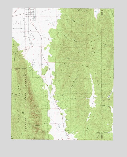
Scipio South, UT USGS Topographic Map
Click on map above to begin viewing in our Map Viewer.

This topographic map contains these locations and features:
Feature Name Type Latitude Longitude GNIS ID View Map
Basin CanyonValleyN39.2283°W112.0697°1438413View Map
Billys CanyonValleyN39.1444°W112.0602°1438777View Map
Cal ValleyBasinN39.1625°W112.0266°1439424View Map
Crooked CanyonValleyN39.2133°W112.1177°1440161View Map
Devils CanyonValleyN39.2500°W112.0508°1440421View Map
Indian KnollSummitN39.1341°W112.0577°1442013View Map
Klondike CanyonValleyN39.1677°W112.0663°1442343View Map
Little ValleyValleyN39.1458°W112.0335°1442793View Map
Lone Cedar PassGapN39.1319°W112.0160°1442869View Map
Long KnollSummitN39.1925°W112.0827°1442923View Map
Lowrys CanyonValleyN39.2158°W112.0013°1443036View Map
Noon Rock CanyonValleyN39.1961°W112.0991°1443841View Map
Noon Rock PeakSummitN39.1916°W112.1210°1443842View Map
Ralph Lund SpringSpringN39.1640°W112.0081°1444719View Map
Raspberry CanyonValleyN39.1436°W112.0788°1444727View Map
Round ValleyValleyN39.1522°W112.0655°1445180View Map
Round Valley CreekStreamN39.2500°W112.0991°1445183View Map
Sawmill CanyonValleyN39.1961°W112.0988°1445344View Map
ScipioPopulated PlaceN39.2450°W112.1041°1445376View Map
Scipio Ambulance ServiceBuildingN39.2478°W112.1036°2665428View Map
Scipio Fire DepartmentBuildingN39.2478°W112.1036°2627279View Map
Scipio Pioneer CemeteryCemeteryN39.2411°W112.0993°2769298View Map
Snage CanyonValleyN39.2430°W112.0594°1445724View Map
Sorensen CanyonValleyN39.2011°W112.0722°1445786View Map
Sweetwater CanyonValleyN39.1722°W112.0013°1446291View Map
The Church of Jesus Christ of Latter Day SaintsChurchN39.2466°W112.1044°1449627View Map
The GapLocaleN39.1825°W112.0880°1437885View Map
Town of ScipioCivilN39.2491°W112.1044°2413266View Map
Upper Ebbs SpringSpringN39.1667°W112.1218°1433807View Map
Wills HoleBasinN39.1500°W112.1091°1447451View Map

Note: Coordinates in the location and feature list above are referenced to NAD83 datum.


Copyright (C) 2008-2025 Ryan Niemi / Sunset Dynamics ... All Rights Reserved