TopoQuest Logo
Do you find TopoQuest useful?
Help keep TopoQuest running and adding new maps/features by donating!
Bitcoin:  19c7KJd3qBynnjoSw5npx9KScwjBe4ifkT
Litecoin:  LXs6TkuXGGXo1vDsWCkWVdjQX94eUKd6ui
Home View Maps Find Maps Find Places Resources & Links


Bison, Kansas Topographic Map

USGS Map Title: Bison, KS
USGS Map MRC: 38099E2
DRG (GeoTIFF) Download: o38099e2.tif


Neighboring USGS Topographic Map Quads:


  Liebenthal, KS  
38099F3
 

  Pfeifer, KS  
38099F2
 

  Otis NE, KS  
38099F1
 

  La Crosse, KS  
38099E3
 

  Bison, KS  
38099E2
 

  Otis, KS  
38099E1
 

  Rush Center, KS  
38099D3
 

  Timken, KS  
38099D2
 

  Albert, KS  
38099D1


Map MRC Location:

N39°
W100°
N39°
W99°
H8 H7 H6 H5 H4 H3 H2 H1
G8 G7 G6 G5 G4 G3 G2 G1
F8 F7 F6 F5 F4 F3 F2 F1
E8 E7 E6 E5 E4 E3 E2 E1
D8 D7 D6 D5 D4 D3 D2 D1
C8 C7 C6 C5 C4 C3 C2 C1
B8 B7 B6 B5 B4 B3 B2 B1
A8 A7 A6 A5 A4 A3 A2 A1
N38°
W100°
N38°
W99°

Bison, KS USGS 1:24K Topographic Map Preview:
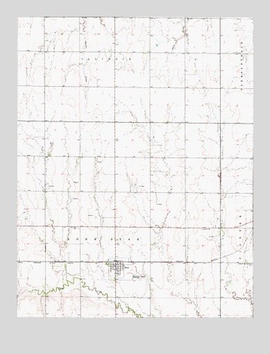
Bison, KS USGS Topographic Map
Click on map above to begin viewing in our Map Viewer.

This topographic map contains these locations and features:
Feature Name Type Latitude Longitude GNIS ID View Map
Baptist CemeteryCemeteryN38.5368°W99.1525°475493View Map
BisonPopulated PlaceN38.5228°W99.1973°475494View Map
Bison City HallBuildingN38.5214°W99.1981°2693040View Map
Bison Community LibraryBuildingN38.5213°W99.1979°1958653View Map
Bison Post OfficePost OfficeN38.5215°W99.1985°2693632View Map
Bison United Methodist ChurchChurchN38.5218°W99.1992°2689356View Map
Bison Wastewater Treatment PlantLocaleN38.5169°W99.1884°2692053View Map
City of BisonCivilN38.5198°W99.1978°2394177View Map
Lone Star CemeteryCemeteryN38.5373°W99.2181°475491View Map
Mid - State Farmers Co - Operative Grain Elevator Number 3LocaleN38.5237°W99.1986°2695237View Map
Otis - Bison Middle SchoolSchoolN38.5198°W99.1978°480695View Map
Pioneer (historical)LocaleN38.5964°W99.2307°482544View Map
Rush County Fire District 5 BisonBuildingN38.5214°W99.1980°2111806View Map
Seventh Day Adventist CemeteryCemeteryN38.5222°W99.1257°475492View Map
Township of Lone StarCivilN38.5304°W99.1984°475616View Map

Note: Coordinates in the location and feature list above are referenced to NAD83 datum.


Copyright (C) 2008-2025 Ryan Niemi / Sunset Dynamics ... All Rights Reserved