TopoQuest Logo
Do you find TopoQuest useful?
Help keep TopoQuest running and adding new maps/features by donating!
Bitcoin:  19c7KJd3qBynnjoSw5npx9KScwjBe4ifkT
Litecoin:  LXs6TkuXGGXo1vDsWCkWVdjQX94eUKd6ui
Home View Maps Find Maps Find Places Resources & Links


Scrivner Butte, Wyoming Topographic Map

USGS Map Title: Scrivner Butte, WY
USGS Map MRC: 41108A7
DRG (GeoTIFF) Download: o41108a7.tif


Neighboring USGS Topographic Map Quads:


  Potter Mountain, WY  
41108B8
 

  Erickson-Kent Ranch, WY  
41108B7
 

  Chicken Creek West, WY  
41108B6
 

  Four J Rim, WY  
41108A8
 

  Scrivner Butte, WY  
41108A7
 

  Chicken Creek SW, WY  
41108A6
 

  Beaver Basin, CO  
40108H8
 

  Sparks, CO  
40108H7
 

  Sugarloaf Butte, CO  
40108H6


Map MRC Location:

N42°
W109°
N42°
W108°
H8 H7 H6 H5 H4 H3 H2 H1
G8 G7 G6 G5 G4 G3 G2 G1
F8 F7 F6 F5 F4 F3 F2 F1
E8 E7 E6 E5 E4 E3 E2 E1
D8 D7 D6 D5 D4 D3 D2 D1
C8 C7 C6 C5 C4 C3 C2 C1
B8 B7 B6 B5 B4 B3 B2 B1
A8 A7 A6 A5 A4 A3 A2 A1
N41°
W109°
N41°
W108°

Scrivner Butte, WY USGS 1:24K Topographic Map Preview:
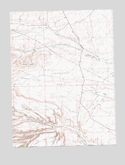
Scrivner Butte, WY USGS Topographic Map
Click on map above to begin viewing in our Map Viewer.

This topographic map contains these locations and features:
Feature Name Type Latitude Longitude GNIS ID View Map
Birdie GulchValleyN41.0126°W108.8463°169613View Map
Canyon CreekStreamN41.0002°W108.7793°1586345View Map
Canyon Creek CampLocaleN41.0489°W108.7732°1586349View Map
Canyon Creek Gas FieldOilfieldN41.0322°W108.7762°1586350View Map
Canyon Creek MineMineN41.0247°W108.8090°1586351View Map
Canyon Creek RanchLocaleN41.0113°W108.8473°1586352View Map
Coyote CreekStreamN41.0880°W108.7898°1587137View Map
Diamond FieldFlatN41.0052°W108.8412°1587587View Map
Fisher CreekStreamN41.0019°W108.7859°169678View Map
Graham RanchLocaleN41.0280°W108.8629°1589018View Map
Guy Rife RanchLocaleN41.0786°W108.7671°1589200View Map
Horseshoe BasinBasinN41.0622°W108.8137°1589725View Map
Johnson DrawValleyN41.0073°W108.8533°1590168View Map
Koskie ProspectMineN41.0342°W108.8239°1747085View Map
McKnight SpringSpringN41.0827°W108.7782°1591362View Map
North Fork Vermillion CreekStreamN41.0839°W108.7796°1592218View Map
Owl CanyonValleyN41.0233°W108.8362°1592516View Map
Rife RanchLocaleN41.1097°W108.8309°1593455View Map
Scofield RanchLocaleN41.0888°W108.8482°1594043View Map
Scrivner ButteSummitN41.0752°W108.8543°1594063View Map
Scrivner CanyonValleyN41.0850°W108.8612°1594064View Map
Two Bar SpringSpringN41.0208°W108.8279°1595819View Map
Whiskey DrawValleyN41.0138°W108.8200°169611View Map

Note: Coordinates in the location and feature list above are referenced to NAD83 datum.


Copyright (C) 2008-2024 Ryan Niemi / Sunset Dynamics ... All Rights Reserved