TopoQuest Logo
Do you find TopoQuest useful?
Help keep TopoQuest running and adding new maps/features by donating!
Bitcoin:  19c7KJd3qBynnjoSw5npx9KScwjBe4ifkT
Litecoin:  LXs6TkuXGGXo1vDsWCkWVdjQX94eUKd6ui
Home View Maps Find Maps Find Places Resources & Links


Sedalia, South Carolina Topographic Map

USGS Map Title: Sedalia, SC
USGS Map MRC: 34081E6
DRG (GeoTIFF) Download: o34081e6.tif


Neighboring USGS Topographic Map Quads:


  Cross Anchor, SC  
34081F7
 

  Union West, SC  
34081F6
 

  Union East, SC  
34081F5
 

  Philson Crossroads, SC  
34081E7
 

  Sedalia, SC  
34081E6
 

  Whitmire North, SC  
34081E5
 

  Joanna, SC  
34081D7
 

  Newberry NW, SC  
34081D6
 

  Whitmire South, SC  
34081D5


Map MRC Location:

N35°
W82°
N35°
W81°
H8 H7 H6 H5 H4 H3 H2 H1
G8 G7 G6 G5 G4 G3 G2 G1
F8 F7 F6 F5 F4 F3 F2 F1
E8 E7 E6 E5 E4 E3 E2 E1
D8 D7 D6 D5 D4 D3 D2 D1
C8 C7 C6 C5 C4 C3 C2 C1
B8 B7 B6 B5 B4 B3 B2 B1
A8 A7 A6 A5 A4 A3 A2 A1
N34°
W82°
N34°
W81°

Sedalia, SC USGS 1:24K Topographic Map Preview:
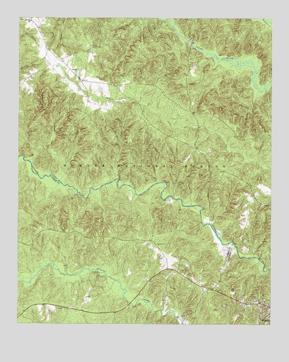
Sedalia, SC USGS Topographic Map
Click on map above to begin viewing in our Map Viewer.

This topographic map contains these locations and features:
Feature Name Type Latitude Longitude GNIS ID View Map
Adams FordCrossingN34.6154°W81.6659°1232814View Map
Black Buck Hunt CampLocaleN34.5710°W81.6637°1230612View Map
Browns Ferry (historical)CrossingN34.5551°W81.7123°1232842View Map
Canaan School (historical)SchoolN34.5865°W81.6643°1232849View Map
Cane Brake BranchStreamN34.5529°W81.6915°1252163View Map
Carver SchoolSchoolN34.5096°W81.6273°1247181View Map
Cross Keys DivisionCivilN34.5798°W81.6842°1938244View Map
Duckett Spring BranchStreamN34.5218°W81.6270°1252188View Map
Enoree Presbyterian Church (historical)ChurchN34.6015°W81.7165°1232876View Map
Flint Hill Church (historical)ChurchN34.5535°W81.6334°1232890View Map
Galilee Baptist ChurchChurchN34.6015°W81.6976°1247860View Map
Gist BridgeBridgeN34.6146°W81.6645°1232904View Map
Gist Bridge Boat RampLocaleN34.5985°W81.6665°1252021View Map
Gist CemeteryCemeteryN34.6017°W81.6797°1232905View Map
Gist Mill (historical)LocaleN34.6154°W81.6670°1232907View Map
Hickory Nut Hunt CampLocaleN34.5832°W81.6459°1230609View Map
Hills CreekStreamN34.5579°W81.7284°1229801View Map
Jones Ferry (historical)CrossingN34.5479°W81.6590°1232941View Map
Judas BranchStreamN34.5657°W81.7434°1252099View Map
Knights Mill (historical)LocaleN34.5029°W81.6712°1234862View Map
Langston BranchStreamN34.5199°W81.7268°1252166View Map
Laurens County Fire Department Renno Station 2BuildingN34.5061°W81.7238°2578437View Map
New Hope ChurchChurchN34.6112°W81.7148°1249827View Map
New Hope School (historical)SchoolN34.6107°W81.7151°1232993View Map
New Prospects CemeteryCemeteryN34.6110°W81.7142°1232994View Map
Odell Church (historical)ChurchN34.5293°W81.6776°1252168View Map
Odells BranchStreamN34.5326°W81.6484°1252169View Map
Odels FordCrossingN34.5335°W81.6434°1251725View Map
Old Quaker CemeteryCemeteryN34.5918°W81.7007°1249970View Map
Padgetts Creek Baptist ChurchChurchN34.6243°W81.7445°1250009View Map
Quaker ChurchChurchN34.6126°W81.7357°1233011View Map
Ridge Road Hunt CampLocaleN34.5543°W81.7076°1230611View Map
Rose Hill Plantation (historical)LocaleN34.6060°W81.6632°1233023View Map
Rose Hill State ParkParkN34.6065°W81.6637°1230257View Map
SedaliaPopulated PlaceN34.6040°W81.7245°1231787View Map
Sedalia Lookout TowerTowerN34.6129°W81.7140°1242466View Map
Sedalia School (historical)SchoolN34.6124°W81.7362°1233036View Map
Sedalia Tower Hunt CampLocaleN34.6126°W81.7109°1252022View Map
Shady Grove (historical)Populated PlaceN34.5724°W81.6632°1233037View Map
Spring Hill ChurchChurchN34.5326°W81.6809°1230358View Map
Spring Hill School (historical)SchoolN34.5340°W81.6826°1234977View Map
Wrights Mill (historical)LocaleN34.5537°W81.6787°1233091View Map

Note: Coordinates in the location and feature list above are referenced to NAD83 datum.


Copyright (C) 2008-2025 Ryan Niemi / Sunset Dynamics ... All Rights Reserved