TopoQuest Logo
Do you find TopoQuest useful?
Help keep TopoQuest running and adding new maps/features by donating!
Bitcoin:  19c7KJd3qBynnjoSw5npx9KScwjBe4ifkT
Litecoin:  LXs6TkuXGGXo1vDsWCkWVdjQX94eUKd6ui
Home View Maps Find Maps Find Places Resources & Links


Seely, Wyoming Topographic Map

USGS Map Title: Seely, WY
USGS Map MRC: 44104G5
DRG (GeoTIFF) Download: o44104g5.tif


Neighboring USGS Topographic Map Quads:


  Page Draw, WY  
44104H6
 

  Gaff Creek, WY  
44104H5
 

  Antelope Gulch, WY  
44104H4
 

  Strawberry Hill, WY  
44104G6
 

  Seely, WY  
44104G5
 

  Mona, WY  
44104G4
 

  Moore Hill, WY  
44104F6
 

  Hulett, WY  
44104F5
 

  Alva, WY  
44104F4


Map MRC Location:

N45°
W105°
N45°
W104°
H8 H7 H6 H5 H4 H3 H2 H1
G8 G7 G6 G5 G4 G3 G2 G1
F8 F7 F6 F5 F4 F3 F2 F1
E8 E7 E6 E5 E4 E3 E2 E1
D8 D7 D6 D5 D4 D3 D2 D1
C8 C7 C6 C5 C4 C3 C2 C1
B8 B7 B6 B5 B4 B3 B2 B1
A8 A7 A6 A5 A4 A3 A2 A1
N44°
W105°
N44°
W104°

Seely, WY USGS 1:24K Topographic Map Preview:
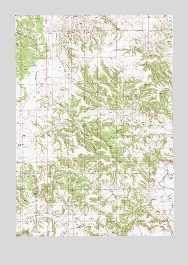
Seely, WY USGS Topographic Map
Click on map above to begin viewing in our Map Viewer.

This topographic map contains these locations and features:
Feature Name Type Latitude Longitude GNIS ID View Map
Ballou RanchLocaleN44.8369°W104.6058°1585088View Map
Bay MountainSummitN44.7517°W104.6177°1585224View Map
Bay RanchLocaleN44.7872°W104.6177°1585225View Map
Bear CreekStreamN44.8114°W104.5136°1585247View Map
Belle RanchLocaleN44.7625°W104.5036°1585376View Map
Buck CreekStreamN44.7758°W104.5008°1586008View Map
Cedar Creek Number One MineMineN44.8230°W104.6100°1704251View Map
Clark Radar Bomb Scoring SiteMilitaryN44.8467°W104.5770°2512084View Map
Davidson Property MineMineN44.8350°W104.5969°1726382View Map
Dry Doe CreekStreamN44.8280°W104.5963°1587825View Map
Hulett DivisionCivilN44.8305°W104.5417°1939715View Map
Jay SchoolSchoolN44.8528°W104.5008°1590067View Map
Johnson SchoolSchoolN44.8233°W104.5991°1590203View Map
Lee RanchLocaleN44.7680°W104.6208°1590625View Map
Lovers LeapCliffN44.7742°W104.6166°1591073View Map
Nielsen RanchLocaleN44.7886°W104.5080°1592035View Map
North Fork Deer CreekStreamN44.8155°W104.5755°1592166View Map
Pearson RanchLocaleN44.8497°W104.5647°1592646View Map
SeelyPopulated PlaceN44.8078°W104.6205°1597491View Map
Seely ForkStreamN44.8103°W104.6022°1594086View Map
Squaw ButtesSummitN44.8072°W104.5450°1594943View Map
Steam Engine CanyonValleyN44.8130°W104.5758°1594998View Map

Note: Coordinates in the location and feature list above are referenced to NAD83 datum.


Copyright (C) 2008-2025 Ryan Niemi / Sunset Dynamics ... All Rights Reserved