TopoQuest Logo
Do you find TopoQuest useful?
Help keep TopoQuest running and adding new maps/features by donating!
Bitcoin:  19c7KJd3qBynnjoSw5npx9KScwjBe4ifkT
Litecoin:  LXs6TkuXGGXo1vDsWCkWVdjQX94eUKd6ui
Home View Maps Find Maps Find Places Resources & Links


Sellers, Mississippi Topographic Map

USGS Map Title: Sellers, MS
USGS Map MRC: 30089E3
DRG (GeoTIFF) Download: o30089e3.tif


Neighboring USGS Topographic Map Quads:


  Savannah, MS  
30089F4
 

  Silver Run, MS  
30089F3
 

  McHenry, MS  
30089F2
 

  Necaise, MS  
30089E4
 

  Sellers, MS  
30089E3
 

  Wortham, MS  
30089E2
 

  Kiln, MS  
30089D4
 

  Dedeaux, MS  
30089D3
 

  Gulfport NW, MS  
30089D2


Map MRC Location:

N31°
W90°
N31°
W89°
H8 H7 H6 H5 H4 H3 H2 H1
G8 G7 G6 G5 G4 G3 G2 G1
F8 F7 F6 F5 F4 F3 F2 F1
E8 E7 E6 E5 E4 E3 E2 E1
D8 D7 D6 D5 D4 D3 D2 D1
C8 C7 C6 C5 C4 C3 C2 C1
B8 B7 B6 B5 B4 B3 B2 B1
A8 A7 A6 A5 A4 A3 A2 A1
N30°
W90°
N30°
W89°

Sellers, MS USGS 1:24K Topographic Map Preview:
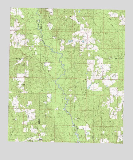
Sellers, MS USGS Topographic Map
Click on map above to begin viewing in our Map Viewer.

This topographic map contains these locations and features:
Feature Name Type Latitude Longitude GNIS ID View Map
Bay BranchStreamN30.5485°W89.2909°692475View Map
Bell CreekStreamN30.5571°W89.3248°692533View Map
Bethel Memorial ChurchChurchN30.5957°W89.3178°705402View Map
Country Acres Summer CampLocaleN30.5287°W89.3630°2596129View Map
Crane CreekStreamN30.6099°W89.3451°693002View Map
Dedeaux School (historical)SchoolN30.5019°W89.3406°705410View Map
First Pentecostal Lighthouse ChurchChurchN30.5541°W89.3609°705447View Map
Grace Baptist ChurchChurchN30.5467°W89.2532°2596468View Map
LizanaPopulated PlaceN30.5377°W89.2523°693796View Map
Mill CreekStreamN30.5871°W89.3295°693988View Map
Mississippi No Name 43 DamDamN30.5952°W89.3467°695288View Map
Morning Glory LakeReservoirN30.5747°W89.3643°705448View Map
Page CemeteryCemeteryN30.5913°W89.2909°705422View Map
Persimmon Mill ChurchChurchN30.6055°W89.2945°705424View Map
Post 58 Volunteer Fire Department Station 2BuildingN30.5948°W89.3403°2668085View Map
RicevillePopulated PlaceN30.6063°W89.2959°694554View Map
Salem Scout Lake DamDamN30.5735°W89.3584°695286View Map
Salmen Scout ReservationLocaleN30.5724°W89.3592°705449View Map
Salmon Boy Scout CampLocaleN30.5743°W89.3600°2596197View Map
Sand Hill CemeteryCemeteryN30.5205°W89.3675°694692View Map
Scenic Trails CampgroundLocaleN30.5729°W89.3491°2596751View Map
SellersPopulated PlaceN30.5916°W89.3576°694742View Map
Sellers BridgeBridgeN30.5949°W89.3395°705429View Map
Sellers School (historical)SchoolN30.5919°W89.3573°705530View Map
Shaw CemeteryCemeteryN30.5991°W89.3259°694754View Map
Shaw Lake DamDamN30.5519°W89.2700°695285View Map
Shaw Lake DamDamN30.6235°W89.3001°695296View Map
Wolf Creek ChurchChurchN30.5466°W89.3620°705450View Map
Wolf River CemeteryCemeteryN30.5224°W89.3020°695210View Map

Note: Coordinates in the location and feature list above are referenced to NAD83 datum.


Copyright (C) 2008-2025 Ryan Niemi / Sunset Dynamics ... All Rights Reserved