TopoQuest Logo
Do you find TopoQuest useful?
Help keep TopoQuest running and adding new maps/features by donating!
Bitcoin:  19c7KJd3qBynnjoSw5npx9KScwjBe4ifkT
Litecoin:  LXs6TkuXGGXo1vDsWCkWVdjQX94eUKd6ui
Home View Maps Find Maps Find Places Resources & Links


Necaise, Mississippi Topographic Map

USGS Map Title: Necaise, MS
USGS Map MRC: 30089E4
DRG (GeoTIFF) Download: o30089e4.tif


Neighboring USGS Topographic Map Quads:


  Millard, MS  
30089F5
 

  Savannah, MS  
30089F4
 

  Silver Run, MS  
30089F3
 

  Caesar, MS  
30089E5
 

  Necaise, MS  
30089E4
 

  Sellers, MS  
30089E3
 

  Dead Tiger Creek, MS  
30089D5
 

  Kiln, MS  
30089D4
 

  Dedeaux, MS  
30089D3


Map MRC Location:

N31°
W90°
N31°
W89°
H8 H7 H6 H5 H4 H3 H2 H1
G8 G7 G6 G5 G4 G3 G2 G1
F8 F7 F6 F5 F4 F3 F2 F1
E8 E7 E6 E5 E4 E3 E2 E1
D8 D7 D6 D5 D4 D3 D2 D1
C8 C7 C6 C5 C4 C3 C2 C1
B8 B7 B6 B5 B4 B3 B2 B1
A8 A7 A6 A5 A4 A3 A2 A1
N30°
W90°
N30°
W89°

Necaise, MS USGS 1:24K Topographic Map Preview:
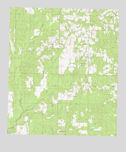
Necaise, MS USGS Topographic Map
Click on map above to begin viewing in our Map Viewer.

This topographic map contains these locations and features:
Feature Name Type Latitude Longitude GNIS ID View Map
B M Brignse Lake DamDamN30.5635°W89.4067°680462View Map
Bennett (historical)Populated PlaceN30.5585°W89.4292°690042View Map
Bobby Sides Lake DamDamN30.6219°W89.4217°680472View Map
Crane CreekPopulated PlaceN30.6099°W89.3848°710452View Map
Crane Creek ChurchChurchN30.6113°W89.3848°668927View Map
Cuevas Lake DamDamN30.5335°W89.4317°680458View Map
Hancock North Central High SchoolSchoolN30.5037°W89.4409°689410View Map
Mint Julep AirparkAirportN30.5481°W89.4615°2676417View Map
NecaisePopulated PlaceN30.6019°W89.4142°674537View Map
Necaise CemeteryCemeteryN30.6102°W89.4281°674538View Map
Necaise Lake DamDamN30.5719°W89.4134°680465View Map
Necaise Lootout TowerTowerN30.6099°W89.4076°689418View Map
Post 58 Volunteer Fire Department Station 1BuildingN30.5345°W89.4258°2667692View Map
Saint Matthew the Apostle ChurchChurchN30.5690°W89.4182°2596192View Map
Sellers Lookout TowerTowerN30.6044°W89.3781°711310View Map
Shiloh ChurchChurchN30.5905°W89.4112°677676View Map
Smith Lake DamDamN30.5685°W89.4217°680464View Map
StandardPopulated PlaceN30.5496°W89.3778°689429View Map
Victory ChurchChurchN30.5388°W89.4239°689435View Map
White Cypress ChurchChurchN30.5491°W89.4151°679585View Map
White Cypress CreekStreamN30.5210°W89.4823°679586View Map

Note: Coordinates in the location and feature list above are referenced to NAD83 datum.


Copyright (C) 2008-2025 Ryan Niemi / Sunset Dynamics ... All Rights Reserved