TopoQuest Logo
Do you find TopoQuest useful?
Help keep TopoQuest running and adding new maps/features by donating!
Bitcoin:  19c7KJd3qBynnjoSw5npx9KScwjBe4ifkT
Litecoin:  LXs6TkuXGGXo1vDsWCkWVdjQX94eUKd6ui
Home View Maps Find Maps Find Places Resources & Links


Alberhill, California Topographic Map

USGS Map Title: Alberhill, CA
USGS Map MRC: 33117F4
DRG (GeoTIFF) Download: o33117f4.tif


Neighboring USGS Topographic Map Quads:


  Corona South, CA  
33117G5
 

  Lake Mathews, CA  
33117G4
 

  Steele Peak, CA  
33117G3
 

  Santiago Peak, CA  
33117F5
 

  Alberhill, CA  
33117F4
 

  Lake Elsinore, CA  
33117F3
 

  Canada Gobernadora, CA  
33117E5
 

  Sitton Peak, CA  
33117E4
 

  Wildomar, CA  
33117E3


Map MRC Location:

N34°
W118°
N34°
W117°
H8 H7 H6 H5 H4 H3 H2 H1
G8 G7 G6 G5 G4 G3 G2 G1
F8 F7 F6 F5 F4 F3 F2 F1
E8 E7 E6 E5 E4 E3 E2 E1
D8 D7 D6 D5 D4 D3 D2 D1
C8 C7 C6 C5 C4 C3 C2 C1
B8 B7 B6 B5 B4 B3 B2 B1
A8 A7 A6 A5 A4 A3 A2 A1
N33°
W118°
N33°
W117°

Alberhill, CA USGS 1:24K Topographic Map Preview:
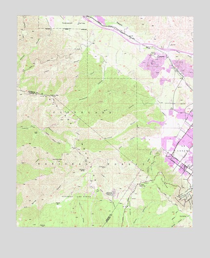
Alberhill, CA USGS Topographic Map
Click on map above to begin viewing in our Map Viewer.

This topographic map contains these locations and features:
Feature Name Type Latitude Longitude GNIS ID View Map
AlberhillPopulated PlaceN33.7272°W117.3998°1660239View Map
Alberhill CanyonValleyN33.7324°W117.3933°2778666View Map
Bishop CanyonValleyN33.7011°W117.4034°251991View Map
Blue Jay CampgroundLocaleN33.6517°W117.4506°277085View Map
Blue Jay TrailheadLocaleN33.6521°W117.4482°2548737View Map
Brooks CanyonValleyN33.6484°W117.3781°270022View Map
Cariso Truck TrailTrailN33.6617°W117.4053°270298View Map
Chiquito SpringSpringN33.6384°W117.4708°270439View Map
Cow CanyonValleyN33.7172°W117.4400°270640View Map
Dickey CanyonValleyN33.6725°W117.4039°270874View Map
East Horsetheif TrailTrailN33.7011°W117.4362°1849255View Map
Edwards CanyonValleyN33.6430°W117.3798°271019View Map
El Cariso CampgroundLocaleN33.6589°W117.4106°277091View Map
El Cariso Guard StationLocaleN33.6511°W117.4125°271030View Map
El Cariso Nature TrailTrailN33.6472°W117.4128°277092View Map
El Cariso Picnic SiteLocaleN33.6511°W117.4133°2548698View Map
Falcon CampgroundLocaleN33.6564°W117.4539°277084View Map
Falcon TrailTrailN33.6550°W117.4523°1765647View Map
Fire Fighter Memorial Picnic SiteLocaleN33.6517°W117.4083°2548700View Map
Guthrie CanyonValleyN33.6452°W117.3780°271459View Map
Harlan CanyonValleyN33.6442°W117.3800°271495View Map
Horsethief CanyonValleyN33.7225°W117.4370°271658View Map
Horsethief TrailTrailN33.6881°W117.4703°271660View Map
Indian CanyonValleyN33.7320°W117.4514°271708View Map
Indian Truck TrailTrailN33.7234°W117.4762°271720View Map
Interchange 81CrossingN33.7299°W117.3936°2455494View Map
Interchange 85CrossingN33.7485°W117.4524°2455497View Map
Johnson CanyonValleyN33.6447°W117.3795°271800View Map
Leach CanyonValleyN33.6772°W117.3992°272007View Map
Lee LakeLakeN33.7485°W117.4424°272013View Map
Lion SpringSpringN33.6316°W117.3806°272064View Map
Los Pinos PeakSummitN33.6643°W117.4716°272232View Map
Los Pinos SpringSpringN33.6590°W117.4523°272233View Map
Machado Elementary SchoolSchoolN33.6835°W117.3758°1849268View Map
Machado ParkParkN33.6861°W117.3753°1849269View Map
Main Divide Truck TrailTrailN33.7034°W117.4859°272317View Map
Mayhew CanyonValleyN33.7445°W117.4764°272376View Map
Mc Conville AirstripAirportN33.6426°W117.4305°2650956View Map
McConville Nudist CampLocaleN33.6453°W117.4312°272384View Map
McVicker CanyonValleyN33.6867°W117.3973°272399View Map
McVicker ParkParkN33.6864°W117.3973°1849272View Map
Morgan TrailheadLocaleN33.6336°W117.3828°2548716View Map
Mountain Avenue Pit Number 2MineN33.7119°W117.3967°2680984View Map
Mountainside MinistriesChurchN33.6529°W117.3797°2455304View Map
Oak Tree ParkParkN33.6917°W117.3964°1849274View Map
Old Dominion MineMineN33.6603°W117.4378°272782View Map
Ortega High SchoolSchoolN33.6945°W117.3912°1849275View Map
Potrero El CarisoCivilN33.6364°W117.4203°273105View Map
Potrero Los PinosCivilN33.6436°W117.4589°273106View Map
Rice CanyonValleyN33.6984°W117.4031°273273View Map
Riverside County Fire Department Station 51BuildingN33.6508°W117.4133°2548697View Map
Riverside County Fire Department Station 85 - McVicker ParkBuildingN33.6874°W117.4010°2665257View Map
Slater CanyonValleyN33.6506°W117.3759°273744View Map
Stinson CanyonValleyN33.6431°W117.3800°273905View Map
SugarloafSummitN33.6292°W117.4902°250014View Map
Summer Lake ParkParkN33.6931°W117.3920°1849283View Map
Terra Cotta Middle SchoolSchoolN33.6942°W117.3918°1849285View Map
Trabuco Canyon TrailTrailN33.6747°W117.4695°274176View Map
Trabuco PeakSummitN33.7022°W117.4750°274177View Map
Viejo Tie TrailTrailN33.6345°W117.4598°1765709View Map
Walker CanyonValleyN33.7306°W117.3917°274368View Map
West Horsethief TrailTrailN33.6845°W117.4762°1765712View Map
Withrow Elementary SchoolSchoolN33.6832°W117.3950°1849289View Map
Yaeger MesaSummitN33.6803°W117.4884°1661714View Map

Note: Coordinates in the location and feature list above are referenced to NAD83 datum.


Copyright (C) 2008-2024 Ryan Niemi / Sunset Dynamics ... All Rights Reserved