TopoQuest Logo
Do you find TopoQuest useful?
Help keep TopoQuest running and adding new maps/features by donating!
Bitcoin:  19c7KJd3qBynnjoSw5npx9KScwjBe4ifkT
Litecoin:  LXs6TkuXGGXo1vDsWCkWVdjQX94eUKd6ui
Home View Maps Find Maps Find Places Resources & Links


Shady Grove, Mississippi Topographic Map

USGS Map Title: Shady Grove, MS
USGS Map MRC: 31090G3
DRG (GeoTIFF) Download: o31090g3.tif


Neighboring USGS Topographic Map Quads:


  Gallman, MS  
31090H4
 

  Crystal Springs, MS  
31090H3
 

  Hopewell, MS  
31090H2
 

  Hazlehurst, MS  
31090G4
 

  Shady Grove, MS  
31090G3
 

  Georgetown, MS  
31090G2
 

  Wesson, MS  
31090F4
 

  Stronghope, MS  
31090F3
 

  Oma, MS  
31090F2


Map MRC Location:

N32°
W91°
N32°
W90°
H8 H7 H6 H5 H4 H3 H2 H1
G8 G7 G6 G5 G4 G3 G2 G1
F8 F7 F6 F5 F4 F3 F2 F1
E8 E7 E6 E5 E4 E3 E2 E1
D8 D7 D6 D5 D4 D3 D2 D1
C8 C7 C6 C5 C4 C3 C2 C1
B8 B7 B6 B5 B4 B3 B2 B1
A8 A7 A6 A5 A4 A3 A2 A1
N31°
W91°
N31°
W90°

Shady Grove, MS USGS 1:24K Topographic Map Preview:
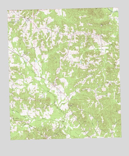
Shady Grove, MS USGS Topographic Map
Click on map above to begin viewing in our Map Viewer.

This topographic map contains these locations and features:
Feature Name Type Latitude Longitude GNIS ID View Map
Anding BranchStreamN31.7685°W90.3506°666264View Map
AshleyPopulated PlaceN31.8021°W90.2631°691672View Map
Ashley CemeteryCemeteryN31.8018°W90.2617°666397View Map
Bethel CemeteryCemeteryN31.8585°W90.2695°708012View Map
Bethel ChurchChurchN31.8196°W90.2543°666913View Map
Bethel ChurchChurchN31.8585°W90.2684°666914View Map
Bethel Volunteer Fire DepartmentBuildingN31.8491°W90.2735°2667879View Map
Eastern Star ChurchChurchN31.7546°W90.3220°669621View Map
Mullens CemeteryCemeteryN31.8035°W90.3259°674464View Map
Pine Grove CemeteryCemeteryN31.8115°W90.2829°675812View Map
Russell CreekStreamN31.7674°W90.3159°676969View Map
Russell-Tillman CemeteryCemeteryN31.7707°W90.3690°676971View Map
Sanderson Farms Pond DamDamN31.8185°W90.3668°680905View Map
SardisPopulated PlaceN31.8010°W90.3243°692210View Map
Sardis Baptist ChurchChurchN31.8010°W90.3248°686735View Map
Sardis Baptist ChurchChurchN31.7818°W90.3073°677414View Map
Sardis BranchStreamN31.7796°W90.3195°677412View Map
Sardis CemeteryCemeteryN31.7813°W90.3076°708054View Map
Shady GrovePopulated PlaceN31.8654°W90.3501°677539View Map
Shady Grove Baptist ChurchChurchN31.8649°W90.3509°686736View Map
Stronghope Volunteer Fire DepartmentBuildingN31.7510°W90.2852°2667916View Map
Supervisor District 2CivilN31.7863°W90.2934°711829View Map
Wolf Pen BranchStreamN31.7660°W90.3526°679824View Map

Note: Coordinates in the location and feature list above are referenced to NAD83 datum.


Copyright (C) 2008-2024 Ryan Niemi / Sunset Dynamics ... All Rights Reserved