TopoQuest Logo
Do you find TopoQuest useful?
Help keep TopoQuest running and adding new maps/features by donating!
Bitcoin:  19c7KJd3qBynnjoSw5npx9KScwjBe4ifkT
Litecoin:  LXs6TkuXGGXo1vDsWCkWVdjQX94eUKd6ui
Home View Maps Find Maps Find Places Resources & Links


Gallman, Mississippi Topographic Map

USGS Map Title: Gallman, MS
USGS Map MRC: 31090H4
DRG (GeoTIFF) Download: o31090h4.tif


Neighboring USGS Topographic Map Quads:


  Utica East, MS  
32090A5
 

  Dabney Crossroads, MS  
32090A4
 

  Terry, MS  
32090A3
 

  Dentville, MS  
31090H5
 

  Gallman, MS  
31090H4
 

  Crystal Springs, MS  
31090H3
 

  Smyrna, MS  
31090G5
 

  Hazlehurst, MS  
31090G4
 

  Shady Grove, MS  
31090G3


Map MRC Location:

N32°
W91°
N32°
W90°
H8 H7 H6 H5 H4 H3 H2 H1
G8 G7 G6 G5 G4 G3 G2 G1
F8 F7 F6 F5 F4 F3 F2 F1
E8 E7 E6 E5 E4 E3 E2 E1
D8 D7 D6 D5 D4 D3 D2 D1
C8 C7 C6 C5 C4 C3 C2 C1
B8 B7 B6 B5 B4 B3 B2 B1
A8 A7 A6 A5 A4 A3 A2 A1
N31°
W91°
N31°
W90°

Gallman, MS USGS 1:24K Topographic Map Preview:
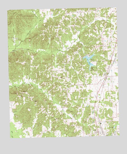
Gallman, MS USGS Topographic Map
Click on map above to begin viewing in our Map Viewer.

This topographic map contains these locations and features:
Feature Name Type Latitude Longitude GNIS ID View Map
Alford CemeteryCemeteryN31.9527°W90.3751°666191View Map
Camp Wesley PinesLocaleN31.9413°W90.4045°667992View Map
Clear CreekStreamN31.9585°W90.4354°668550View Map
Clear Creek ChurchChurchN31.9332°W90.4120°668571View Map
Clear Springs CemeteryCemeteryN31.9327°W90.4109°708015View Map
Copiah County Sheriff's OfficeBuildingN31.9228°W90.3942°2754152View Map
Damascus Baptist ChurchChurchN31.8804°W90.4020°669085View Map
Damascus CemeteryCemeteryN31.8815°W90.4023°708021View Map
Deaton CemeteryCemeteryN31.9074°W90.4368°669184View Map
Finley BranchStreamN31.9871°W90.4665°669962View Map
GallmanPopulated PlaceN31.9321°W90.3893°670303View Map
Gallman Baptist ChurchChurchN31.9315°W90.3904°686722View Map
Gallman CemeteryCemeteryN31.9335°W90.3915°708023View Map
Gallman Post OfficePost OfficeN31.9292°W90.3910°712227View Map
Hurricane CreekStreamN31.9599°W90.4945°671622View Map
Interchange 65CrossingN31.9257°W90.4015°691413View Map
Interchange 68CrossingN31.9696°W90.3818°691414View Map
Lake CopiahReservoirN31.9436°W90.4026°672257View Map
Lake Copiah DamDamN31.9502°W90.4134°680956View Map
Mill CreekStreamN31.9696°W90.4212°673605View Map
Mount Canna ChurchChurchN31.9199°W90.4840°673947View Map
New Pisgah ChurchChurchN31.9838°W90.4534°674797View Map
Persimmon BranchStreamN31.9640°W90.4915°675629View Map
Pisgah CemeteryCemeteryN31.9832°W90.4537°708044View Map
Spring Ridge ChurchChurchN31.9399°W90.4351°678157View Map
Tabernacle CemeteryCemeteryN31.9110°W90.4712°708062View Map
Tabernacle ChurchChurchN31.9104°W90.4712°678528View Map
Taylor BranchStreamN31.9571°W90.4579°678582View Map
TillmanPopulated PlaceN31.8927°W90.4465°692267View Map
Union ChurchChurchN31.9165°W90.4331°679051View Map
WCSP-AM (Crystal Springs)TowerN31.9971°W90.3801°680096View Map
Wiltshire-King CemeteryCemeteryN31.9490°W90.4065°679776View Map
WMDC-AM (Hazelhurst)TowerN31.8929°W90.4023°680092View Map
WMDC-FM (Hazlehurst)TowerN31.8929°W90.4023°680204View Map
Zion ChurchChurchN31.9410°W90.3848°679995View Map
Zion Hill ChurchChurchN31.9327°W90.4409°680022View Map

Note: Coordinates in the location and feature list above are referenced to NAD83 datum.


Copyright (C) 2008-2025 Ryan Niemi / Sunset Dynamics ... All Rights Reserved