TopoQuest Logo
Do you find TopoQuest useful?
Help keep TopoQuest running and adding new maps/features by donating!
Bitcoin:  19c7KJd3qBynnjoSw5npx9KScwjBe4ifkT
Litecoin:  LXs6TkuXGGXo1vDsWCkWVdjQX94eUKd6ui
Home View Maps Find Maps Find Places Resources & Links


Sheep Creek Divide, Oregon Topographic Map

USGS Map Title: Sheep Creek Divide, OR
USGS Map MRC: 45116D7
DRG (GeoTIFF) Download: o45116d7.tif


Neighboring USGS Topographic Map Quads:


  Findley Buttes, OR  
45116E8
 

  Imnaha, OR  
45116E7
 

  Sleepy Ridge, OR  
45116E6
 

  Clear Lake Ridge, OR  
45116D8
 

  Sheep Creek Divide, OR  
45116D7
 

  Hat Point, OR  
45116D6
 

  Harl Butte, OR  
45116C8
 

  Jaynes Ridge, OR  
45116C7
 

  Squirrel Prairie, OR  
45116C6


Map MRC Location:

N46°
W117°
N46°
W116°
H8 H7 H6 H5 H4 H3 H2 H1
G8 G7 G6 G5 G4 G3 G2 G1
F8 F7 F6 F5 F4 F3 F2 F1
E8 E7 E6 E5 E4 E3 E2 E1
D8 D7 D6 D5 D4 D3 D2 D1
C8 C7 C6 C5 C4 C3 C2 C1
B8 B7 B6 B5 B4 B3 B2 B1
A8 A7 A6 A5 A4 A3 A2 A1
N45°
W117°
N45°
W116°

Sheep Creek Divide, OR USGS 1:24K Topographic Map Preview:
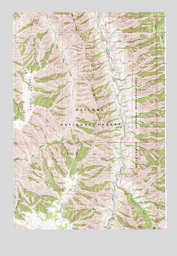
Sheep Creek Divide, OR USGS Topographic Map
Click on map above to begin viewing in our Map Viewer.

This topographic map contains these locations and features:
Feature Name Type Latitude Longitude GNIS ID View Map
Adams CreekStreamN45.4399°W116.7865°1137016View Map
Beeler RidgeRidgeN45.3982°W116.8243°1137886View Map
Blackmore CreekStreamN45.4271°W116.7865°1138233View Map
Boneyard CreekStreamN45.4721°W116.8343°1152902View Map
Bristo CreekStreamN45.4043°W116.8718°1138633View Map
Brown CreekStreamN45.4240°W116.8468°1138667View Map
Campbell CreekStreamN45.3852°W116.7926°1139282View Map
Chalk CreekStreamN45.4015°W116.7935°1139550View Map
Cold CanyonValleyN45.4238°W116.8452°1139910View Map
College CreekStreamN45.4396°W116.7865°1139988View Map
College Creek Ranger Station (historical)BuildingN45.4338°W116.7860°1139989View Map
Cowhead CreekStreamN45.4127°W116.8610°1140295View Map
Cripple CreekStreamN45.4210°W116.8532°1140447View Map
Dead Horse RidgeRidgeN45.4549°W116.8593°1140697View Map
Double CreekStreamN45.4304°W116.7838°1141202View Map
Dunlap CreekStreamN45.4904°W116.8040°1141409View Map
Dunn CreekStreamN45.4013°W116.7938°1141412View Map
East Muley CreekStreamN45.4260°W116.8363°1141631View Map
Freezeout CreekStreamN45.4021°W116.7918°1142446View Map
Freezeout School (historical)SchoolN45.4358°W116.7842°1142449View Map
Freezeout TrailheadLocaleN45.3785°W116.7629°1156556View Map
Gaily CreekStreamN45.4846°W116.8399°1142554View Map
Godias CreekStreamN45.4829°W116.8393°1142796View Map
Gowing CreekStreamN45.3865°W116.7971°1142891View Map
Gowing SpringSpringN45.3902°W116.8329°1153015View Map
Granny CreekStreamN45.3927°W116.7779°1142933View Map
Happy CreekStreamN45.4393°W116.8263°1143279View Map
Hope CreekStreamN45.3902°W116.7743°1143724View Map
Indian CreekStreamN45.4065°W116.7890°1144031View Map
Jody CreekStreamN45.4793°W116.7982°1144289View Map
Keeler CreekStreamN45.4774°W116.7974°1144499View Map
Little Bristo CreekStreamN45.4018°W116.8740°1145110View Map
Lost Basin CreekStreamN45.4979°W116.8474°1145493View Map
Loyd CreekStreamN45.4721°W116.7938°1145646View Map
Muley CreekStreamN45.4274°W116.8352°1146648View Map
Schleur CreekStreamN45.4468°W116.7879°1149121View Map
Sheep Creek DivideRidgeN45.4279°W116.8082°1149334View Map
Snell CreekStreamN45.4615°W116.7918°1149795View Map
Spring CreekStreamN45.4546°W116.7877°1150169View Map
Steer CreekStreamN45.4590°W116.8260°1150395View Map
Thorn CreekStreamN45.4838°W116.7996°1151122View Map
Turner CreekStreamN45.4160°W116.7876°1151531View Map
Warden CreekStreamN45.4340°W116.8315°1151888View Map
Wild Horse CreekStreamN45.4907°W116.8443°1152329View Map
Wilde RanchLocaleN45.4282°W116.8343°1638059View Map

Note: Coordinates in the location and feature list above are referenced to NAD83 datum.


Copyright (C) 2008-2024 Ryan Niemi / Sunset Dynamics ... All Rights Reserved