TopoQuest Logo
Do you find TopoQuest useful?
Help keep TopoQuest running and adding new maps/features by donating!
Bitcoin:  19c7KJd3qBynnjoSw5npx9KScwjBe4ifkT
Litecoin:  LXs6TkuXGGXo1vDsWCkWVdjQX94eUKd6ui
Home View Maps Find Maps Find Places Resources & Links


Harl Butte, Oregon Topographic Map

USGS Map Title: Harl Butte, OR
USGS Map MRC: 45116C8
DRG (GeoTIFF) Download: o45116c8.tif


Neighboring USGS Topographic Map Quads:


  Three Lakes Country, OR  
45117D1
 

  Clear Lake Ridge, OR  
45116D8
 

  Sheep Creek Divide, OR  
45116D7
 

  Kinney Lake, OR  
45117C1
 

  Harl Butte, OR  
45116C8
 

  Jaynes Ridge, OR  
45116C7
 

  Lick Creek, OR  
45117B1
 

  Gumboot Butte, OR  
45116B8
 

  Puderbaugh Ridge, OR  
45116B7


Map MRC Location:

N46°
W117°
N46°
W116°
H8 H7 H6 H5 H4 H3 H2 H1
G8 G7 G6 G5 G4 G3 G2 G1
F8 F7 F6 F5 F4 F3 F2 F1
E8 E7 E6 E5 E4 E3 E2 E1
D8 D7 D6 D5 D4 D3 D2 D1
C8 C7 C6 C5 C4 C3 C2 C1
B8 B7 B6 B5 B4 B3 B2 B1
A8 A7 A6 A5 A4 A3 A2 A1
N45°
W117°
N45°
W116°

Harl Butte, OR USGS 1:24K Topographic Map Preview:
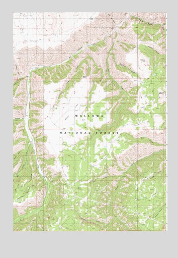
Harl Butte, OR USGS Topographic Map
Click on map above to begin viewing in our Map Viewer.

This topographic map contains these locations and features:
Feature Name Type Latitude Longitude GNIS ID View Map
Armin (historical)Populated PlaceN45.3402°W116.9885°1152903View Map
Armin Post Office (historical)Post OfficeN45.3402°W116.9885°1164857View Map
Bunch PointRidgeN45.3399°W116.9407°1133841View Map
Carrol CreekStreamN45.2999°W116.9843°1139393View Map
Coyote CreekStreamN45.3382°W116.9857°1140325View Map
Cumming GulchValleyN45.3377°W116.9935°1140546View Map
Dixie Jett GulchValleyN45.3674°W116.9163°1141081View Map
Double Hitch SpringSpringN45.3206°W116.8937°1152901View Map
East waqi?mata?w CreekStreamN45.3671°W116.8796°1141605View Map
Griffith CreekStreamN45.3140°W116.9902°1143088View Map
Harl ButteSummitN45.3288°W116.8771°1143308View Map
Harl Butte LookoutLocaleN45.3285°W116.8771°1156525View Map
Marr CreekStreamN45.3652°W116.9168°1145825View Map
Marr FlatFlatN45.3135°W116.9479°1145826View Map
Marr Flat Cow CampLocaleN45.3204°W116.8929°1156520View Map
Morgan CreekStreamN45.2582°W116.9168°1146451View Map
Needham ButteSummitN45.3465°W116.8918°1146746View Map
Needham CreekStreamN45.3515°W116.9224°1146747View Map
Needham GulchValleyN45.3499°W116.8774°1158569View Map
North Fork Carrol CreekStreamN45.2957°W116.9888°1146920View Map
Road CreekStreamN45.2818°W116.9115°1148503View Map
South waqi?mata?w CreekStreamN45.3671°W116.8793°1150021View Map
Spoon SpringSpringN45.2742°W116.9484°1150138View Map
Timber CreekStreamN45.3563°W116.9413°1151241View Map
waqi?mata?w CreekStreamN45.3738°W116.9063°1150243View Map

Note: Coordinates in the location and feature list above are referenced to NAD83 datum.


Copyright (C) 2008-2025 Ryan Niemi / Sunset Dynamics ... All Rights Reserved