TopoQuest Logo
Do you find TopoQuest useful?
Help keep TopoQuest running and adding new maps/features by donating!
Bitcoin:  19c7KJd3qBynnjoSw5npx9KScwjBe4ifkT
Litecoin:  LXs6TkuXGGXo1vDsWCkWVdjQX94eUKd6ui
Home View Maps Find Maps Find Places Resources & Links


Sheep Hill, Idaho Topographic Map

USGS Map Title: Sheep Hill, ID
USGS Map MRC: 45115E1
DRG (GeoTIFF) Download: o45115e1.tif


Neighboring USGS Topographic Map Quads:


  Boston Mountain, ID  
45115F2
 

  Spread Creek Point, ID  
45115F1
 

  Sabe Mountain, ID  
45114F8
 

  Hida Point, ID  
45115E2
 

  Sheep Hill, ID  
45115E1
 

  Dennis Mountain, ID  
45114E8
 

  Meadow of Doubt, ID  
45115D2
 

  Arctic Point, ID  
45115D1
 

  Devils Teeth Rapids, ID  
45114D8


Map MRC Location:

N46°
W116°
N46°
W115°
H8 H7 H6 H5 H4 H3 H2 H1
G8 G7 G6 G5 G4 G3 G2 G1
F8 F7 F6 F5 F4 F3 F2 F1
E8 E7 E6 E5 E4 E3 E2 E1
D8 D7 D6 D5 D4 D3 D2 D1
C8 C7 C6 C5 C4 C3 C2 C1
B8 B7 B6 B5 B4 B3 B2 B1
A8 A7 A6 A5 A4 A3 A2 A1
N45°
W116°
N45°
W115°

Sheep Hill, ID USGS 1:24K Topographic Map Preview:
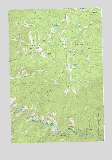
Sheep Hill, ID USGS Topographic Map
Click on map above to begin viewing in our Map Viewer.

This topographic map contains these locations and features:
Feature Name Type Latitude Longitude GNIS ID View Map
Barth Hot SpringsSpringN45.5123°W115.0436°376983View Map
Bear BarBarN45.5207°W115.0884°377066View Map
Bear CreekStreamN45.5205°W115.0884°377091View Map
Bear PointCapeN45.5516°W115.0462°377188View Map
Black CanyonValleyN45.5080°W115.0362°377727View Map
Black CreekStreamN45.5027°W115.0073°377742View Map
Brown LakeLakeN45.5849°W115.0308°378272View Map
Bruin CreekStreamN45.5169°W115.0757°378309View Map
Bruin Creek CampgroundLocaleN45.5171°W115.0732°378311View Map
Canyon CreekStreamN45.5271°W115.0143°378860View Map
Center Creek LakesLakeN45.5726°W115.0418°379131View Map
Center MountainSummitN45.5844°W115.0451°379135View Map
Dead Man SaddleGapN45.5952°W115.0773°380305View Map
Deer Park BarBarN45.5307°W115.1123°380471View Map
Deer Park CreekStreamN45.5310°W115.1121°380473View Map
Dillinger CreekStreamN45.5296°W115.1090°380594View Map
Goat LakeLakeN45.5954°W115.0940°382333View Map
Hancock RapidsRapidsN45.5211°W115.0920°382857View Map
Hot Springs CreekStreamN45.5105°W115.0418°383453View Map
Lake Creek LakesLakeN45.6093°W115.0646°384373View Map
Nixon BarBarN45.5102°W115.0629°387582View Map
Nixon CreekStreamN45.5107°W115.0640°387583View Map
Rattlesnake LakeLakeN45.5824°W115.0751°389154View Map
Rattlesnake PointSummitN45.5555°W115.1090°389161View Map
Rattlesnake SpringSpringN45.5539°W115.0992°389166View Map
Ring Creek PointCliffN45.6205°W115.0129°389392View Map
Sabe CreekStreamN45.5077°W115.0246°389763View Map
Salmon Wild and Scenic RiverParkN45.5002°W115.0012°399590View Map
Sheep HillSummitN45.5880°W115.0887°390232View Map
Sheep SpringSpringN45.5880°W115.0945°390257View Map
Sheep Spring LakeLakeN45.5843°W115.0926°390260View Map
Sunny BarBarN45.5135°W115.0437°391657View Map

Note: Coordinates in the location and feature list above are referenced to NAD83 datum.


Copyright (C) 2008-2024 Ryan Niemi / Sunset Dynamics ... All Rights Reserved