TopoQuest Logo
Do you find TopoQuest useful?
Help keep TopoQuest running and adding new maps/features by donating!
Bitcoin:  19c7KJd3qBynnjoSw5npx9KScwjBe4ifkT
Litecoin:  LXs6TkuXGGXo1vDsWCkWVdjQX94eUKd6ui
Home View Maps Find Maps Find Places Resources & Links


Devils Teeth Rapids, Idaho Topographic Map

USGS Map Title: Devils Teeth Rapids, ID
USGS Map MRC: 45114D8
DRG (GeoTIFF) Download: o45114d8.tif


Neighboring USGS Topographic Map Quads:


  Sheep Hill, ID  
45115E1
 

  Dennis Mountain, ID  
45114E8
 

  Stripe Mountain, ID  
45114E7
 

  Arctic Point, ID  
45115D1
 

  Devils Teeth Rapids, ID  
45114D8
 

  Waugh Mountain, ID  
45114D7
 

  Wapiti Creek, ID  
45115C1
 

  Cold Meadows, ID  
45114C8
 

  Cottonwood Butte, ID  
45114C7


Map MRC Location:

N46°
W115°
N46°
W114°
H8 H7 H6 H5 H4 H3 H2 H1
G8 G7 G6 G5 G4 G3 G2 G1
F8 F7 F6 F5 F4 F3 F2 F1
E8 E7 E6 E5 E4 E3 E2 E1
D8 D7 D6 D5 D4 D3 D2 D1
C8 C7 C6 C5 C4 C3 C2 C1
B8 B7 B6 B5 B4 B3 B2 B1
A8 A7 A6 A5 A4 A3 A2 A1
N45°
W115°
N45°
W114°

Devils Teeth Rapids, ID USGS 1:24K Topographic Map Preview:
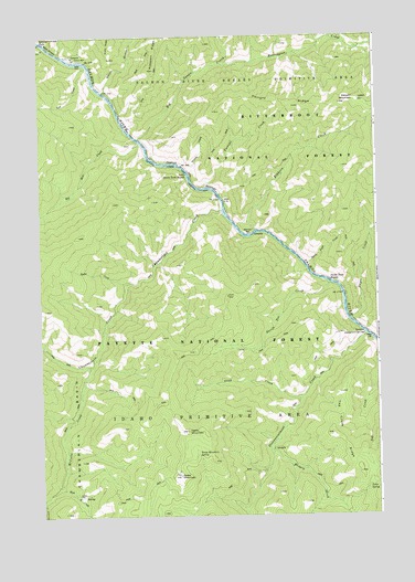
Devils Teeth Rapids, ID USGS Topographic Map
Click on map above to begin viewing in our Map Viewer.

This topographic map contains these locations and features:
Feature Name Type Latitude Longitude GNIS ID View Map
Arctic CreekStreamN45.4977°W114.9982°376699View Map
Big Bear CreekStreamN45.4724°W114.9634°377431View Map
Big Squaw CreekStreamN45.4735°W114.9640°377604View Map
Cabin MountainSummitN45.3971°W114.9462°378665View Map
Chamberlain CreekStreamN45.4544°W114.9323°379162View Map
Corey BarBarN45.4938°W114.9837°379745View Map
Corey Bar CampgroundLocaleN45.4944°W114.9871°394731View Map
Cub CreekStreamN45.4924°W114.9823°380139View Map
Devils Teeth CreekStreamN45.4405°W114.9026°380548View Map
Devils Teeth RapidsRapidsN45.4360°W114.8932°380549View Map
Devils Toe CreekStreamN45.4352°W114.8937°380550View Map
Disappointment BarBarN45.4227°W114.8815°380604View Map
Disappointment CreekStreamN45.4219°W114.8798°380605View Map
Dwyer CreekStreamN45.4263°W114.8854°380969View Map
Elkhorn BarBarN45.4488°W114.9223°381404View Map
Elkhorn Bar CampgroundLocaleN45.4485°W114.9207°394733View Map
Elkhorn CreekStreamN45.4485°W114.9218°381414View Map
Elkhorn LookoutLocaleN45.4832°W114.8807°394732View Map
Fortune CreekStreamN45.4605°W114.9401°381943View Map
Grass MountainSummitN45.3852°W114.9498°382566View Map
Grass Mountain SpringSpringN45.3912°W114.9427°382569View Map
Harrington CreekStreamN45.4927°W114.9320°382921View Map
Hungry CreekStreamN45.3916°W114.9157°383548View Map
Little Devils Teeth RapidsRapidsN45.4631°W114.9445°384808View Map
McCalla CreekStreamN45.4132°W114.9826°386568View Map
Parks CreekStreamN45.4355°W114.9682°388229View Map
Patrol PointSummitN45.4321°W114.9318°388266View Map
Root CreekStreamN45.3824°W114.9923°389598View Map
Salmon FallsFallsN45.4985°W114.9990°389851View Map
Smith GulchValleyN45.4852°W114.9754°390692View Map
Steep CreekStreamN45.4060°W114.9040°391410View Map
Table SpringSpringN45.3826°W114.8792°391808View Map
Tag Creek RidgeRidgeN45.3960°W114.8929°391814View Map
Thirst CreekStreamN45.4630°W114.9451°392010View Map
Whimstick CreekStreamN45.3785°W114.9996°393281View Map

Note: Coordinates in the location and feature list above are referenced to NAD83 datum.


Copyright (C) 2008-2024 Ryan Niemi / Sunset Dynamics ... All Rights Reserved