TopoQuest Logo
Do you find TopoQuest useful?
Help keep TopoQuest running and adding new maps/features by donating!
Bitcoin:  19c7KJd3qBynnjoSw5npx9KScwjBe4ifkT
Litecoin:  LXs6TkuXGGXo1vDsWCkWVdjQX94eUKd6ui
Home View Maps Find Maps Find Places Resources & Links


Sheepshead Mountain, Montana Topographic Map

USGS Map Title: Sheepshead Mountain, MT
USGS Map MRC: 46112B4
DRG (GeoTIFF) Download: o46112b4.tif


Neighboring USGS Topographic Map Quads:


  Sugarloaf Mountain, MT  
46112C5
 

  Thunderbolt Creek, MT  
46112C4
 

  Basin, MT  
46112C3
 

  Lockhart Meadows, MT  
46112B5
 

  Sheepshead Mountain, MT  
46112B4
 

  Bison Canyon, MT  
46112B3
 

  Butte North, MT  
46112A5
 

  Elk Park Pass, MT  
46112A4
 

  Whitetail Peak, MT  
46112A3


Map MRC Location:

N47°
W113°
N47°
W112°
H8 H7 H6 H5 H4 H3 H2 H1
G8 G7 G6 G5 G4 G3 G2 G1
F8 F7 F6 F5 F4 F3 F2 F1
E8 E7 E6 E5 E4 E3 E2 E1
D8 D7 D6 D5 D4 D3 D2 D1
C8 C7 C6 C5 C4 C3 C2 C1
B8 B7 B6 B5 B4 B3 B2 B1
A8 A7 A6 A5 A4 A3 A2 A1
N46°
W113°
N46°
W112°

Sheepshead Mountain, MT USGS 1:24K Topographic Map Preview:
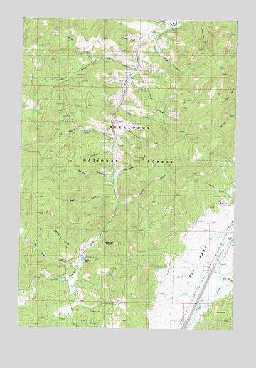
Sheepshead Mountain, MT USGS Topographic Map
Click on map above to begin viewing in our Map Viewer.

This topographic map contains these locations and features:
Feature Name Type Latitude Longitude GNIS ID View Map
Big GulchValleyN46.1455°W112.3764°806202View Map
Buffalo GulchValleyN46.1749°W112.4400°780543View Map
Cluney GulchValleyN46.2430°W112.4236°781422View Map
Dry GulchValleyN46.2299°W112.4356°782616View Map
Farcella PlaceLocaleN46.1388°W112.4664°794109View Map
Ferdinand GulchValleyN46.1966°W112.4489°783353View Map
Freedom Point CampgroundLocaleN46.1491°W112.4684°794110View Map
Headquarters CreekStreamN46.1874°W112.4461°784685View Map
Ice PondLakeN46.1612°W112.3761°806203View Map
Irvine RanchLocaleN46.1608°W112.4972°785346View Map
Kit Carson GulchValleyN46.2027°W112.4459°785778View Map
Kit Carson Gulch CreekStreamN46.2027°W112.4459°793851View Map
Konda RanchLocaleN46.1260°W112.4497°801916View Map
Lowland CreekStreamN46.2455°W112.4139°786692View Map
Lowland Creek DamDamN46.1549°W112.4642°798510View Map
Main GulchValleyN46.1752°W112.4453°786794View Map
Maney LakeReservoirN46.1521°W112.4634°806205View Map
Moraine GulchValleyN46.1855°W112.4459°787675View Map
NE NE Section 9 MineMineN46.2077°W112.4584°803336View Map
North Fork Dry GulchValleyN46.2319°W112.4597°788145View Map
NW NW Section 13 MineMineN46.1924°W112.4317°803549View Map
Olson GulchValleyN46.1497°W112.4720°788453View Map
Placer GulchValleyN46.2135°W112.4431°788978View Map
Ramsey GulchValleyN46.2410°W112.4336°789370View Map
Ruby CreekStreamN46.2027°W112.4461°806206View Map
Ruby MineMineN46.1977°W112.4350°789838View Map
SE SE Section 32 MineMineN46.2319°W112.4536°802834View Map
Sheep CreekStreamN46.2244°W112.4409°790320View Map
Sheepshead MountainSummitN46.1563°W112.4331°790380View Map
Sheepshead Recreation AreaLocaleN46.1541°W112.4670°794107View Map
South Fork Dry GulchValleyN46.2319°W112.4595°790953View Map
Spruce GulchValleyN46.1749°W112.3753°806204View Map
SW SE Section 8 MineMineN46.1935°W112.3770°803518View Map
Swede GulchValleyN46.1535°W112.4650°791803View Map
Tamieti PlaceLocaleN46.1335°W112.4734°794113View Map

Note: Coordinates in the location and feature list above are referenced to NAD83 datum.


Copyright (C) 2008-2024 Ryan Niemi / Sunset Dynamics ... All Rights Reserved