TopoQuest Logo
Do you find TopoQuest useful?
Help keep TopoQuest running and adding new maps/features by donating!
Bitcoin:  19c7KJd3qBynnjoSw5npx9KScwjBe4ifkT
Litecoin:  LXs6TkuXGGXo1vDsWCkWVdjQX94eUKd6ui
Home View Maps Find Maps Find Places Resources & Links


Sugarloaf Mountain, Montana Topographic Map

USGS Map Title: Sugarloaf Mountain, MT
USGS Map MRC: 46112C5
DRG (GeoTIFF) Download: o46112c5.tif


Neighboring USGS Topographic Map Quads:


  Deer Lodge, MT  
46112D6
 

  Baggs Creek, MT  
46112D5
 

  Bison Mountain, MT  
46112D4
 

  Orofino Creek, MT  
46112C6
 

  Sugarloaf Mountain, MT  
46112C5
 

  Thunderbolt Creek, MT  
46112C4
 

  Orofino Mountain, MT  
46112B6
 

  Lockhart Meadows, MT  
46112B5
 

  Sheepshead Mountain, MT  
46112B4


Map MRC Location:

N47°
W113°
N47°
W112°
H8 H7 H6 H5 H4 H3 H2 H1
G8 G7 G6 G5 G4 G3 G2 G1
F8 F7 F6 F5 F4 F3 F2 F1
E8 E7 E6 E5 E4 E3 E2 E1
D8 D7 D6 D5 D4 D3 D2 D1
C8 C7 C6 C5 C4 C3 C2 C1
B8 B7 B6 B5 B4 B3 B2 B1
A8 A7 A6 A5 A4 A3 A2 A1
N46°
W113°
N46°
W112°

Sugarloaf Mountain, MT USGS 1:24K Topographic Map Preview:
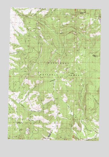
Sugarloaf Mountain, MT USGS Topographic Map
Click on map above to begin viewing in our Map Viewer.

This topographic map contains these locations and features:
Feature Name Type Latitude Longitude GNIS ID View Map
07N08W17DA__01 WellWellN46.3588°W112.6214°815712View Map
07N08W21BA__01 WellWellN46.3513°W112.6111°815650View Map
Black MountainSummitN46.3144°W112.5845°780009View Map
Blizzard HillSummitN46.2519°W112.5714°780114View Map
Cliff MountainSummitN46.3649°W112.5014°781393View Map
Cold SpringSpringN46.2752°W112.5572°781494View Map
Dieders ForkStreamN46.2780°W112.6020°782380View Map
Jaslowski (historical)LocaleN46.3008°W112.5228°801861View Map
Jaslowski MineMineN46.3022°W112.5209°803552View Map
LeadvillePopulated PlaceN46.3144°W112.5431°786011View Map
Leadville MineMineN46.3152°W112.5411°803263View Map
Long ParkLocaleN46.3010°W112.5634°786539View Map
Middle Fork Cottonwood CreekStreamN46.3641°W112.5873°787257View Map
North Fork Cottonwood CreekStreamN46.3669°W112.6070°788126View Map
Orofino CampgroundLocaleN46.2610°W112.6114°793810View Map
Rock CreekStreamN46.2572°W112.5020°789663View Map
Rocker GulchValleyN46.3672°W112.5950°789717View Map
Saratoga MountainSummitN46.2608°W112.5981°790027View Map
Schurchs TunnelTunnelN46.2891°W112.5634°790142View Map
South Fork Cottonwood CreekStreamN46.3666°W112.6067°790931View Map
Spring CreekStreamN46.2838°W112.6109°791210View Map
Spring CreekStreamN46.3710°W112.5703°791248View Map
Sugarloaf MountainSummitN46.3708°W112.5253°791632View Map

Note: Coordinates in the location and feature list above are referenced to NAD83 datum.


Copyright (C) 2008-2025 Ryan Niemi / Sunset Dynamics ... All Rights Reserved