TopoQuest Logo
Do you find TopoQuest useful?
Help keep TopoQuest running and adding new maps/features by donating!
Bitcoin:  19c7KJd3qBynnjoSw5npx9KScwjBe4ifkT
Litecoin:  LXs6TkuXGGXo1vDsWCkWVdjQX94eUKd6ui
Home View Maps Find Maps Find Places Resources & Links


Sheldon, Minnesota Topographic Map

USGS Map Title: Sheldon, MN
USGS Map MRC: 43091F5
DRG (GeoTIFF) Download: o43091f5.tif


Neighboring USGS Topographic Map Quads:


  Rushford East, MN  
43091G6
 

  Houston, MN  
43091G5
 

  Mound Prairie, MN  
43091G4
 

  Yucatan, MN  
43091F6
 

  Sheldon, MN  
43091F5
 

  Caledonia, MN  
43091F4
 

  Spring Grove, MN  
43091E6
 

  Wilmington, MN  
43091E5
 

  Eitzen, MN  
43091E4


Map MRC Location:

N44°
W92°
N44°
W91°
H8 H7 H6 H5 H4 H3 H2 H1
G8 G7 G6 G5 G4 G3 G2 G1
F8 F7 F6 F5 F4 F3 F2 F1
E8 E7 E6 E5 E4 E3 E2 E1
D8 D7 D6 D5 D4 D3 D2 D1
C8 C7 C6 C5 C4 C3 C2 C1
B8 B7 B6 B5 B4 B3 B2 B1
A8 A7 A6 A5 A4 A3 A2 A1
N43°
W92°
N43°
W91°

Sheldon, MN USGS 1:24K Topographic Map Preview:
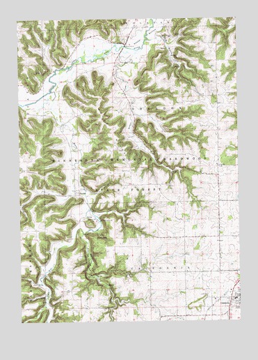
Sheldon, MN USGS Topographic Map
Click on map above to begin viewing in our Map Viewer.

This topographic map contains these locations and features:
Feature Name Type Latitude Longitude GNIS ID View Map
Badger CreekStreamN43.7375°W91.5551°639558View Map
Beaver CreekStreamN43.7202°W91.6063°639818View Map
Beaver Creek EastStreamN43.6611°W91.5890°639824View Map
Beaver Creek Valley State ParkParkN43.6427°W91.5818°639825View Map
Beaver Creek WestStreamN43.6611°W91.5890°639826View Map
Big Spring Historical MarkerParkN43.6400°W91.5751°2050585View Map
Caledonia Elementary SchoolSchoolN43.6341°W91.5007°2050546View Map
Caledonia HIgh SchoolSchoolN43.6341°W91.5024°2050545View Map
Caledonia Wayside ParkParkN43.6944°W91.5474°2050586View Map
City of CaledoniaCivilN43.6344°W91.5009°2393493View Map
Evergreen CemeteryCemeteryN43.6339°W91.5071°2050437View Map
Franciscan Skemp Healthcare CenterHospitalN43.6394°W91.5007°2050548View Map
Hauge RidgeRidgeN43.7044°W91.5715°644725View Map
Houston County Poor Farm CemeteryCemeteryN43.6255°W91.5224°2050436View Map
Messeral CemeteryCemeteryN43.6666°W91.5901°2050434View Map
Mill PondReservoirN43.6666°W91.5801°1777172View Map
Old Caledonia CemeteryCemeteryN43.6319°W91.5010°2050435View Map
Old Ridge CemeteryCemeteryN43.7469°W91.5574°2050593View Map
Old Sheldon CemeteryCemeteryN43.6744°W91.6085°2050414View Map
Saint John's German Lutheran CemeteryCemeteryN43.6339°W91.5060°2050438View Map
Schechs MillPopulated PlaceN43.6675°W91.5810°654933View Map
Schechs Mill DamDamN43.6666°W91.5801°1777171View Map
SheldonPopulated PlaceN43.6783°W91.5932°651939View Map
Sheldon CemeteryCemeteryN43.6863°W91.5929°2050415View Map
Sheldon Post Office (historical)Post OfficeN43.6783°W91.5932°2050485View Map
Swede BottomFlatN43.7433°W91.5526°652920View Map
Swede Bottom CemeteryCemeteryN43.7425°W91.5368°652921View Map
Swede Bottom CreekStreamN43.7411°W91.5501°652922View Map
Township of CaledoniaCivilN43.6304°W91.5541°663725View Map
Township of SheldonCivilN43.7101°W91.5513°665587View Map

Note: Coordinates in the location and feature list above are referenced to NAD83 datum.


Copyright (C) 2008-2024 Ryan Niemi / Sunset Dynamics ... All Rights Reserved