TopoQuest Logo
Do you find TopoQuest useful?
Help keep TopoQuest running and adding new maps/features by donating!
Bitcoin:  19c7KJd3qBynnjoSw5npx9KScwjBe4ifkT
Litecoin:  LXs6TkuXGGXo1vDsWCkWVdjQX94eUKd6ui
Home View Maps Find Maps Find Places Resources & Links


Eitzen, Minnesota Topographic Map

USGS Map Title: Eitzen, MN
USGS Map MRC: 43091E4
DRG (GeoTIFF) Download: o43091e4.tif


Neighboring USGS Topographic Map Quads:


  Sheldon, MN  
43091F5
 

  Caledonia, MN  
43091F4
 

  Brownsville, MN  
43091F3
 

  Wilmington, MN  
43091E5
 

  Eitzen, MN  
43091E4
 

  Reno, MN  
43091E3
 

  Dorchester, IA  
43091D5
 

  Waukon NW, IA  
43091D4
 

  New Albin, IA  
43091D3


Map MRC Location:

N44°
W92°
N44°
W91°
H8 H7 H6 H5 H4 H3 H2 H1
G8 G7 G6 G5 G4 G3 G2 G1
F8 F7 F6 F5 F4 F3 F2 F1
E8 E7 E6 E5 E4 E3 E2 E1
D8 D7 D6 D5 D4 D3 D2 D1
C8 C7 C6 C5 C4 C3 C2 C1
B8 B7 B6 B5 B4 B3 B2 B1
A8 A7 A6 A5 A4 A3 A2 A1
N43°
W92°
N43°
W91°

Eitzen, MN USGS 1:24K Topographic Map Preview:
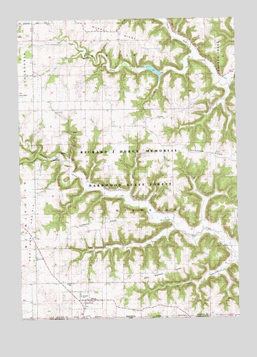
Eitzen, MN USGS Topographic Map
Click on map above to begin viewing in our Map Viewer.

This topographic map contains these locations and features:
Feature Name Type Latitude Longitude GNIS ID View Map
Cabbage RidgeRidgeN43.5383°W91.4560°640724View Map
Camp WinnebagoLocaleN43.5661°W91.4765°640845View Map
Carsten CemeteryCemeteryN43.5150°W91.4712°640940View Map
City of EitzenCivilN43.5081°W91.4636°2394630View Map
Crooked Creek S-3 DamDamN43.6033°W91.4768°1777280View Map
Dog Square RidgeRidgeN43.5189°W91.4171°642873View Map
EitzenPopulated PlaceN43.5080°W91.4615°643220View Map
Eitzen City HallBuildingN43.5083°W91.4607°2050576View Map
Eitzen Fire DepartmentBuildingN43.5075°W91.4618°2050575View Map
Eitzen Post OfficePost OfficeN43.5083°W91.4643°2050574View Map
Grove Prairie CemeteryCemeteryN43.5889°W91.4876°2050409View Map
Macal Grove Country ClubLocaleN43.6180°W91.4974°2050533View Map
Murphy RidgeRidgeN43.6205°W91.4474°648393View Map
New Yorker HollowValleyN43.5251°W91.3770°648525View Map
North Fork Crooked CreekStreamN43.6083°W91.3996°648636View Map
Portland PrairieFlatN43.5400°W91.4968°649682View Map
Portland Prairie CemeteryCemeteryN43.5259°W91.4907°1948927View Map
Portland Prairie ChurchChurchN43.5258°W91.4913°649681View Map
R-4 PoolReservoirN43.6233°W91.3751°1776702View Map
R3 PoolReservoirN43.6033°W91.4151°1776706View Map
R3 Structure DamDamN43.6033°W91.4151°1776705View Map
Saint Lukes CemeteryCemeteryN43.5097°W91.4657°650803View Map
Saint Lukes ChurchChurchN43.5008°W91.4643°650807View Map
South Fork Crooked CreekStreamN43.6083°W91.3996°652293View Map
Steele CemeteryCemeteryN43.5402°W91.4196°2050408View Map
Structure R-4 DamDamN43.6233°W91.3751°1776701View Map
Township of WinnebagoCivilN43.5445°W91.4311°666022View Map
Zion Lutheran ChurchChurchN43.5044°W91.4635°2050573View Map

Note: Coordinates in the location and feature list above are referenced to NAD83 datum.


Copyright (C) 2008-2024 Ryan Niemi / Sunset Dynamics ... All Rights Reserved