TopoQuest Logo
Do you find TopoQuest useful?
Help keep TopoQuest running and adding new maps/features by donating!
Bitcoin:  19c7KJd3qBynnjoSw5npx9KScwjBe4ifkT
Litecoin:  LXs6TkuXGGXo1vDsWCkWVdjQX94eUKd6ui
Home View Maps Find Maps Find Places Resources & Links


Sheldon, Arizona Topographic Map

USGS Map Title: Sheldon, AZ
USGS Map MRC: 32109G2
DRG (GeoTIFF) Download: o32109g2.tif


Neighboring USGS Topographic Map Quads:


  Guthrie, AZ  
32109H3
 

  York, AZ  
32109H2
 

  Tillie Hall Peak, NM  
32109H1
 

  Ash Peak, AZ  
32109G3
 

  Sheldon, AZ  
32109G2
 

  Goat Camp Spring, NM  
32109G1
 

  Whitlock Mountains NE, AZ  
32109F3
 

  Hot Well, AZ  
32109F2
 

  Duncan, AZ  
32109F1


Map MRC Location:

N33°
W110°
N33°
W109°
H8 H7 H6 H5 H4 H3 H2 H1
G8 G7 G6 G5 G4 G3 G2 G1
F8 F7 F6 F5 F4 F3 F2 F1
E8 E7 E6 E5 E4 E3 E2 E1
D8 D7 D6 D5 D4 D3 D2 D1
C8 C7 C6 C5 C4 C3 C2 C1
B8 B7 B6 B5 B4 B3 B2 B1
A8 A7 A6 A5 A4 A3 A2 A1
N32°
W110°
N32°
W109°

Sheldon, AZ USGS 1:24K Topographic Map Preview:
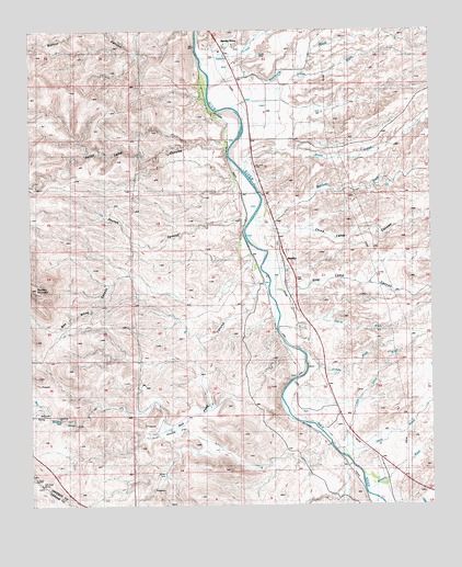
Sheldon, AZ USGS Topographic Map
Click on map above to begin viewing in our Map Viewer.

This topographic map contains these locations and features:
Feature Name Type Latitude Longitude GNIS ID View Map
Apache CreekStreamN32.8677°W109.1971°25698View Map
Apache GrovePopulated PlaceN32.8698°W109.1903°24305View Map
Apache GulchArroyoN32.8692°W109.1865°42776View Map
Ash Peak CanyonValleyN32.8084°W109.1798°851View Map
Bitter CreekStreamN32.8376°W109.1837°26361View Map
China Camp CanyonValleyN32.8220°W109.1717°2850View Map
Colmonero CanalCanalN32.7528°W109.1440°3122View Map
Duncan DivisionCivilN32.7543°W109.1408°1934937View Map
Erve Adams FlatFlatN32.7694°W109.2087°4471View Map
Goat Camp CanyonValleyN32.8059°W109.1706°5075View Map
Harris Camp CanyonValleyN32.8442°W109.1903°5575View Map
Harris WashStreamN32.7967°W109.1684°5581View Map
Kaywood WashStreamN32.8617°W109.1812°30712View Map
Little Sand WashStreamN32.7653°W109.1534°7181View Map
McKeon RanchLocaleN32.8315°W109.1848°7842View Map
Murphy WellWellN32.7728°W109.2417°8446View Map
Sand WashStreamN32.7653°W109.1562°10905View Map
Sanders WashStreamN32.8256°W109.1734°10915View Map
Sandia WashStreamN32.7867°W109.1631°10917View Map
Sexton CanyonValleyN32.8251°W109.1842°11135View Map
SheldonPopulated PlaceN32.8148°W109.1723°24612View Map
Sheldon MountainSummitN32.8070°W109.2487°11208View Map
Stove WashStreamN32.8551°W109.1862°11889View Map
Walnut CanyonValleyN32.8742°W109.2009°13310View Map
Waters WashStreamN32.7540°W109.1459°13403View Map
Wes White CanyonValleyN32.8126°W109.1826°13472View Map

Note: Coordinates in the location and feature list above are referenced to NAD83 datum.


Copyright (C) 2008-2025 Ryan Niemi / Sunset Dynamics ... All Rights Reserved