TopoQuest Logo
Do you find TopoQuest useful?
Help keep TopoQuest running and adding new maps/features by donating!
Bitcoin:  19c7KJd3qBynnjoSw5npx9KScwjBe4ifkT
Litecoin:  LXs6TkuXGGXo1vDsWCkWVdjQX94eUKd6ui
Home View Maps Find Maps Find Places Resources & Links


Guthrie, Arizona Topographic Map

USGS Map Title: Guthrie, AZ
USGS Map MRC: 32109H3
DRG (GeoTIFF) Download: o32109h3.tif


Neighboring USGS Topographic Map Quads:


  Copperplate Gulch, AZ  
33109A4
 

  Clifton, AZ  
33109A3
 

  Rattlesnake Spring, AZ  
33109A2
 

  Gila Box, AZ  
32109H4
 

  Guthrie, AZ  
32109H3
 

  York, AZ  
32109H2
 

  Tollgate Tank, AZ  
32109G4
 

  Ash Peak, AZ  
32109G3
 

  Sheldon, AZ  
32109G2


Map MRC Location:

N33°
W110°
N33°
W109°
H8 H7 H6 H5 H4 H3 H2 H1
G8 G7 G6 G5 G4 G3 G2 G1
F8 F7 F6 F5 F4 F3 F2 F1
E8 E7 E6 E5 E4 E3 E2 E1
D8 D7 D6 D5 D4 D3 D2 D1
C8 C7 C6 C5 C4 C3 C2 C1
B8 B7 B6 B5 B4 B3 B2 B1
A8 A7 A6 A5 A4 A3 A2 A1
N32°
W110°
N32°
W109°

Guthrie, AZ USGS 1:24K Topographic Map Preview:
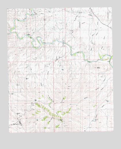
Guthrie, AZ USGS Topographic Map
Click on map above to begin viewing in our Map Viewer.

This topographic map contains these locations and features:
Feature Name Type Latitude Longitude GNIS ID View Map
Aragon PlacePopulated PlaceN32.9723°W109.3576°24308View Map
Basin TankReservoirN32.8885°W109.3416°1045View Map
Brushy CanyonValleyN32.9481°W109.2642°2031View Map
Clay TankReservoirN32.9198°W109.2595°2992View Map
Dark CanyonValleyN32.9026°W109.3267°3703View Map
Frisco CanyonValleyN32.9756°W109.3723°40477View Map
George Hill TankReservoirN32.8943°W109.3663°4979View Map
Gillard Hot SpringsSpringN32.9731°W109.3503°5036View Map
GuthriePopulated PlaceN32.9462°W109.2531°24445View Map
Guthrie CanyonValleyN32.9387°W109.2534°5439View Map
Guthrie MountainSummitN32.9392°W109.2698°5440View Map
Guthrie PeakSummitN32.8870°W109.3151°5441View Map
Guthrie Railroad StationBuildingN32.9437°W109.2545°22724View Map
Guthrie TankReservoirN32.9055°W109.2563°5443View Map
KFMM-FM (Thatcher)TowerN32.8895°W109.3237°45247View Map
KJJJ-FM (Clifton)TowerN32.8895°W109.3234°45175View Map
Lines TankReservoirN32.9144°W109.3697°7045View Map
Maques PlacePopulated PlaceN32.9759°W109.3665°24508View Map
Mesa TankReservoirN32.9381°W109.3116°7907View Map
Negro CanyonValleyN32.9476°W109.2809°32272View Map
Oak CanyonValleyN32.9617°W109.3342°8855View Map
Old Zorilla RanchLocaleN32.9226°W109.3348°8974View Map
Owl CanyonValleyN32.9648°W109.3045°32592View Map
Peach Tree TankReservoirN32.8868°W109.2734°9284View Map
PotholeBasinN32.9317°W109.2665°9690View Map
Pumroy CanyonValleyN32.9640°W109.3095°9814View Map
Rattlesnake CanyonValleyN32.9515°W109.2512°33393View Map
Saddle TanksReservoirN32.9068°W109.3434°10654View Map
San Francisco RiverStreamN32.9762°W109.3720°34011View Map
Smuggler CanyonValleyN32.9959°W109.3453°11483View Map
Smuggler MineMineN32.9940°W109.3473°11484View Map
South Stock Pen TankReservoirN32.9922°W109.2745°11636View Map
Stock Pen CanyonValleyN32.9709°W109.2745°11850View Map
Stock Pen TankReservoirN32.9922°W109.2745°22727View Map
Subia RanchLocaleN32.9662°W109.3328°11907View Map
Wilkerson RanchLocaleN32.9559°W109.3031°13804View Map
Wilkerson TankReservoirN32.9295°W109.3546°13805View Map

Note: Coordinates in the location and feature list above are referenced to NAD83 datum.


Copyright (C) 2008-2025 Ryan Niemi / Sunset Dynamics ... All Rights Reserved