TopoQuest Logo
Do you find TopoQuest useful?
Help keep TopoQuest running and adding new maps/features by donating!
Bitcoin:  19c7KJd3qBynnjoSw5npx9KScwjBe4ifkT
Litecoin:  LXs6TkuXGGXo1vDsWCkWVdjQX94eUKd6ui
Home View Maps Find Maps Find Places Resources & Links


Shenandoah Peak, Nevada Topographic Map

USGS Map Title: Shenandoah Peak, NV
USGS Map MRC: 35115G5
DRG (GeoTIFF) Download: o35115g5.tif


Neighboring USGS Topographic Map Quads:


  Green Monster Mine, NV  
35115H6
 

  Potosi, NV  
35115H5
 

  Cottonwood Pass, NV  
35115H4
 

  West of Shenandoah Peak, CA  
35115G6
 

  Shenandoah Peak, NV  
35115G5
 

  Goodsprings, NV  
35115G4
 

  Mesquite Mountains, CA  
35115F6
 

  Mesquite Lake, CA  
35115F5
 

  State Line Pass, CA  
35115F4


Map MRC Location:

N36°
W116°
N36°
W115°
H8 H7 H6 H5 H4 H3 H2 H1
G8 G7 G6 G5 G4 G3 G2 G1
F8 F7 F6 F5 F4 F3 F2 F1
E8 E7 E6 E5 E4 E3 E2 E1
D8 D7 D6 D5 D4 D3 D2 D1
C8 C7 C6 C5 C4 C3 C2 C1
B8 B7 B6 B5 B4 B3 B2 B1
A8 A7 A6 A5 A4 A3 A2 A1
N35°
W116°
N35°
W115°

Shenandoah Peak, NV USGS 1:24K Topographic Map Preview:
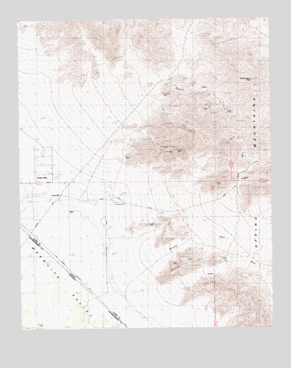
Shenandoah Peak, NV USGS Topographic Map
Click on map above to begin viewing in our Map Viewer.

This topographic map contains these locations and features:
Feature Name Type Latitude Longitude GNIS ID View Map
Akron MineMineN35.8055°W115.5072°855256View Map
Azurite MineMineN35.8236°W115.5675°855246View Map
Bill Nye MineMineN35.8103°W115.5106°838782View Map
Bonanza HillSummitN35.7750°W115.5444°847252View Map
Bonanza WashStreamN35.7700°W115.5725°838965View Map
Boss MineMineN35.8191°W115.5711°838985View Map
Cairn East of Shenandoah MineSummitN35.8197°W115.5458°853704View Map
Chiquita MineMineN35.8400°W115.5319°845796View Map
Clementina MineMineN35.8350°W115.5189°855251View Map
Copper Chief MineMineN35.8225°W115.5489°855250View Map
Copper Flower MineMineN35.7894°W115.5500°855255View Map
Copperside MineMineN35.8244°W115.5644°855247View Map
Cub Lee WellWellN35.7519°W115.6153°241148View Map
Galena WashStreamN35.8166°W115.5092°846721View Map
Golden Chariot MineMineN35.8344°W115.5206°855252View Map
Goodsprings Mining DistrictCivilN35.8455°W115.5003°848424View Map
Highline MineMineN35.8244°W115.5628°855248View Map
Hoodoo MineMineN35.7914°W115.5522°841049View Map
Ironside MineMineN35.8253°W115.5594°855249View Map
Keystone AcademySchoolN35.8089°W115.6236°2086771View Map
Keystone Mill (historical)LocaleN35.8016°W115.6064°846713View Map
Keystone MineMineN35.8344°W115.5189°841484View Map
Keystone Post OfficePost OfficeN35.8016°W115.6064°864429View Map
Keystone WashStreamN35.7978°W115.5856°841486View Map
Kirby MineMineN35.8255°W115.5222°841498View Map
Kirby WashStreamN35.7839°W115.5336°841499View Map
Lincoln CityPopulated PlaceN35.8019°W115.6231°846714View Map
McVicar MineMineN35.7725°W115.5422°842037View Map
Mobile MineMineN35.8216°W115.5467°842176View Map
Oro Amigo MineMineN35.8472°W115.5475°842640View Map
Platina (historical)Populated PlaceN35.8022°W115.5797°851516View Map
Platina MineMineN35.8194°W115.5642°855274View Map
Platina Post OfficePost OfficeN35.8022°W115.5797°864310View Map
Ragged PeakSummitN35.8730°W115.5842°851515View Map
Rattler HillSummitN35.8378°W115.5006°846720View Map
RipleyPopulated PlaceN35.7980°W115.6017°856119View Map
Ripley Post OfficePost OfficeN35.7980°W115.6017°864430View Map
Root Camp (historical)Populated PlaceN35.7830°W115.5403°864316View Map
Root MineMineN35.7783°W115.5456°843351View Map
Sandy MillPopulated PlaceN35.8041°W115.6050°856129View Map
Sandy Post OfficePost OfficeN35.8041°W115.6050°864431View Map
Sandy Valley Middle SchoolSchoolN35.8131°W115.6097°2085606View Map
Shenandoah MillLocaleN35.8005°W115.5789°843656View Map
Shenandoah MineMineN35.8219°W115.5511°843657View Map
Shenandoah PeakSummitN35.8503°W115.5094°843658View Map
Singer MineMineN35.7769°W115.5269°843728View Map
Singer WashStreamN35.7650°W115.5519°843729View Map
Smithsonite MineMineN35.8244°W115.5553°843783View Map
Spelter MineMineN35.7928°W115.5550°843915View Map
Sultan MineMineN35.7516°W115.5000°844072View Map
Tiffin MineMineN35.7764°W115.5258°855254View Map
Whale MineMineN35.8078°W115.5286°844745View Map

Note: Coordinates in the location and feature list above are referenced to NAD83 datum.


Copyright (C) 2008-2024 Ryan Niemi / Sunset Dynamics ... All Rights Reserved