TopoQuest Logo
Do you find TopoQuest useful?
Help keep TopoQuest running and adding new maps/features by donating!
Bitcoin:  19c7KJd3qBynnjoSw5npx9KScwjBe4ifkT
Litecoin:  LXs6TkuXGGXo1vDsWCkWVdjQX94eUKd6ui
Home View Maps Find Maps Find Places Resources & Links


Black Creek, South Carolina Topographic Map

USGS Map Title: Black Creek, SC
USGS Map MRC: 32080G7
DRG (GeoTIFF) Download: o32080g7.tif


Neighboring USGS Topographic Map Quads:


  Islandton, SC  
32080H8
 

  Sniders Crossroads, SC  
32080H7
 

  Walterboro, SC  
32080H6
 

  Cummings, SC  
32080G8
 

  Black Creek, SC  
32080G7
 

  Hendersonville, SC  
32080G6
 

  McPhersonville, SC  
32080F8
 

  Yemassee, SC  
32080F7
 

  White Hall, SC  
32080F6


Map MRC Location:

N33°
W81°
N33°
W80°
H8 H7 H6 H5 H4 H3 H2 H1
G8 G7 G6 G5 G4 G3 G2 G1
F8 F7 F6 F5 F4 F3 F2 F1
E8 E7 E6 E5 E4 E3 E2 E1
D8 D7 D6 D5 D4 D3 D2 D1
C8 C7 C6 C5 C4 C3 C2 C1
B8 B7 B6 B5 B4 B3 B2 B1
A8 A7 A6 A5 A4 A3 A2 A1
N32°
W81°
N32°
W80°

Black Creek, SC USGS 1:24K Topographic Map Preview:
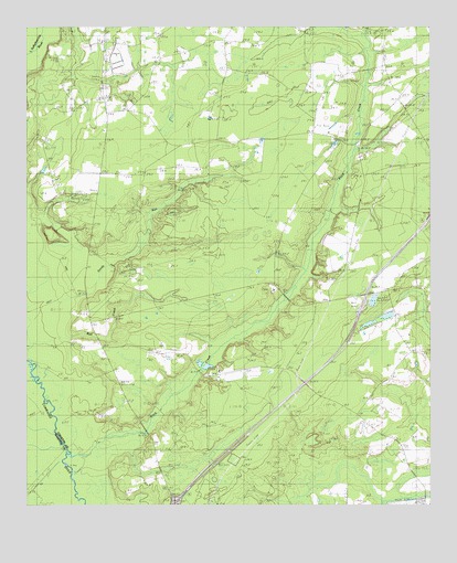
Black Creek, SC USGS Topographic Map
Click on map above to begin viewing in our Map Viewer.

This topographic map contains these locations and features:
Feature Name Type Latitude Longitude GNIS ID View Map
Bertha School (historical)SchoolN32.8571°W80.8512°1240553View Map
Big Gate School (historical)SchoolN32.8241°W80.7945°1240562View Map
Big Survey LakeReservoirN32.7865°W80.8189°1239390View Map
Big Survey Lake Dam D-2547DamN32.7885°W80.8165°1239389View Map
Black CreekStreamN32.7588°W80.8593°1220765View Map
Black Creek ChurchChurchN32.8066°W80.7957°1246897View Map
Bull CreekStreamN32.7932°W80.8607°1247052View Map
Cane Branch Lookout TowerTowerN32.8491°W80.7854°1240578View Map
Cane Branch School (historical)SchoolN32.8446°W80.7720°1240579View Map
Caney Branch SchoolSchoolN32.8663°W80.7623°1221322View Map
Cavern Branch SchoolSchoolN32.8293°W80.7723°1221419View Map
Colleton Fire Department Station 29BuildingN32.8530°W80.8456°2368432View Map
Colleton Fire Department Station 8BuildingN32.8039°W80.7768°2368130View Map
Crosbys PondReservoirN32.8105°W80.7797°1239392View Map
Crosbys Pond Dam D-2546DamN32.8085°W80.7798°1239391View Map
Fire Hill SchoolSchoolN32.8702°W80.8095°1222393View Map
Hendersonville DivisionCivilN32.8009°W80.7609°1938296View Map
Heyward ChurchChurchN32.8482°W80.8509°1240637View Map
Heyward School (historical)SchoolN32.8482°W80.8509°1240638View Map
Interchange 42CrossingN32.7507°W80.8290°1228304View Map
Marys ChurchChurchN32.8304°W80.8557°1224355View Map
New Hope SchoolSchoolN32.8266°W80.8465°1225000View Map
Newville SchoolSchoolN32.7788°W80.7679°1231591View Map
Polly Bottom SchoolSchoolN32.7818°W80.8462°1225590View Map
Sandy RunStreamN32.7980°W80.8637°1226378View Map
Shiloh CemeteryCemeteryN32.8593°W80.8515°1240740View Map
Shiloh ChurchChurchN32.8588°W80.8523°1226569View Map

Note: Coordinates in the location and feature list above are referenced to NAD83 datum.


Copyright (C) 2008-2024 Ryan Niemi / Sunset Dynamics ... All Rights Reserved