TopoQuest Logo
Do you find TopoQuest useful?
Help keep TopoQuest running and adding new maps/features by donating!
Bitcoin:  19c7KJd3qBynnjoSw5npx9KScwjBe4ifkT
Litecoin:  LXs6TkuXGGXo1vDsWCkWVdjQX94eUKd6ui
Home View Maps Find Maps Find Places Resources & Links


Black Draw, Wyoming Topographic Map

USGS Map Title: Black Draw, WY
USGS Map MRC: 44105H8
DRG (GeoTIFF) Download: o44105h8.tif


Neighboring USGS Topographic Map Quads:


  Sayle Hall, MT  
45106A1
 

  Bradshaw Creek, MT  
45105A8
 

  Moorhead, MT  
45105A7
 

  Cabin Creek NE, WY  
44106H1
 

  Black Draw, WY  
44105H8
 

  Dead Horse Lake, WY  
44105H7
 

  Cabin Creek SE, WY  
44106G1
 

  Kline Draw, WY  
44105G8
 

  Reservoir Creek, WY  
44105G7


Map MRC Location:

N45°
W106°
N45°
W105°
H8 H7 H6 H5 H4 H3 H2 H1
G8 G7 G6 G5 G4 G3 G2 G1
F8 F7 F6 F5 F4 F3 F2 F1
E8 E7 E6 E5 E4 E3 E2 E1
D8 D7 D6 D5 D4 D3 D2 D1
C8 C7 C6 C5 C4 C3 C2 C1
B8 B7 B6 B5 B4 B3 B2 B1
A8 A7 A6 A5 A4 A3 A2 A1
N44°
W106°
N44°
W105°

Black Draw, WY USGS 1:24K Topographic Map Preview:
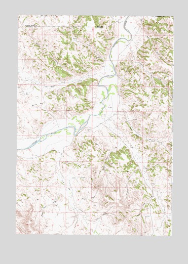
Black Draw, WY USGS Topographic Map
Click on map above to begin viewing in our Map Viewer.

This topographic map contains these locations and features:
Feature Name Type Latitude Longitude GNIS ID View Map
Bear GulchValleyN44.9914°W105.9056°1585263View Map
Black DrawValleyN44.9628°W105.9528°768958View Map
Black DrawValleyN44.9628°W105.9531°1585592View Map
Coal CreekStreamN44.9033°W105.9570°1586803View Map
Crooked CreekStreamN44.9136°W105.8978°1587237View Map
Dead Horse CreekStreamN44.9464°W105.9242°1587404View Map
ER CemeteryCemeteryN44.9385°W105.9334°2774526View Map
Fence CreekStreamN44.9647°W105.9320°1588412View Map
Flat DrawValleyN44.8842°W105.9434°1588561View Map
Greenough DamDamN44.8950°W105.8939°1606418View Map
Greenough ReservoirReservoirN44.8950°W105.8939°1606419View Map
L X Bar CreekStreamN44.9236°W105.9667°1590435View Map
Line CreekStreamN44.9967°W105.9133°773376View Map
Long CreekStreamN44.9025°W105.8908°1590973View Map
SA CreekStreamN44.9433°W105.9292°1593733View Map
Short CreekStreamN44.9739°W105.9300°1594277View Map
Spring CreekStreamN44.9278°W105.9108°1594849View Map
Warren DamDamN44.9700°W105.9106°1607422View Map
Warren ReservoirReservoirN44.9700°W105.9106°1607423View Map
Water Gap DrawValleyN44.9008°W105.9606°1596073View Map
Watson BasinBasinN44.9494°W105.9828°1596088View Map
Williams CreekStreamN44.9855°W105.9114°1596412View Map
Yerger DrawValleyN44.8914°W105.9522°1596680View Map

Note: Coordinates in the location and feature list above are referenced to NAD83 datum.


Copyright (C) 2008-2025 Ryan Niemi / Sunset Dynamics ... All Rights Reserved