TopoQuest Logo
Do you find TopoQuest useful?
Help keep TopoQuest running and adding new maps/features by donating!
Bitcoin:  19c7KJd3qBynnjoSw5npx9KScwjBe4ifkT
Litecoin:  LXs6TkuXGGXo1vDsWCkWVdjQX94eUKd6ui
Home View Maps Find Maps Find Places Resources & Links


Moorhead, Montana Topographic Map

USGS Map Title: Moorhead, MT
USGS Map MRC: 45105A7
DRG (GeoTIFF) Download: o45105a7.tif


Neighboring USGS Topographic Map Quads:


  Sayle, MT  
45105B8
 

  Bloom Creek, MT  
45105B7
 

  Huckins School, MT  
45105B6
 

  Bradshaw Creek, MT  
45105A8
 

  Moorhead, MT  
45105A7
 

  Three Bar Ranch, MT  
45105A6
 

  Black Draw, WY  
44105H8
 

  Dead Horse Lake, WY  
44105H7
 

  Corral Creek, WY  
44105H6


Map MRC Location:

N46°
W106°
N46°
W105°
H8 H7 H6 H5 H4 H3 H2 H1
G8 G7 G6 G5 G4 G3 G2 G1
F8 F7 F6 F5 F4 F3 F2 F1
E8 E7 E6 E5 E4 E3 E2 E1
D8 D7 D6 D5 D4 D3 D2 D1
C8 C7 C6 C5 C4 C3 C2 C1
B8 B7 B6 B5 B4 B3 B2 B1
A8 A7 A6 A5 A4 A3 A2 A1
N45°
W106°
N45°
W105°

Moorhead, MT USGS 1:24K Topographic Map Preview:
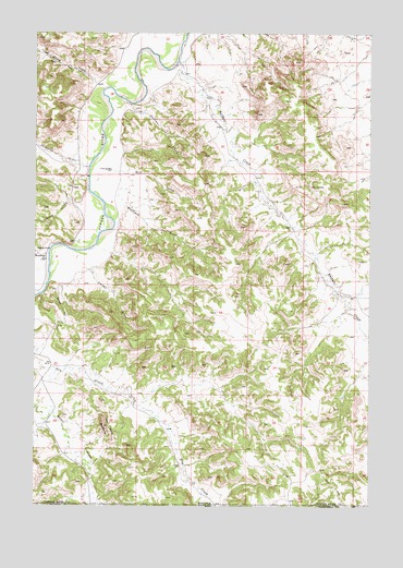
Moorhead, MT USGS Topographic Map
Click on map above to begin viewing in our Map Viewer.

This topographic map contains these locations and features:
Feature Name Type Latitude Longitude GNIS ID View Map
08S49E32CB__01 WellWellN45.0942°W105.7531°807886View Map
09S48E01BBDB01 WellWellN45.0855°W105.7922°807808View Map
09S48E05AC__01 WellWellN45.0811°W105.8628°807786View Map
09S48E05ACDC01 WellWellN45.0803°W105.8639°807782View Map
09S48E05ACDD01 WellWellN45.0833°W105.8645°807798View Map
09S48E08CABC01 WellWellN45.0644°W105.8720°807636View Map
09S48E08CDB_01 WellWellN45.0592°W105.8722°807602View Map
09S48E12AC__01 WellWellN45.0672°W105.7831°807667View Map
09S48E27DBCB01 WellWellN45.0203°W105.8258°807352View Map
Bootjack DrawValleyN45.0805°W105.8425°769107View Map
Buffalo CreekStreamN45.1175°W105.8228°769342View Map
Cliff CreekStreamN45.1039°W105.8570°1689999View Map
East Thompson CreekStreamN45.0936°W105.8425°1689998View Map
Flood CreekStreamN45.1111°W105.8522°783548View Map
Graham CreekStreamN45.0794°W105.8578°784149View Map
Jenkins CreekStreamN45.1064°W105.8403°772809View Map
Kelsey DrawValleyN45.0625°W105.8545°772973View Map
Kelsey HillSummitN45.0511°W105.8661°772974View Map
MoorheadPopulated PlaceN45.0650°W105.8711°774368View Map
The Devils BackboneRidgeN45.0217°W105.8495°777501View Map
Thompson CreekStreamN45.0897°W105.8558°777579View Map
Well CreekStreamN45.0889°W105.8470°778179View Map

Note: Coordinates in the location and feature list above are referenced to NAD83 datum.


Copyright (C) 2008-2024 Ryan Niemi / Sunset Dynamics ... All Rights Reserved