TopoQuest Logo
Do you find TopoQuest useful?
Help keep TopoQuest running and adding new maps/features by donating!
Bitcoin:  19c7KJd3qBynnjoSw5npx9KScwjBe4ifkT
Litecoin:  LXs6TkuXGGXo1vDsWCkWVdjQX94eUKd6ui
Home View Maps Find Maps Find Places Resources & Links


Ship Mountain, California Topographic Map

USGS Map Title: Ship Mountain, CA
USGS Map MRC: 41123F7
DRG (GeoTIFF) Download: o41123f7.tif


Neighboring USGS Topographic Map Quads:


  Gasquet, CA  
41123G8
 

  Hurdygurdy Butte, CA  
41123G7
 

  Devils Punchbowl, CA  
41123G6
 

  Canthook Mountain, CA  
41123F8
 

  Ship Mountain, CA  
41123F7
 

  Prescott Mountain, CA  
41123F6
 

  Klamath Glen, CA  
41123E8
 

  Summit Valley, CA  
41123E7
 

  Chimney Rock, CA  
41123E6


Map MRC Location:

N42°
W124°
N42°
W123°
H8 H7 H6 H5 H4 H3 H2 H1
G8 G7 G6 G5 G4 G3 G2 G1
F8 F7 F6 F5 F4 F3 F2 F1
E8 E7 E6 E5 E4 E3 E2 E1
D8 D7 D6 D5 D4 D3 D2 D1
C8 C7 C6 C5 C4 C3 C2 C1
B8 B7 B6 B5 B4 B3 B2 B1
A8 A7 A6 A5 A4 A3 A2 A1
N41°
W124°
N41°
W123°

Ship Mountain, CA USGS 1:24K Topographic Map Preview:
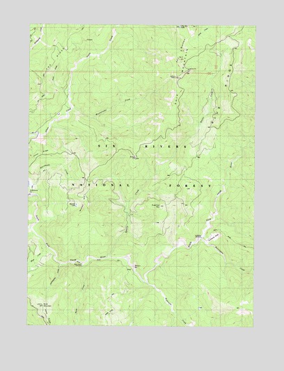
Ship Mountain, CA USGS Topographic Map
Click on map above to begin viewing in our Map Viewer.

This topographic map contains these locations and features:
Feature Name Type Latitude Longitude GNIS ID View Map
Blackhawk BarBarN41.6796°W123.8734°254627View Map
Blue RidgeRidgeN41.7093°W123.7720°233526View Map
Buck CreekStreamN41.6510°W123.8456°219983View Map
Buck Creek CampsiteLocaleN41.6507°W123.8462°1657313View Map
Buck MountainSummitN41.6335°W123.8673°219998View Map
Buck Mountain LookoutLocaleN41.6332°W123.8676°1655226View Map
Eightmile CreekStreamN41.6432°W123.8103°223007View Map
Elkhorn BarBarN41.6485°W123.8176°223132View Map
Four BrothersRangeN41.7357°W123.7928°1658568View Map
Fox RidgeRidgeN41.7309°W123.8678°223791View Map
Gunbarrel CampsiteLocaleN41.6618°W123.7803°1657322View Map
Gunbarrel SlideSlopeN41.6623°W123.7734°1657323View Map
Gunbarrel TrailTrailN41.6671°W123.7790°275091View Map
Harrington CreekStreamN41.6621°W123.7795°224957View Map
Horse CreekStreamN41.6579°W123.8653°225600View Map
Jones RidgeRidgeN41.6957°W123.8706°1657328View Map
Lems Ridge TrailTrailN41.6371°W123.8720°227024View Map
Muslatt LakeLakeN41.6750°W123.8496°252409View Map
Muslatt MountainSummitN41.6726°W123.8442°229375View Map
Muzzleloader CreekStreamN41.7154°W123.8520°229395View Map
Number FourSummitN41.7287°W123.7951°1659236View Map
Number OneSummitN41.7493°W123.7865°254975View Map
Number TwoSummitN41.7390°W123.7903°1659234View Map
Prescott ForkStreamN41.7001°W123.7548°1654932View Map
Quartz CreekStreamN41.6535°W123.8315°231124View Map
Ship MountainSummitN41.7357°W123.7928°233027View Map
Ship Mountain LakeLakeN41.7491°W123.7932°1657347View Map
Ship Mountain LookoutLocaleN41.7282°W123.7956°275087View Map
Ship Mountain TrailTrailN41.7079°W123.8028°233028View Map
Six Rivers National ForestForestN41.7247°W123.8452°255927View Map
Sugarloaf MountainSummitN41.6748°W123.8028°1659907View Map
Upper Smith River TrailTrailN41.6498°W123.8556°236923View Map
Williams Ranch (historical)LocaleN41.6632°W123.7745°1682283View Map
Yellowjacket CreekStreamN41.6504°W123.8570°1657356View Map

Note: Coordinates in the location and feature list above are referenced to NAD83 datum.


Copyright (C) 2008-2025 Ryan Niemi / Sunset Dynamics ... All Rights Reserved