TopoQuest Logo
Do you find TopoQuest useful?
Help keep TopoQuest running and adding new maps/features by donating!
Bitcoin:  19c7KJd3qBynnjoSw5npx9KScwjBe4ifkT
Litecoin:  LXs6TkuXGGXo1vDsWCkWVdjQX94eUKd6ui
Home View Maps Find Maps Find Places Resources & Links


Canthook Mountain, California Topographic Map

USGS Map Title: Canthook Mountain, CA
USGS Map MRC: 41123F8
DRG (GeoTIFF) Download: o41123f8.tif


Neighboring USGS Topographic Map Quads:


  Hiouchi, CA  
41124G1
 

  Gasquet, CA  
41123G8
 

  Hurdygurdy Butte, CA  
41123G7
 

  Childs Hill, CA  
41124F1
 

  Canthook Mountain, CA  
41123F8
 

  Ship Mountain, CA  
41123F7
 

  Requa, CA  
41124E1
 

  Klamath Glen, CA  
41123E8
 

  Summit Valley, CA  
41123E7


Map MRC Location:

N42°
W124°
N42°
W123°
H8 H7 H6 H5 H4 H3 H2 H1
G8 G7 G6 G5 G4 G3 G2 G1
F8 F7 F6 F5 F4 F3 F2 F1
E8 E7 E6 E5 E4 E3 E2 E1
D8 D7 D6 D5 D4 D3 D2 D1
C8 C7 C6 C5 C4 C3 C2 C1
B8 B7 B6 B5 B4 B3 B2 B1
A8 A7 A6 A5 A4 A3 A2 A1
N41°
W124°
N41°
W123°

Canthook Mountain, CA USGS 1:24K Topographic Map Preview:
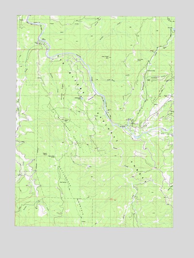
Canthook Mountain, CA USGS Topographic Map
Click on map above to begin viewing in our Map Viewer.

This topographic map contains these locations and features:
Feature Name Type Latitude Longitude GNIS ID View Map
Alma RanchLocaleN41.6832°W123.9051°256191View Map
Big FlatFlatN41.6973°W123.8853°256927View Map
Big Flat CampgroundLocaleN41.6876°W123.9098°275092View Map
Big Flat Forest Service StationLocaleN41.6871°W123.9112°256930View Map
Blackhawk CreekStreamN41.6832°W123.8753°254628View Map
Boulder CreekStreamN41.7248°W123.9731°257379View Map
Boulder RidgeRidgeN41.7065°W123.9631°257388View Map
Cable CrossingCrossingN41.7351°W123.9817°1657314View Map
Canthook CreekStreamN41.7173°W123.9434°257935View Map
Canthook MountainSummitN41.7254°W123.9281°257936View Map
Canthook PrairieAreaN41.7240°W123.9067°257937View Map
China MineMineN41.7121°W123.8976°221050View Map
Chrome MineMineN41.6723°W123.9345°258357View Map
Deer CreekStreamN41.7398°W123.9798°222174View Map
Del Norte CountyCivilN41.7449°W123.9578°1682074View Map
Dry LakeLakeN41.7425°W123.8769°259583View Map
Goose CreekStreamN41.6854°W123.9240°260705View Map
Gordon CreekStreamN41.7237°W123.9495°260715View Map
Haines FlatFlatN41.7462°W123.9354°261010View Map
Hardin MountainSummitN41.6954°W123.9170°1658712View Map
Haydens GulchValleyN41.7129°W123.9001°1657324View Map
Horse FlatFlatN41.7284°W123.8859°261482View Map
Hurdygurdy BridgeBridgeN41.7179°W123.8981°261657View Map
Hurdygurdy CreekStreamN41.6843°W123.9140°261659View Map
Indian BarBarN41.6829°W123.8840°261708View Map
Jones CreekStreamN41.6837°W123.8934°262000View Map
Knapp EstateLocaleN41.7304°W123.9762°1682416View Map
Little Rattlesnake Lookout (historical)LocaleN41.7034°W123.9737°1682420View Map
Little Rattlesnake MountainSummitN41.6832°W123.9559°262696View Map
Melson RanchLocaleN41.6868°W123.8981°263450View Map
Mud SpringSpringN41.6518°W123.9606°263943View Map
Paradise FlatFlatN41.7454°W123.9851°1657336View Map
Paradise Ranch (historical)LocaleN41.7451°W123.9856°1682279View Map
Paradise TrailTrailN41.7390°W123.9909°264512View Map
Pigeon RoostSummitN41.6684°W123.9756°264720View Map
Pigeon Roost SpringSpringN41.6668°W123.9695°264723View Map
Rattlesnake FlatFlatN41.6907°W123.9284°1657340View Map
Rattlesnake LakeLakeN41.7008°W123.9493°265219View Map
Rattlesnake MountainSummitN41.6298°W123.9490°265224View Map
Rattlesnake TrailTrailN41.7021°W123.9492°265231View Map
Rock CreekStreamN41.7354°W123.9829°265496View Map
Rock Creek CampLocaleN41.7271°W123.9931°265499View Map
Soldier WellWellN41.6879°W123.9623°234871View Map
Stevens RanchLocaleN41.7021°W123.8806°267736View Map
Wilson RanchLocaleN41.6962°W123.8873°269213View Map

Note: Coordinates in the location and feature list above are referenced to NAD83 datum.


Copyright (C) 2008-2025 Ryan Niemi / Sunset Dynamics ... All Rights Reserved