TopoQuest Logo
Do you find TopoQuest useful?
Help keep TopoQuest running and adding new maps/features by donating!
Bitcoin:  19c7KJd3qBynnjoSw5npx9KScwjBe4ifkT
Litecoin:  LXs6TkuXGGXo1vDsWCkWVdjQX94eUKd6ui
Home View Maps Find Maps Find Places Resources & Links


Short Bend, Missouri Topographic Map

USGS Map Title: Short Bend, MO
USGS Map MRC: 37091F4
DRG (GeoTIFF) Download: o37091f4.tif


Neighboring USGS Topographic Map Quads:


  Seaton, MO  
37091G5
 

  Cook Station, MO  
37091G4
 

  Cherryville, MO  
37091G3
 

  Salem, MO  
37091F5
 

  Short Bend, MO  
37091F4
 

  Howes Mill Spring, MO  
37091F3
 

  Darien, MO  
37091E5
 

  Doss, MO  
37091E4
 

  Stone Hill, MO  
37091E3


Map MRC Location:

N38°
W92°
N38°
W91°
H8 H7 H6 H5 H4 H3 H2 H1
G8 G7 G6 G5 G4 G3 G2 G1
F8 F7 F6 F5 F4 F3 F2 F1
E8 E7 E6 E5 E4 E3 E2 E1
D8 D7 D6 D5 D4 D3 D2 D1
C8 C7 C6 C5 C4 C3 C2 C1
B8 B7 B6 B5 B4 B3 B2 B1
A8 A7 A6 A5 A4 A3 A2 A1
N37°
W92°
N37°
W91°

Short Bend, MO USGS 1:24K Topographic Map Preview:
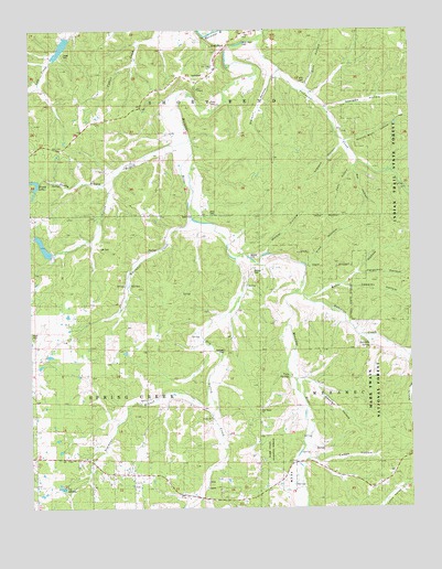
Short Bend, MO USGS Topographic Map
Click on map above to begin viewing in our Map Viewer.

This topographic map contains these locations and features:
Feature Name Type Latitude Longitude GNIS ID View Map
Baker HollowValleyN37.6800°W91.4093°751648View Map
Beasley HollowValleyN37.6584°W91.4135°738197View Map
Capps HollowValleyN37.6375°W91.4093°753277View Map
Cassidy HollowValleyN37.6834°W91.3976°753274View Map
Deerpen HollowValleyN37.7292°W91.4004°749612View Map
Dent CemeteryCemeteryN37.7023°W91.4412°742120View Map
Dent FordPopulated PlaceN37.7009°W91.4465°749630View Map
Dowdy BranchStreamN37.7209°W91.4474°753281View Map
Dry Valley CreekStreamN37.6900°W91.4329°749739View Map
Ellis CemeteryCemeteryN37.7369°W91.4091°753947View Map
Ellis HollowValleyN37.7356°W91.4090°754040View Map
England HollowValleyN37.7209°W91.3965°738201View Map
Ferguson HollowValleyN37.6867°W91.3913°749908View Map
Fishwater CreekStreamN37.7478°W91.4240°749927View Map
Fishwater SchoolSchoolN37.7381°W91.4132°749928View Map
Fraser CemeteryCemeteryN37.7436°W91.4890°742119View Map
Gamblin SpringSpringN37.6681°W91.3893°738198View Map
Gambling HollowValleyN37.6648°W91.3763°753273View Map
Hight CemeteryCemeteryN37.6714°W91.4996°753279View Map
Honey LakeReservoirN37.7097°W91.4977°738200View Map
Honey Lake DamDamN37.7100°W91.4968°763947View Map
Hutchins CreekStreamN37.6817°W91.4121°750435View Map
Kelly HollowValleyN37.7145°W91.3932°738202View Map
Kent ChapelChurchN37.7345°W91.4449°753282View Map
Lay CemeteryCemeteryN37.6934°W91.4771°750667View Map
Maledy CemeteryCemeteryN37.6870°W91.4268°753284View Map
Maledy FordLocaleN37.6903°W91.4276°753283View Map
Masters DamDamN37.7467°W91.4868°763662View Map
Masters LakeReservoirN37.7458°W91.4893°763663View Map
Mitchell DamDamN37.6917°W91.4918°763959View Map
Mooney LakeReservoirN37.6934°W91.4958°763960View Map
MouncePopulated PlaceN37.6662°W91.3871°740146View Map
Mount Dyke Baptist Church (historical)ChurchN37.7006°W91.4576°735466View Map
Mount Dyke SchoolSchoolN37.7006°W91.4579°751175View Map
Nelson BranchStreamN37.7109°W91.4726°753280View Map
New Home ChurchChurchN37.6512°W91.4246°742118View Map
New Home School (historical)SchoolN37.6664°W91.4057°751292View Map
North Crossroads School (historical)SchoolN37.7492°W91.4846°760138View Map
North Fairview School (historical)SchoolN37.6781°W91.4240°751330View Map
Pine HollowValleyN37.6884°W91.4085°753104View Map
Pryor CemeteryCemeteryN37.7314°W91.4399°749458View Map
Rollins Bluff HollowValleyN37.7328°W91.3790°753275View Map
Rollins Bluff HollowValleyN37.7209°W91.3965°753285View Map
Short BendPopulated PlaceN37.7464°W91.4340°752139View Map
Simmons BranchStreamN37.6531°W91.4413°753276View Map
Simmons SchoolSchoolN37.6570°W91.4515°752168View Map
Springers Mill (historical)LocaleN37.7459°W91.4338°735467View Map
Township of Short BendCivilN37.7448°W91.4197°766607View Map
Township of Spring Creek EastCivilN37.6460°W91.4766°2397876View Map
Twin SpringsSpringN37.6594°W91.4157°753278View Map
Union ChurchChurchN37.6487°W91.4415°752658View Map
Walker HollowValleyN37.6931°W91.4224°751614View Map
Warner DamDamN37.7167°W91.4801°765042View Map
Watson HollowValleyN37.7381°W91.4207°753945View Map
Wet HollowValleyN37.7145°W91.3932°753286View Map
Whitaker CreekStreamN37.7006°W91.4468°753944View Map

Note: Coordinates in the location and feature list above are referenced to NAD83 datum.


Copyright (C) 2008-2025 Ryan Niemi / Sunset Dynamics ... All Rights Reserved