TopoQuest Logo
Do you find TopoQuest useful?
Help keep TopoQuest running and adding new maps/features by donating!
Bitcoin:  19c7KJd3qBynnjoSw5npx9KScwjBe4ifkT
Litecoin:  LXs6TkuXGGXo1vDsWCkWVdjQX94eUKd6ui
Home View Maps Find Maps Find Places Resources & Links


Sierra De La Cruz, New Mexico Topographic Map

USGS Map Title: Sierra De La Cruz, NM
USGS Map MRC: 34106B6
DRG (GeoTIFF) Download: o34106b6.tif


Neighboring USGS Topographic Map Quads:


  La Joya, NM  
34106C7
 

  Becker SW, NM  
34106C6
 

  Cerro Montoso, NM  
34106C5
 

  Mesa Del Yeso, NM  
34106B7
 

  Sierra De La Cruz, NM  
34106B6
 

  Sierra Larga North, NM  
34106B5
 

  Loma De Las Canas, NM  
34106A7
 

  Bustos Well, NM  
34106A6
 

  Sierra Larga South, NM  
34106A5


Map MRC Location:

N35°
W107°
N35°
W106°
H8 H7 H6 H5 H4 H3 H2 H1
G8 G7 G6 G5 G4 G3 G2 G1
F8 F7 F6 F5 F4 F3 F2 F1
E8 E7 E6 E5 E4 E3 E2 E1
D8 D7 D6 D5 D4 D3 D2 D1
C8 C7 C6 C5 C4 C3 C2 C1
B8 B7 B6 B5 B4 B3 B2 B1
A8 A7 A6 A5 A4 A3 A2 A1
N34°
W107°
N34°
W106°

Sierra De La Cruz, NM USGS 1:24K Topographic Map Preview:
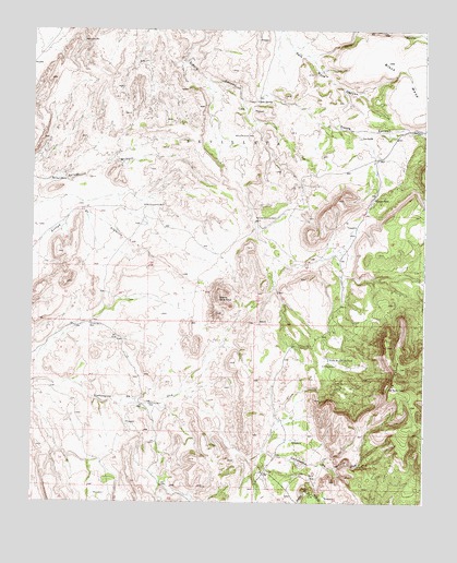
Sierra De La Cruz, NM USGS Topographic Map
Click on map above to begin viewing in our Map Viewer.

This topographic map contains these locations and features:
Feature Name Type Latitude Longitude GNIS ID View Map
10029 Water WellWellN34.2220°W106.6847°925674View Map
Agua de los TorresStreamN34.2437°W106.6625°900270View Map
Buffalo Water WellWellN34.2234°W106.6267°925675View Map
Buffalo WellWellN34.2234°W106.6264°886870View Map
Cibola SpringSpringN34.2312°W106.6786°887595View Map
Cuesta de la McBrideSummitN34.1276°W106.6614°888140View Map
Donnis TankReservoirN34.2053°W106.6417°888456View Map
Gallina WellWellN34.1509°W106.7122°889301View Map
La CaidaReservoirN34.2216°W106.6461°890774View Map
La CebollaSummitN34.1553°W106.6350°899700View Map
Milagro WellWellN34.2103°W106.7439°892040View Map
Partition WellWellN34.2220°W106.6839°893103View Map
Rancho Grande WellWellN34.1995°W106.6789°893658View Map
Sierra de la CruzSummitN34.1792°W106.6906°899915View Map
Stapleton WellWellN34.2034°W106.7131°895303View Map
Tomas Baca WellWellN34.1726°W106.7314°895741View Map
Valle de Adrian TankReservoirN34.1630°W106.6554°896078View Map

Note: Coordinates in the location and feature list above are referenced to NAD83 datum.


Copyright (C) 2008-2025 Ryan Niemi / Sunset Dynamics ... All Rights Reserved