TopoQuest Logo
Do you find TopoQuest useful?
Help keep TopoQuest running and adding new maps/features by donating!
Bitcoin:  19c7KJd3qBynnjoSw5npx9KScwjBe4ifkT
Litecoin:  LXs6TkuXGGXo1vDsWCkWVdjQX94eUKd6ui
Home View Maps Find Maps Find Places Resources & Links


Loma De Las Canas, New Mexico Topographic Map

USGS Map Title: Loma De Las Canas, NM
USGS Map MRC: 34106A7
DRG (GeoTIFF) Download: o34106a7.tif


Neighboring USGS Topographic Map Quads:


  Lemitar, NM  
34106B8
 

  Mesa Del Yeso, NM  
34106B7
 

  Sierra De La Cruz, NM  
34106B6
 

  Socorro, NM  
34106A8
 

  Loma De Las Canas, NM  
34106A7
 

  Bustos Well, NM  
34106A6
 

  Luis Lopez, NM  
33106H8
 

  San Antonio, NM  
33106H7
 

  Canon Agua Buena, NM  
33106H6


Map MRC Location:

N35°
W107°
N35°
W106°
H8 H7 H6 H5 H4 H3 H2 H1
G8 G7 G6 G5 G4 G3 G2 G1
F8 F7 F6 F5 F4 F3 F2 F1
E8 E7 E6 E5 E4 E3 E2 E1
D8 D7 D6 D5 D4 D3 D2 D1
C8 C7 C6 C5 C4 C3 C2 C1
B8 B7 B6 B5 B4 B3 B2 B1
A8 A7 A6 A5 A4 A3 A2 A1
N34°
W107°
N34°
W106°

Loma De Las Canas, NM USGS 1:24K Topographic Map Preview:
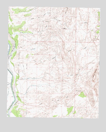
Loma De Las Canas, NM USGS Topographic Map
Click on map above to begin viewing in our Map Viewer.

This topographic map contains these locations and features:
Feature Name Type Latitude Longitude GNIS ID View Map
Arroyo de la CaņasStreamN34.0159°W106.8617°897585View Map
Arroyo de la PresillaValleyN34.0651°W106.8706°897582View Map
Arroyo de los PinosValleyN34.0817°W106.8636°897592View Map
Arroyo de Tio BartoloValleyN34.0778°W106.8628°897597View Map
Arroyo del CoyoteValleyN34.1073°W106.8689°897601View Map
Arroyo del TajoValleyN34.0406°W106.8645°897607View Map
Arroyo MatanzaValleyN34.0026°W106.8706°923553View Map
Arroyo TinajasStreamN34.0678°W106.8106°897682View Map
Bosquecito DitchCanalN34.0042°W106.8634°886652View Map
Brown Interior DrainCanalN34.0237°W106.8736°886763View Map
Cerros de AmadoSummitN34.1012°W106.8000°887398View Map
Chupadero MinesMineN34.1095°W106.8070°917904View Map
East Side Salvage DrainCanalN34.0912°W106.8700°888695View Map
El CoyoteMineN34.1217°W106.7964°917907View Map
Gonzales ProspectMineN34.0806°W106.8075°916534View Map
La Bonita ProspectMineN34.0640°W106.7964°916537View Map
Loma de la CaņasSummitN34.0490°W106.7567°897998View Map
Luis Lopez DrainCanalN34.0384°W106.8736°898370View Map
Martinez ProspectMineN34.0626°W106.8186°916440View Map
Minas del ChupaderoSummitN34.1095°W106.8070°899798View Map
Ojo De AmadoSpringN34.1081°W106.8200°902621View Map
Ojo de AmadoSpringN34.1084°W106.8200°898086View Map
Ojo de la CaņasSpringN34.0309°W106.7786°898083View Map
Ojo de las CaņasSpringN34.0320°W106.7786°902644View Map
Ojo de las CaņasSpringN34.0334°W106.7839°929142View Map
Ojo del CoyoteSpringN34.1178°W106.8184°902645View Map
Ojo del CoyoteSpringN34.1184°W106.8175°898090View Map
Ojo del Rancho de LopezSpringN34.1087°W106.7703°898091View Map
RG39526 Water WellWellN34.0228°W106.7931°925530View Map
Sierra De Las Caņas Wilderness Study AreaParkN34.0320°W106.7786°935865View Map
Socorro DivisionCivilN34.0036°W106.8094°1937578View Map
Socorro Riverside Sub DrainCanalN34.0134°W106.8697°894982View Map
Tajo (historical)Populated PlaceN34.0431°W106.8528°920423View Map

Note: Coordinates in the location and feature list above are referenced to NAD83 datum.


Copyright (C) 2008-2024 Ryan Niemi / Sunset Dynamics ... All Rights Reserved