TopoQuest Logo
Do you find TopoQuest useful?
Help keep TopoQuest running and adding new maps/features by donating!
Bitcoin:  19c7KJd3qBynnjoSw5npx9KScwjBe4ifkT
Litecoin:  LXs6TkuXGGXo1vDsWCkWVdjQX94eUKd6ui
Home View Maps Find Maps Find Places Resources & Links


Silver Falls, Washington Topographic Map

USGS Map Title: Silver Falls, WA
USGS Map MRC: 47120H5
DRG (GeoTIFF) Download: o47120h5.tif


Neighboring USGS Topographic Map Quads:


  Saska Peak, WA  
48120A6
 

  Pyramid Mountain, WA  
48120A5
 

  Big Goat Mountain, WA  
48120A4
 

  Chikamin Creek, WA  
47120H6
 

  Silver Falls, WA  
47120H5
 

  Brief, WA  
47120H4
 

  Plain, WA  
47120G6
 

  Sugarloaf Peak, WA  
47120G5
 

  Tyee Mountain, WA  
47120G4


Map MRC Location:

N48°
W121°
N48°
W120°
H8 H7 H6 H5 H4 H3 H2 H1
G8 G7 G6 G5 G4 G3 G2 G1
F8 F7 F6 F5 F4 F3 F2 F1
E8 E7 E6 E5 E4 E3 E2 E1
D8 D7 D6 D5 D4 D3 D2 D1
C8 C7 C6 C5 C4 C3 C2 C1
B8 B7 B6 B5 B4 B3 B2 B1
A8 A7 A6 A5 A4 A3 A2 A1
N47°
W121°
N47°
W120°

Silver Falls, WA USGS 1:24K Topographic Map Preview:
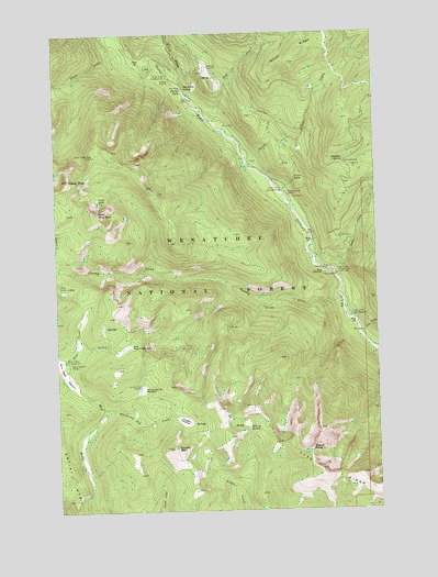
Silver Falls, WA USGS Topographic Map
Click on map above to begin viewing in our Map Viewer.

This topographic map contains these locations and features:
Feature Name Type Latitude Longitude GNIS ID View Map
Blue CreekStreamN47.9085°W120.6215°1516670View Map
Blue Creek CampgroundLocaleN47.9143°W120.6231°1516674View Map
Blue Creek Forest Service StationBuildingN47.9141°W120.6208°2554716View Map
Blue Creek MeadowFlatN47.9104°W120.6231°1516675View Map
Box CanyonValleyN47.9371°W120.5176°1516894View Map
Cougar MeadowFlatN47.8987°W120.5770°1518181View Map
Cougar MountainSummitN47.8912°W120.5806°1518183View Map
Cougar Mountain LookoutTowerN47.8914°W120.5809°2554717View Map
Devil LakeLakeN47.9568°W120.6096°1518692View Map
East Blue Creek MeadowFlatN47.9179°W120.5984°1519072View Map
Entiat FallsFallsN47.9854°W120.5751°1519358View Map
Fox CreekStreamN47.9210°W120.5079°1519755View Map
Fox Creek CampgroundLocaleN47.9254°W120.5109°1519756View Map
Halfway SpringSpringN47.9663°W120.5133°1520459View Map
Halfway Spring CampgroundLocaleN47.9657°W120.5126°1529452View Map
Hunters TrailTrailN47.9112°W120.5912°1521082View Map
Hunters Trail ShelterLocaleN47.9073°W120.5934°1521083View Map
Jungle CreekStreamN47.9643°W120.5476°1521522View Map
Kelly MountainSummitN47.9529°W120.6098°1521602View Map
Klone PeakSummitN47.9618°W120.6209°1521740View Map
Lake CreekStreamN47.9360°W120.5165°1521843View Map
Lake Creek CampgroundLocaleN47.9368°W120.5165°1521848View Map
North Fork CampgroundLocaleN47.9890°W120.5801°1523749View Map
North Fork Entiat RiverStreamN47.9871°W120.5782°1523773View Map
Pope CreekStreamN47.9771°W120.5626°1524571View Map
Signal PeakSummitN47.8910°W120.5270°1525738View Map
Silver CreekStreamN47.9574°W120.5365°1525764View Map
Silver FallsFallsN47.9617°W120.5326°1525773View Map
Silver Falls CampgroundLocaleN47.9585°W120.5373°1525774View Map
Silver Falls Forest Service StationBuildingN47.9585°W120.5373°2554718View Map
Silver RidgeRidgeN47.9965°W120.5257°1525792View Map
Snowshoe SpringSpringN47.9858°W120.5748°1526058View Map
Three CreekStreamN47.9957°W120.5968°1527140View Map
Three Creek Ridge CampLocaleN47.9682°W120.6104°1527141View Map
Tommy CreekStreamN47.9307°W120.5154°1527296View Map
Whistling Pig CreekStreamN47.8998°W120.6087°1528046View Map
Whistling Pig MeadowFlatN47.9065°W120.5926°1528047View Map

Note: Coordinates in the location and feature list above are referenced to NAD83 datum.


Copyright (C) 2008-2025 Ryan Niemi / Sunset Dynamics ... All Rights Reserved