TopoQuest Logo
Do you find TopoQuest useful?
Help keep TopoQuest running and adding new maps/features by donating!
Bitcoin:  19c7KJd3qBynnjoSw5npx9KScwjBe4ifkT
Litecoin:  LXs6TkuXGGXo1vDsWCkWVdjQX94eUKd6ui
Home View Maps Find Maps Find Places Resources & Links


Brief, Washington Topographic Map

USGS Map Title: Brief, WA
USGS Map MRC: 47120H4
DRG (GeoTIFF) Download: o47120h4.tif


Neighboring USGS Topographic Map Quads:


  Pyramid Mountain, WA  
48120A5
 

  Big Goat Mountain, WA  
48120A4
 

  South Navarre Peak, WA  
48120A3
 

  Silver Falls, WA  
47120H5
 

  Brief, WA  
47120H4
 

  Stormy Mountain, WA  
47120H3
 

  Sugarloaf Peak, WA  
47120G5
 

  Tyee Mountain, WA  
47120G4
 

  Baldy Mountain, WA  
47120G3


Map MRC Location:

N48°
W121°
N48°
W120°
H8 H7 H6 H5 H4 H3 H2 H1
G8 G7 G6 G5 G4 G3 G2 G1
F8 F7 F6 F5 F4 F3 F2 F1
E8 E7 E6 E5 E4 E3 E2 E1
D8 D7 D6 D5 D4 D3 D2 D1
C8 C7 C6 C5 C4 C3 C2 C1
B8 B7 B6 B5 B4 B3 B2 B1
A8 A7 A6 A5 A4 A3 A2 A1
N47°
W121°
N47°
W120°

Brief, WA USGS 1:24K Topographic Map Preview:
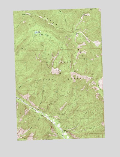
Brief, WA USGS Topographic Map
Click on map above to begin viewing in our Map Viewer.

This topographic map contains these locations and features:
Feature Name Type Latitude Longitude GNIS ID View Map
Angle PeakSummitN47.9399°W120.4176°1515903View Map
Bear LakeLakeN47.9409°W120.4364°1516275View Map
Brennegan CreekStreamN47.8885°W120.4451°1516933View Map
BriefLocaleN47.8821°W120.4359°1516956View Map
Burns CreekStreamN47.9021°W120.4718°1517119View Map
Chesapeake SaddleGapN47.9990°W120.3865°1517665View Map
Crescent HillSummitN47.9749°W120.4126°1518313View Map
Devils BackboneRidgeN47.9287°W120.3859°1518695View Map
East PointSummitN47.9582°W120.4084°1519139View Map
Fourmile RidgeRidgeN47.9426°W120.4448°1519738View Map
Grandma CreekStreamN47.9001°W120.4643°1520198View Map
Handy SpringSpringN47.9793°W120.4128°1520499View Map
Handy Spring CampgroundLocaleN47.9796°W120.4123°1529781View Map
Hazel CampLocaleN47.9971°W120.4737°1520639View Map
Junior PointSummitN47.9943°W120.3995°1521528View Map
Junior Point CampgroundLocaleN47.9949°W120.4009°1530392View Map
Junior Point LookoutLocaleN47.9943°W120.4006°1530403View Map
Lake Creek BasinBasinN47.9782°W120.4606°1521846View Map
Lower Pawn LakeLakeN47.9784°W120.4703°1522549View Map
McCrea CreekStreamN47.8985°W120.4626°1522878View Map
Mott CreekStreamN47.8846°W120.4395°1523414View Map
Pawn LakesLakeN47.9771°W120.4654°1530408View Map
Preston CreekStreamN47.8807°W120.4359°1524633View Map
Preston FallsFallsN47.8826°W120.4314°1524635View Map
Shady PassGapN47.9960°W120.4851°1525609View Map
Shady Pass CampgroundLocaleN47.9954°W120.4848°1529780View Map
South Fork Preston CreekStreamN47.8835°W120.4237°1526230View Map
Upper Pawn LakeLakeN47.9759°W120.4634°1527647View Map

Note: Coordinates in the location and feature list above are referenced to NAD83 datum.


Copyright (C) 2008-2024 Ryan Niemi / Sunset Dynamics ... All Rights Reserved