TopoQuest Logo
Do you find TopoQuest useful?
Help keep TopoQuest running and adding new maps/features by donating!
Bitcoin:  19c7KJd3qBynnjoSw5npx9KScwjBe4ifkT
Litecoin:  LXs6TkuXGGXo1vDsWCkWVdjQX94eUKd6ui
Home View Maps Find Maps Find Places Resources & Links


Silver Lake, Washington Topographic Map

USGS Map Title: Silver Lake, WA
USGS Map MRC: 46122C7
DRG (GeoTIFF) Download: o46122c7.tif


Neighboring USGS Topographic Map Quads:


  Winlock, WA  
46122D8
 

  Toledo, WA  
46122D7
 

  Eden Valley, WA  
46122D6
 

  Castle Rock, WA  
46122C8
 

  Silver Lake, WA  
46122C7
 

  Toutle, WA  
46122C6
 

  Kelso, WA  
46122B8
 

  Mount Brynion, WA  
46122B7
 

  Hemlock Pass, WA  
46122B6


Map MRC Location:

N47°
W123°
N47°
W122°
H8 H7 H6 H5 H4 H3 H2 H1
G8 G7 G6 G5 G4 G3 G2 G1
F8 F7 F6 F5 F4 F3 F2 F1
E8 E7 E6 E5 E4 E3 E2 E1
D8 D7 D6 D5 D4 D3 D2 D1
C8 C7 C6 C5 C4 C3 C2 C1
B8 B7 B6 B5 B4 B3 B2 B1
A8 A7 A6 A5 A4 A3 A2 A1
N46°
W123°
N46°
W122°

Silver Lake, WA USGS 1:24K Topographic Map Preview:
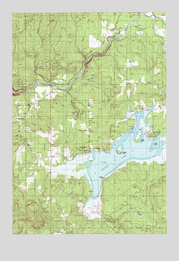
Silver Lake, WA USGS Topographic Map
Click on map above to begin viewing in our Map Viewer.

This topographic map contains these locations and features:
Feature Name Type Latitude Longitude GNIS ID View Map
Camp CowlitzLocaleN46.3348°W122.8346°1503735View Map
Cline CreekStreamN46.3368°W122.8551°1504024View Map
Cowlitz County Fire District 3 Castle Rock SubstationBuildingN46.2915°W122.8564°2619666View Map
Goat IslandIslandN46.3043°W122.7732°1505154View Map
Hollywood GorgeValleyN46.3446°W122.8173°1505562View Map
Indian IslandIslandN46.3007°W122.7621°1510200View Map
Pete Moore IslandIslandN46.2879°W122.8201°1507388View Map
Rock CreekStreamN46.3471°W122.8146°1507844View Map
Rosin CemeteryCemeteryN46.3229°W122.8618°1507924View Map
Seaquest State ParkParkN46.2984°W122.8182°1508188View Map
Seven Wonders MuseumBuildingN46.3210°W122.7539°2610401View Map
Silver LakeLakeN46.2946°W122.7868°1508347View Map
Silver LakePopulated PlaceN46.2973°W122.8107°1508354View Map
Silver Lake CemeteryCemeteryN46.3198°W122.7715°1508348View Map
Stankey CreekStreamN46.3318°W122.8326°1508688View Map
Sucker CreekStreamN46.2662°W122.8109°1508792View Map
Timber PointCapeN46.2818°W122.8026°1510201View Map
Tower CemeteryCemeteryN46.3654°W122.7923°1509062View Map
Waldon IslandIslandN46.2973°W122.7890°1510699View Map

Note: Coordinates in the location and feature list above are referenced to NAD83 datum.


Copyright (C) 2008-2025 Ryan Niemi / Sunset Dynamics ... All Rights Reserved