TopoQuest Logo
Do you find TopoQuest useful?
Help keep TopoQuest running and adding new maps/features by donating!
Bitcoin:  19c7KJd3qBynnjoSw5npx9KScwjBe4ifkT
Litecoin:  LXs6TkuXGGXo1vDsWCkWVdjQX94eUKd6ui
Home View Maps Find Maps Find Places Resources & Links


Castle Rock, Washington Topographic Map

USGS Map Title: Castle Rock, WA
USGS Map MRC: 46122C8
DRG (GeoTIFF) Download: o46122c8.tif


Neighboring USGS Topographic Map Quads:


  Wildwood, WA  
46123D1
 

  Winlock, WA  
46122D8
 

  Toledo, WA  
46122D7
 

  Abernathy Mountain, WA  
46123C1
 

  Castle Rock, WA  
46122C8
 

  Silver Lake, WA  
46122C7
 

  Coal Creek, WA  
46123B1
 

  Kelso, WA  
46122B8
 

  Mount Brynion, WA  
46122B7


Map MRC Location:

N47°
W123°
N47°
W122°
H8 H7 H6 H5 H4 H3 H2 H1
G8 G7 G6 G5 G4 G3 G2 G1
F8 F7 F6 F5 F4 F3 F2 F1
E8 E7 E6 E5 E4 E3 E2 E1
D8 D7 D6 D5 D4 D3 D2 D1
C8 C7 C6 C5 C4 C3 C2 C1
B8 B7 B6 B5 B4 B3 B2 B1
A8 A7 A6 A5 A4 A3 A2 A1
N46°
W123°
N46°
W122°

Castle Rock, WA USGS 1:24K Topographic Map Preview:
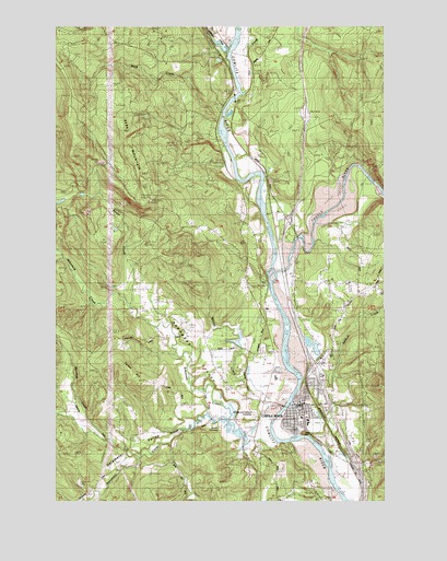
Castle Rock, WA USGS Topographic Map
Click on map above to begin viewing in our Map Viewer.

This topographic map contains these locations and features:
Feature Name Type Latitude Longitude GNIS ID View Map
Arkansas CreekStreamN46.2665°W122.9171°1503057View Map
Arkansas ValleyValleyN46.2701°W122.9271°1503058View Map
Barnes Forest CorridorAreaN46.3321°W122.9062°1514750View Map
Barnes State ParkParkN46.3623°W122.9212°1503181View Map
Baxter CreekStreamN46.3012°W122.9729°1503205View Map
Bebe MountainSummitN46.3537°W122.9948°1513060View Map
Castle RockPopulated PlaceN46.2751°W122.9076°1512072View Map
Castle RockPillarN46.2684°W122.9076°1509795View Map
Castle Rock Elementary SchoolSchoolN46.2709°W122.9054°1514552View Map
Castle Rock FairgroundsLocaleN46.2748°W122.9173°1514525View Map
Castle Rock High SchoolSchoolN46.2824°W122.9176°1514365View Map
Castle Rock Middle SchoolSchoolN46.2718°W122.9077°1514366View Map
Castle Rock Police DepartmentBuildingN46.2744°W122.9097°2721871View Map
Castle Rock Post OfficePost OfficeN46.2756°W122.9095°2769246View Map
Castle Rock Truck TrailTrailN46.3382°W122.9857°1503855View Map
City of Castle RockCivilN46.2717°W122.9056°2409409View Map
Coal Mine CreekStreamN46.2579°W122.8871°1512923View Map
Cougar Flat Airstrip (historical)AirportN46.2926°W122.9504°1533703View Map
Cowlitz County Fire District 6 Station 61BuildingN46.2748°W122.9098°2619465View Map
Delameter CreekStreamN46.2718°W122.9359°1504428View Map
Delameter ValleyValleyN46.2709°W122.9434°1504429View Map
Dobson CreekStreamN46.3021°W122.9871°1504491View Map
Flying K Ranch AirportAirportN46.3293°W122.8862°1533702View Map
GardnerLocaleN46.3240°W122.9107°1514749View Map
Hill CreekStreamN46.3573°W122.9282°1505518View Map
Independent Order of Odd Fellows CemeteryCemeteryN46.2757°W122.8915°1514221View Map
Jackson CemeteryCemeteryN46.2693°W122.9390°1505776View Map
Lower Elementary SchoolSchoolN46.2701°W122.9054°1514250View Map
Monahan CreekStreamN46.2615°W122.9690°1506754View Map
North Castle Rock InterchangeCrossingN46.2846°W122.9026°1514304View Map
North Fork Arkansas CreekStreamN46.2721°W122.9359°1848453View Map
Ogden HillSummitN46.2812°W122.9701°1509895View Map
OlequaPopulated PlaceN46.3740°W122.9398°1511203View Map
Olequa CreekStreamN46.3682°W122.9360°1507162View Map
Rock CreekStreamN46.3523°W122.9371°1507845View Map
Salmon CreekStreamN46.2523°W122.8868°1508053View Map
South Castle Rock InterchangeCrossingN46.2601°W122.8873°1514491View Map
Toutle RiverStreamN46.3109°W122.9184°1509058View Map
Whittle and Hubbard CemeteryCemeteryN46.2734°W122.9254°1510380View Map
Whittle CreekStreamN46.2737°W122.9162°1509492View Map

Note: Coordinates in the location and feature list above are referenced to NAD83 datum.


Copyright (C) 2008-2024 Ryan Niemi / Sunset Dynamics ... All Rights Reserved