TopoQuest Logo
Do you find TopoQuest useful?
Help keep TopoQuest running and adding new maps/features by donating!
Bitcoin:  19c7KJd3qBynnjoSw5npx9KScwjBe4ifkT
Litecoin:  LXs6TkuXGGXo1vDsWCkWVdjQX94eUKd6ui
Home View Maps Find Maps Find Places Resources & Links


Sioux Pine Island, Minnesota Topographic Map

USGS Map Title: Sioux Pine Island, MN
USGS Map MRC: 47092H3
DRG (GeoTIFF) Download: o47092h3.tif


Neighboring USGS Topographic Map Quads:


  Picket Lake, MN  
48092A4
 

  Astrid Lake, MN  
48092A3
 

  Bootleg Lake, MN  
48092A2
 

  Vermilion Dam, MN  
47092H4
 

  Sioux Pine Island, MN  
47092H3
 

  Chad Lake, MN  
47092H2
 

  Lost Lake, MN  
47092G4
 

  Tower, MN  
47092G3
 

  Soudan, MN  
47092G2


Map MRC Location:

N48°
W93°
N48°
W92°
H8 H7 H6 H5 H4 H3 H2 H1
G8 G7 G6 G5 G4 G3 G2 G1
F8 F7 F6 F5 F4 F3 F2 F1
E8 E7 E6 E5 E4 E3 E2 E1
D8 D7 D6 D5 D4 D3 D2 D1
C8 C7 C6 C5 C4 C3 C2 C1
B8 B7 B6 B5 B4 B3 B2 B1
A8 A7 A6 A5 A4 A3 A2 A1
N47°
W93°
N47°
W92°

Sioux Pine Island, MN USGS 1:24K Topographic Map Preview:
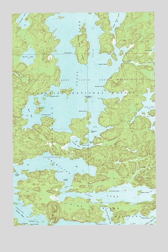
Sioux Pine Island, MN USGS Topographic Map
Click on map above to begin viewing in our Map Viewer.

This topographic map contains these locations and features:
Feature Name Type Latitude Longitude GNIS ID View Map
Arrowhead PointCapeN47.8752°W92.3657°660682View Map
Bear CreekStreamN47.8999°W92.2729°660731View Map
Buzzard IslandIslandN47.8952°W92.2899°660929View Map
Canfield PortageTrailN47.8860°W92.2929°660951View Map
Canfield Portage BayBayN47.8807°W92.2918°660952View Map
Cramer IslandIslandN47.9705°W92.2888°661057View Map
Dollar IslandIslandN47.9763°W92.3293°661126View Map
Dunaway IslandIslandN47.9516°W92.3435°661149View Map
Equay IslandIslandN47.9219°W92.3077°662530View Map
Five Sisters IslandsIslandN47.9482°W92.3104°661282View Map
Gull RockIslandN47.9330°W92.3049°661402View Map
Little Trout LakeLakeN48.0000°W92.2819°661780View Map
Matson IslandIslandN47.8941°W92.2646°661878View Map
Merritt LakeLakeN47.9743°W92.3608°661907View Map
Norway PointCapeN47.9563°W92.2946°662080View Map
Paradise IslandIslandN47.9399°W92.3490°662134View Map
Peanut IslandIslandN47.9246°W92.3065°662148View Map
Pine CreekStreamN47.9707°W92.2774°662196View Map
Pine IslandIslandN47.8852°W92.3024°662199View Map
Portage BayBayN47.9224°W92.3196°662215View Map
Saint Marys IslandIslandN47.9063°W92.3715°662338View Map
Sioux Pine IslandIslandN47.9794°W92.3157°662458View Map
Steamboat IslandIslandN47.9299°W92.3065°662540View Map
Stony IslandIslandN47.9538°W92.3276°662562View Map
Sunset IslandIslandN47.9019°W92.3307°662595View Map
Trout LakeLakeN47.9648°W92.3173°662674View Map
Trout RockCapeN47.9491°W92.2957°662675View Map
Twin IslandIslandN47.9460°W92.3521°662686View Map
Vermilion LakeLakeN47.8916°W92.3668°662716View Map
West BayBayN47.9413°W92.3599°662765View Map
Windy IslandIslandN47.8794°W92.2538°662810View Map
Windy PointCapeN47.9413°W92.3090°662811View Map

Note: Coordinates in the location and feature list above are referenced to NAD83 datum.


Copyright (C) 2008-2025 Ryan Niemi / Sunset Dynamics ... All Rights Reserved