TopoQuest Logo
Do you find TopoQuest useful?
Help keep TopoQuest running and adding new maps/features by donating!
Bitcoin:  19c7KJd3qBynnjoSw5npx9KScwjBe4ifkT
Litecoin:  LXs6TkuXGGXo1vDsWCkWVdjQX94eUKd6ui
Home View Maps Find Maps Find Places Resources & Links


Vermilion Dam, Minnesota Topographic Map

USGS Map Title: Vermilion Dam, MN
USGS Map MRC: 47092H4
DRG (GeoTIFF) Download: o47092h4.tif


Neighboring USGS Topographic Map Quads:


  Buyck, MN  
48092A5
 

  Picket Lake, MN  
48092A4
 

  Astrid Lake, MN  
48092A3
 

  Norwegian Bay, MN  
47092H5
 

  Vermilion Dam, MN  
47092H4
 

  Sioux Pine Island, MN  
47092H3
 

  Sassas Creek, MN  
47092G5
 

  Lost Lake, MN  
47092G4
 

  Tower, MN  
47092G3


Map MRC Location:

N48°
W93°
N48°
W92°
H8 H7 H6 H5 H4 H3 H2 H1
G8 G7 G6 G5 G4 G3 G2 G1
F8 F7 F6 F5 F4 F3 F2 F1
E8 E7 E6 E5 E4 E3 E2 E1
D8 D7 D6 D5 D4 D3 D2 D1
C8 C7 C6 C5 C4 C3 C2 C1
B8 B7 B6 B5 B4 B3 B2 B1
A8 A7 A6 A5 A4 A3 A2 A1
N47°
W93°
N47°
W92°

Vermilion Dam, MN USGS 1:24K Topographic Map Preview:
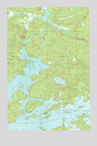
Vermilion Dam, MN USGS Topographic Map
Click on map above to begin viewing in our Map Viewer.

This topographic map contains these locations and features:
Feature Name Type Latitude Longitude GNIS ID View Map
Alepo IslandIslandN47.8985°W92.3893°660644View Map
Birch NarrowsChannelN47.8919°W92.4746°660811View Map
Black Duck BayBayN47.8869°W92.3988°660823View Map
Black Duck IslandIslandN47.8935°W92.4118°660824View Map
Black Duck PointCapeN47.8824°W92.3890°660826View Map
Breezy PointCapeN47.8780°W92.4477°660873View Map
Bystrom BayBayN47.9063°W92.3879°660930View Map
Fectos PointCapeN47.8874°W92.4168°661256View Map
Frazer BayBayN47.8763°W92.4882°661323View Map
Gold IslandIslandN47.8888°W92.4416°661370View Map
Grassy PointCapeN47.8977°W92.4293°661389View Map
Greenwood BayBayN47.8799°W92.4029°661396View Map
Hinsdale IslandIslandN47.8999°W92.4618°661477View Map
Hinsdale Island CampgroundLocaleN47.8944°W92.4641°660524View Map
Hoyt IslandIslandN47.9016°W92.4374°661510View Map
Knotts IslandIslandN47.9457°W92.4660°661654View Map
Little East CreekStreamN47.9791°W92.4213°661736View Map
Moccasin PointCapeN47.8907°W92.3846°661939View Map
Muskrat ChannelChannelN47.8927°W92.4441°662018View Map
Oak IslandIslandN47.9199°W92.4771°662087View Map
Oak NarrowsChannelN47.9110°W92.4713°662088View Map
Peils Vermillion Wings Seaplane BaseAirportN47.8852°W92.4052°660619View Map
Saint Paul IslandIslandN47.8944°W92.3771°662342View Map
Smart BayBayN47.8969°W92.4482°662475View Map
Township of GreenwoodCivilN47.8895°W92.3934°664351View Map
Twomile CreekStreamN47.9885°W92.4449°662698View Map
Vermilion DamDamN47.9610°W92.4760°662712View Map
Vermilion Dam ClubBuildingN47.9916°W92.4707°662713View Map
Vermilion Dam Lookout TowerTowerN47.9699°W92.4774°662714View Map
Wolf BayBayN47.9399°W92.4549°662818View Map
Wolf CreekStreamN47.9066°W92.4288°662819View Map
Wolf LakeLakeN47.9257°W92.4212°662824View Map

Note: Coordinates in the location and feature list above are referenced to NAD83 datum.


Copyright (C) 2008-2025 Ryan Niemi / Sunset Dynamics ... All Rights Reserved