TopoQuest Logo
Do you find TopoQuest useful?
Help keep TopoQuest running and adding new maps/features by donating!
Bitcoin:  19c7KJd3qBynnjoSw5npx9KScwjBe4ifkT
Litecoin:  LXs6TkuXGGXo1vDsWCkWVdjQX94eUKd6ui
Home View Maps Find Maps Find Places Resources & Links


Sister Rocks, California Topographic Map

USGS Map Title: Sister Rocks, CA
USGS Map MRC: 41124F2
DRG (GeoTIFF) Download: o41124f2.tif


Neighboring USGS Topographic Map Quads:


  Crescent City, CA  
41124G2
 

  Hiouchi, CA  
41124G1


  Sister Rocks, CA  
41124F2
 

  Childs Hill, CA  
41124F1


  Requa, CA  
41124E1


Map MRC Location:

N42°
W125°
N42°
W124°
H8 H7 H6 H5 H4 H3 H2 H1
G8 G7 G6 G5 G4 G3 G2 G1
F8 F7 F6 F5 F4 F3 F2 F1
E8 E7 E6 E5 E4 E3 E2 E1
D8 D7 D6 D5 D4 D3 D2 D1
C8 C7 C6 C5 C4 C3 C2 C1
B8 B7 B6 B5 B4 B3 B2 B1
A8 A7 A6 A5 A4 A3 A2 A1
N41°
W125°
N41°
W124°

Sister Rocks, CA USGS 1:24K Topographic Map Preview:
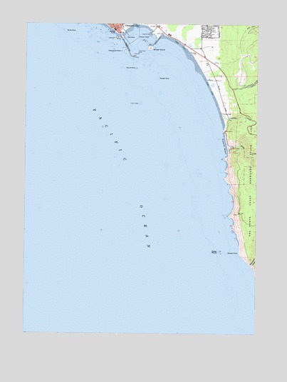
Sister Rocks, CA USGS Topographic Map
Click on map above to begin viewing in our Map Viewer.

This topographic map contains these locations and features:
Feature Name Type Latitude Longitude GNIS ID View Map
Battery PointCapeN41.7465°W124.2045°218735View Map
Battery Point IslandIslandN41.7440°W124.2031°1682066View Map
Beach Front ParkParkN41.7496°W124.1951°1702431View Map
Chase LedgeBenchN41.7182°W124.1906°220928View Map
Citizens DockLocaleN41.7459°W124.1851°221123View Map
Crescent BeachBeachN41.7304°W124.1554°1702435View Map
Crescent City LighthouseBuildingN41.7440°W124.2029°1682070View Map
Crescent HarborHarborN41.7443°W124.1915°1682073View Map
Cushing CreekStreamN41.7134°W124.1454°221940View Map
Damnation CreekStreamN41.6526°W124.1292°233754View Map
Fauntleroy RockIslandN41.7384°W124.1920°1658526View Map
Flat RockIslandN41.7446°W124.1984°223587View Map
Midway PointCapeN41.6573°W124.1354°228635View Map
Mussel RockIslandN41.7282°W124.1806°229382View Map
Nickel CreekStreamN41.6998°W124.1423°229544View Map
Pelican RockIslandN41.7440°W124.1870°230475View Map
Round RockIslandN41.7323°W124.1926°231970View Map
Sister RocksIslandN41.6579°W124.1456°233182View Map
Steamboat RockIslandN41.7390°W124.2009°235417View Map
Whaler IslandIslandN41.7401°W124.1856°237591View Map
White RockIslandN41.7471°W124.2304°237659View Map

Note: Coordinates in the location and feature list above are referenced to NAD83 datum.


Copyright (C) 2008-2025 Ryan Niemi / Sunset Dynamics ... All Rights Reserved