TopoQuest Logo
Do you find TopoQuest useful?
Help keep TopoQuest running and adding new maps/features by donating!
Bitcoin:  19c7KJd3qBynnjoSw5npx9KScwjBe4ifkT
Litecoin:  LXs6TkuXGGXo1vDsWCkWVdjQX94eUKd6ui
Home View Maps Find Maps Find Places Resources & Links


Sitka, Kentucky Topographic Map

USGS Map Title: Sitka, KY
USGS Map MRC: 37082H7
DRG (GeoTIFF) Download: o37082h7.tif


Neighboring USGS Topographic Map Quads:


  Mazie, KY  
38082A8
 

  Blaine, KY  
38082A7
 

  Adams, KY  
38082A6
 

  Redbush, KY  
37082H8
 

  Sitka, KY  
37082H7
 

  Richardson, KY  
37082H6
 

  Oil Springs, KY  
37082G8
 

  Paintsville, KY  
37082G7
 

  Offutt, KY  
37082G6


Map MRC Location:

N38°
W83°
N38°
W82°
H8 H7 H6 H5 H4 H3 H2 H1
G8 G7 G6 G5 G4 G3 G2 G1
F8 F7 F6 F5 F4 F3 F2 F1
E8 E7 E6 E5 E4 E3 E2 E1
D8 D7 D6 D5 D4 D3 D2 D1
C8 C7 C6 C5 C4 C3 C2 C1
B8 B7 B6 B5 B4 B3 B2 B1
A8 A7 A6 A5 A4 A3 A2 A1
N37°
W83°
N37°
W82°

Sitka, KY USGS 1:24K Topographic Map Preview:
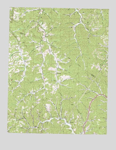
Sitka, KY USGS Topographic Map
Click on map above to begin viewing in our Map Viewer.

This topographic map contains these locations and features:
Feature Name Type Latitude Longitude GNIS ID View Map
Barn HollowValleyN37.9253°W82.7617°2094009View Map
Bear BranchStreamN37.9954°W82.8321°486538View Map
Belles ChapelChurchN37.9160°W82.7568°2337715View Map
Brafford ForkStreamN37.9143°W82.7604°487812View Map
Broad HollowValleyN37.8798°W82.8478°487929View Map
Browns ForkStreamN37.9143°W82.7557°488035View Map
Browns ForkStreamN37.8804°W82.8452°488037View Map
Burnt Cabin BranchStreamN37.8904°W82.8077°488457View Map
Castle ForkStreamN37.9143°W82.7604°489070View Map
Caudill BranchStreamN37.9201°W82.8302°489105View Map
Cave ForkStreamN37.8887°W82.7740°489118View Map
ChandlervillePopulated PlaceN37.9348°W82.8135°507684View Map
Church of ChristChurchN37.8818°W82.8382°509994View Map
Church of ChristChurchN37.8904°W82.8060°509995View Map
Daniels BranchStreamN37.9309°W82.8321°490569View Map
Davis BranchStreamN37.9640°W82.8221°490639View Map
DavisvillePopulated PlaceN37.9704°W82.8299°507823View Map
Davisville Post Office (historical)Post OfficeN37.9697°W82.8301°2121033View Map
Dogwood ForkStreamN37.8862°W82.7777°490990View Map
Enterprise ChurchChurchN37.9134°W82.8496°491792View Map
Fairchild BranchStreamN37.9370°W82.8552°491873View Map
Fitch BranchStreamN37.9420°W82.8329°509996View Map
Frank Vanhoose BranchStreamN37.8904°W82.8188°492440View Map
Franks Creek ChurchChurchN37.9493°W82.8571°510091View Map
Frogonery BranchStreamN37.8895°W82.8082°492569View Map
Goose ForkStreamN37.8856°W82.8321°493021View Map
Gray Mare BranchStreamN37.9145°W82.8446°493203View Map
Green BranchStreamN37.9404°W82.8129°493257View Map
Hawes ForkStreamN37.9187°W82.7702°493880View Map
Hoods Fork United Baptist ChurchChurchN37.9723°W82.8291°510108View Map
Hunterscamp BranchStreamN37.9543°W82.7827°494790View Map
Jim Stambaugh ForkStreamN37.8804°W82.8454°495273View Map
Jim Sturgill BranchStreamN37.9631°W82.8224°495274View Map
KerzPopulated PlaceN37.9168°W82.8396°508383View Map
Left Fork Brushy CreekStreamN37.9862°W82.7838°496200View Map
Lettered RocksSummitN37.9045°W82.7915°496302View Map
Lick BranchStreamN37.9761°W82.7742°2092925View Map
Lick ForkStreamN37.8773°W82.7793°496503View Map
Lick ForkStreamN37.9090°W82.8049°496504View Map
Locust Grove United Baptist ChurchChurchN37.8787°W82.7938°496958View Map
Marvin Sparks CemeteryCemeteryN37.9726°W82.8285°509998View Map
Meadow ForkStreamN37.9262°W82.8110°497989View Map
Mount Olive School (historical)SchoolN37.9608°W82.7861°2337807View Map
Mount Olive United Baptist Church (historical)ChurchN37.9525°W82.7874°2337726View Map
Nat Pickle ForkStreamN37.8898°W82.8541°499182View Map
Nippa DivisionCivilN37.9013°W82.7870°1937175View Map
Pack and Chandler CemeteryCemeteryN37.9270°W82.8140°509999View Map
Peter BranchStreamN37.9826°W82.7904°500457View Map
Puncheon ForkStreamN37.9145°W82.8443°501450View Map
Ramey BranchStreamN37.9854°W82.8368°501549View Map
Ramey BranchStreamN37.8756°W82.8749°501552View Map
Rockhouse ForkStreamN37.9673°W82.8271°502199View Map
Rocky Point School (historical)SchoolN37.9781°W82.8320°2337814View Map
Ross BranchStreamN37.9762°W82.8257°502360View Map
Shop BranchStreamN37.9554°W82.8596°503421View Map
SipPopulated PlaceN37.9251°W82.8277°509064View Map
SitkaPopulated PlaceN37.8806°W82.8382°509066View Map
Sloane BranchStreamN37.9620°W82.8346°503701View Map
Sparks BranchStreamN37.9745°W82.8266°504023View Map
Sparks CemeteryCemeteryN37.9187°W82.8699°504025View Map
Stambaugh CemeteryCemeteryN37.8859°W82.7965°504241View Map
Stonecoal BranchStreamN37.9990°W82.7910°504468View Map
Sugar Grove United Baptist ChurchChurchN37.9340°W82.8313°504665View Map
Tarkiln (historical)Populated PlaceN37.9992°W82.8372°2337451View Map
Tarkiln BranchStreamN37.9990°W82.8332°504960View Map
Tarkiln Post Office (historical)Post OfficeN37.9922°W82.8585°2121067View Map
Tarkiln School (historical)SchoolN37.9992°W82.8372°2337818View Map
Tarklin Church (historical)ChurchN37.9992°W82.8372°510175View Map
Tick Vanhoose BranchStreamN37.8859°W82.8338°505275View Map
Travis BranchStreamN37.9756°W82.7729°505476View Map
Well BranchStreamN37.8845°W82.7993°506367View Map
Wheeler CemeteryCemeteryN37.9656°W82.8568°509997View Map
WilburPopulated PlaceN37.9862°W82.7846°509368View Map
Wilbur Post Office (historical)Post OfficeN37.9861°W82.7852°2121074View Map
Wilbur School (historical)SchoolN37.9856°W82.7833°2337827View Map
WinifredPopulated PlaceN37.9462°W82.8546°509387View Map

Note: Coordinates in the location and feature list above are referenced to NAD83 datum.


Copyright (C) 2008-2025 Ryan Niemi / Sunset Dynamics ... All Rights Reserved