TopoQuest Logo
Do you find TopoQuest useful?
Help keep TopoQuest running and adding new maps/features by donating!
Bitcoin:  19c7KJd3qBynnjoSw5npx9KScwjBe4ifkT
Litecoin:  LXs6TkuXGGXo1vDsWCkWVdjQX94eUKd6ui
Home View Maps Find Maps Find Places Resources & Links


Sixmile Point, Idaho Topographic Map

USGS Map Title: Sixmile Point, ID
USGS Map MRC: 44115C8
DRG (GeoTIFF) Download: o44115c8.tif


Neighboring USGS Topographic Map Quads:


  Alpha, ID  
44116D1
 

  Skunk Creek Summit, ID  
44115D8
 

  Bull Creek Hot Springs, ID  
44115D7
 

  Smiths Ferry, ID  
44116C1
 

  Sixmile Point, ID  
44115C8
 

  Boiling Springs, ID  
44115C7
 

  Packer John Mountain, ID  
44116B1
 

  Pyle Creek, ID  
44115B8
 

  Lightning Ridge, ID  
44115B7


Map MRC Location:

N45°
W116°
N45°
W115°
H8 H7 H6 H5 H4 H3 H2 H1
G8 G7 G6 G5 G4 G3 G2 G1
F8 F7 F6 F5 F4 F3 F2 F1
E8 E7 E6 E5 E4 E3 E2 E1
D8 D7 D6 D5 D4 D3 D2 D1
C8 C7 C6 C5 C4 C3 C2 C1
B8 B7 B6 B5 B4 B3 B2 B1
A8 A7 A6 A5 A4 A3 A2 A1
N44°
W116°
N44°
W115°

Sixmile Point, ID USGS 1:24K Topographic Map Preview:
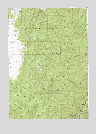
Sixmile Point, ID USGS Topographic Map
Click on map above to begin viewing in our Map Viewer.

This topographic map contains these locations and features:
Feature Name Type Latitude Longitude GNIS ID View Map
Bear Wallow Trail (historical)TrailN44.2682°W115.9660°377213View Map
Herrick ReservoirReservoirN44.3735°W115.9843°398534View Map
Herrick Reservoir Public Fishing AreaLocaleN44.3727°W115.9876°401397View Map
Hot SpringsSpringN44.2526°W115.8920°395694View Map
Middle Fork Picnic AreaLocaleN44.2571°W115.8887°398474View Map
Rattlesnake CampgroundLocaleN44.2660°W115.8798°398536View Map
Rattlesnake CreekStreamN44.2680°W115.8807°400055View Map
Rocky CanyonValleyN44.2507°W115.8932°389549View Map
Sixmile CreekStreamN44.2835°W115.8751°390496View Map
Sixmile PointSummitN44.3074°W115.9535°390500View Map
Sixmile TrailTrailN44.3152°W115.9237°398134View Map
South Fork West Fork CreekStreamN44.3205°W115.8893°391054View Map
Trail CreekStreamN44.2749°W115.8751°392275View Map
West Fork Sixmile CreekStreamN44.2816°W115.9362°393196View Map

Note: Coordinates in the location and feature list above are referenced to NAD83 datum.


Copyright (C) 2008-2025 Ryan Niemi / Sunset Dynamics ... All Rights Reserved