TopoQuest Logo
Do you find TopoQuest useful?
Help keep TopoQuest running and adding new maps/features by donating!
Bitcoin:  19c7KJd3qBynnjoSw5npx9KScwjBe4ifkT
Litecoin:  LXs6TkuXGGXo1vDsWCkWVdjQX94eUKd6ui
Home View Maps Find Maps Find Places Resources & Links


Bull Creek Hot Springs, Idaho Topographic Map

USGS Map Title: Bull Creek Hot Springs, ID
USGS Map MRC: 44115D7
DRG (GeoTIFF) Download: o44115d7.tif


Neighboring USGS Topographic Map Quads:


  Eagle Nest, ID  
44115E8
 

  Oro Mountain, ID  
44115E7
 

  Rice Peak, ID  
44115E6
 

  Skunk Creek Summit, ID  
44115D8
 

  Bull Creek Hot Springs, ID  
44115D7
 

  Wild Buck Peak, ID  
44115D6
 

  Sixmile Point, ID  
44115C8
 

  Boiling Springs, ID  
44115C7
 

  Deadwood Reservoir, ID  
44115C6


Map MRC Location:

N45°
W116°
N45°
W115°
H8 H7 H6 H5 H4 H3 H2 H1
G8 G7 G6 G5 G4 G3 G2 G1
F8 F7 F6 F5 F4 F3 F2 F1
E8 E7 E6 E5 E4 E3 E2 E1
D8 D7 D6 D5 D4 D3 D2 D1
C8 C7 C6 C5 C4 C3 C2 C1
B8 B7 B6 B5 B4 B3 B2 B1
A8 A7 A6 A5 A4 A3 A2 A1
N44°
W116°
N44°
W115°

Bull Creek Hot Springs, ID USGS 1:24K Topographic Map Preview:
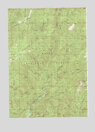
Bull Creek Hot Springs, ID USGS Topographic Map
Click on map above to begin viewing in our Map Viewer.

This topographic map contains these locations and features:
Feature Name Type Latitude Longitude GNIS ID View Map
Bryan CreekStreamN44.3813°W115.8415°378345View Map
Bull CreekStreamN44.4227°W115.8135°378458View Map
Bull Creek Hot SpringsSpringN44.4292°W115.7630°378462View Map
Dash CreekStreamN44.3830°W115.8407°380253View Map
East Fork Clear CreekStreamN44.4835°W115.8501°381067View Map
East MountainSummitN44.4424°W115.8701°381210View Map
East Mountain LookoutLocaleN44.4424°W115.8704°394555View Map
East Mountain WayTrailN44.4591°W115.8285°381211View Map
Eureka PointCapeN44.4816°W115.7701°381499View Map
Fool CreekStreamN44.4291°W115.8146°381909View Map
Fool Creek TrailTrailN44.4349°W115.8451°381910View Map
Goat CreekStreamN44.3960°W115.8318°382311View Map
Ground Hog CreekStreamN44.3924°W115.8365°382705View Map
Lake CreekStreamN44.3971°W115.8296°384350View Map
Ligget CreekStreamN44.4727°W115.7943°384622View Map
Liggett Creek WayChannelN44.4702°W115.7782°394556View Map
Long Fork Silver CreekStreamN44.3816°W115.7612°386043View Map
Silver Creek LookoutLocaleN44.3852°W115.7898°390436View Map
Silver Creek SummitSummitN44.4135°W115.7604°390437View Map
Sixteen-to-one CreekStreamN44.4260°W115.8029°390504View Map

Note: Coordinates in the location and feature list above are referenced to NAD83 datum.


Copyright (C) 2008-2025 Ryan Niemi / Sunset Dynamics ... All Rights Reserved