TopoQuest Logo
Do you find TopoQuest useful?
Help keep TopoQuest running and adding new maps/features by donating!
Bitcoin:  19c7KJd3qBynnjoSw5npx9KScwjBe4ifkT
Litecoin:  LXs6TkuXGGXo1vDsWCkWVdjQX94eUKd6ui
Home View Maps Find Maps Find Places Resources & Links


Skedee, Oklahoma Topographic Map

USGS Map Title: Skedee, OK
USGS Map MRC: 36096D6
DRG (GeoTIFF) Download: o36096d6.tif


Neighboring USGS Topographic Map Quads:


  Doga Creek, OK  
36096E7
 

  Fairfax, OK  
36096E6
 

  Lucy Creek, OK  
36096E5
 

  Masham, OK  
36096D7
 

  Skedee, OK  
36096D6
 

  Bug Creek, OK  
36096D5
 

  Pawnee, OK  
36096C7
 

  Casey, OK  
36096C6
 

  Blackburn, OK  
36096C5


Map MRC Location:

N37°
W97°
N37°
W96°
H8 H7 H6 H5 H4 H3 H2 H1
G8 G7 G6 G5 G4 G3 G2 G1
F8 F7 F6 F5 F4 F3 F2 F1
E8 E7 E6 E5 E4 E3 E2 E1
D8 D7 D6 D5 D4 D3 D2 D1
C8 C7 C6 C5 C4 C3 C2 C1
B8 B7 B6 B5 B4 B3 B2 B1
A8 A7 A6 A5 A4 A3 A2 A1
N36°
W97°
N36°
W96°

Skedee, OK USGS 1:24K Topographic Map Preview:
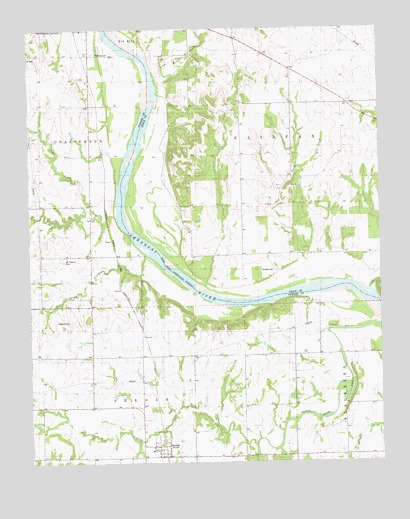
Skedee, OK USGS Topographic Map
Click on map above to begin viewing in our Map Viewer.

This topographic map contains these locations and features:
Feature Name Type Latitude Longitude GNIS ID View Map
Coal CreekStreamN36.4459°W96.7195°1091507View Map
Coon CreekStreamN36.4484°W96.7298°1091656View Map
Crystal CreekStreamN36.3801°W96.6706°1091877View Map
Dry CreekStreamN36.4264°W96.6514°1092223View Map
Endicott CemeteryCemeteryN36.4156°W96.7409°1092624View Map
Gray Horse CreekStreamN36.4795°W96.7053°1093345View Map
JobesPopulated PlaceN36.4389°W96.7209°1100539View Map
Mount Pleasant CemeteryCemeteryN36.4331°W96.7381°1095596View Map
P S O LakeReservoirN36.4238°W96.7049°1755295View Map
P S O Lake DamDamN36.4234°W96.7053°1755294View Map
Riverside CemeteryCemeteryN36.4928°W96.7272°1097226View Map
SkedeePopulated PlaceN36.3795°W96.7050°1098086View Map
Skedee Volunteer Fire DepartmentBuildingN36.3788°W96.7069°2657220View Map
Spring CreekStreamN36.4351°W96.7095°1098409View Map
Sycamore CreekStreamN36.4245°W96.6292°1098706View Map
Sycamore Fire DepartmentBuildingN36.4355°W96.6689°2657309View Map
Town of SkedeeCivilN36.3804°W96.7039°2413292View Map
Township of SkedeeCivilN36.3806°W96.7448°1824838View Map
Wheeler CemeteryCemeteryN36.4300°W96.6634°1099663View Map

Note: Coordinates in the location and feature list above are referenced to NAD83 datum.


Copyright (C) 2008-2025 Ryan Niemi / Sunset Dynamics ... All Rights Reserved