TopoQuest Logo
Do you find TopoQuest useful?
Help keep TopoQuest running and adding new maps/features by donating!
Bitcoin:  19c7KJd3qBynnjoSw5npx9KScwjBe4ifkT
Litecoin:  LXs6TkuXGGXo1vDsWCkWVdjQX94eUKd6ui
Home View Maps Find Maps Find Places Resources & Links


Slickear Mountain, Oregon Topographic Map

USGS Map Title: Slickear Mountain, OR
USGS Map MRC: 44119H3
DRG (GeoTIFF) Download: o44119h3.tif


Neighboring USGS Topographic Map Quads:


  Madison Butte, OR  
45119A4
 

  Lake Penland, OR  
45119A3
 

  Thompson Flat, OR  
45119A2
 

  Johnny Cake Mountain, OR  
44119H4
 

  Slickear Mountain, OR  
44119H3
 

  Ritter, OR  
44119H2
 

  Monument, OR  
44119G4
 

  Steet Mountain, OR  
44119G3
 

  Bullock Gulch, OR  
44119G2


Map MRC Location:

N45°
W120°
N45°
W119°
H8 H7 H6 H5 H4 H3 H2 H1
G8 G7 G6 G5 G4 G3 G2 G1
F8 F7 F6 F5 F4 F3 F2 F1
E8 E7 E6 E5 E4 E3 E2 E1
D8 D7 D6 D5 D4 D3 D2 D1
C8 C7 C6 C5 C4 C3 C2 C1
B8 B7 B6 B5 B4 B3 B2 B1
A8 A7 A6 A5 A4 A3 A2 A1
N44°
W120°
N44°
W119°

Slickear Mountain, OR USGS 1:24K Topographic Map Preview:
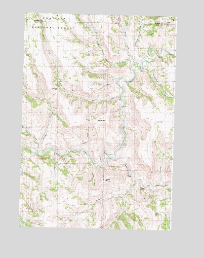
Slickear Mountain, OR USGS Topographic Map
Click on map above to begin viewing in our Map Viewer.

This topographic map contains these locations and features:
Feature Name Type Latitude Longitude GNIS ID View Map
Birch CreekStreamN44.9238°W119.3619°1138148View Map
Cabin CreekStreamN44.9188°W119.3633°1139103View Map
Cole CanyonValleyN44.9029°W119.2805°1139975View Map
Conger MountainSummitN44.8827°W119.2642°1144700View Map
Ditch CreekStreamN44.9518°W119.2953°1141057View Map
Elder FlatFlatN44.9838°W119.3489°1141720View Map
Fourmile GapGapN44.9549°W119.3472°1142371View Map
Graves CreekStreamN44.9743°W119.2878°1142989View Map
Jones CanyonValleyN44.9921°W119.3192°1144376View Map
Little Škáypiya CreekStreamN44.9632°W119.3005°1145264View Map
Mallory CreekStreamN44.9729°W119.2847°1145776View Map
Middle Fork John Day RiverStreamN44.9163°W119.3022°1146148View Map
Murphy MountainSummitN44.9379°W119.3058°1146682View Map
Potamus CreekStreamN44.9738°W119.2755°1147932View Map
Potamus RidgeRidgeN44.9943°W119.2642°1147934View Map
Reade CanyonValleyN44.9501°W119.3561°1148261View Map
Škáypiya CreekStreamN44.9624°W119.2972°1150239View Map
Slickear CanyonValleyN44.9118°W119.3147°1149688View Map
Slickear MountainSummitN44.9040°W119.3075°1149690View Map
Threemile CreekStreamN44.9024°W119.2608°1151189View Map
Troff CanyonValleyN44.8943°W119.2892°1151423View Map
Twomile CanyonValleyN44.9210°W119.3261°1151616View Map
Twomile GapGapN44.9385°W119.3194°1151620View Map
Wrightman CanyonValleyN44.9693°W119.2764°1152663View Map

Note: Coordinates in the location and feature list above are referenced to NAD83 datum.


Copyright (C) 2008-2024 Ryan Niemi / Sunset Dynamics ... All Rights Reserved