TopoQuest Logo
Do you find TopoQuest useful?
Help keep TopoQuest running and adding new maps/features by donating!
Bitcoin:  19c7KJd3qBynnjoSw5npx9KScwjBe4ifkT
Litecoin:  LXs6TkuXGGXo1vDsWCkWVdjQX94eUKd6ui
Home View Maps Find Maps Find Places Resources & Links


Ritter, Oregon Topographic Map

USGS Map Title: Ritter, OR
USGS Map MRC: 44119H2
DRG (GeoTIFF) Download: o44119h2.tif


Neighboring USGS Topographic Map Quads:


  Lake Penland, OR  
45119A3
 

  Thompson Flat, OR  
45119A2
 

  Deerhorn Creek, OR  
45119A1
 

  Slickear Mountain, OR  
44119H3
 

  Ritter, OR  
44119H2
 

  Meadow Brook Summit, OR  
44119H1
 

  Steet Mountain, OR  
44119G3
 

  Bullock Gulch, OR  
44119G2
 

  Flowers Gulch, OR  
44119G1


Map MRC Location:

N45°
W120°
N45°
W119°
H8 H7 H6 H5 H4 H3 H2 H1
G8 G7 G6 G5 G4 G3 G2 G1
F8 F7 F6 F5 F4 F3 F2 F1
E8 E7 E6 E5 E4 E3 E2 E1
D8 D7 D6 D5 D4 D3 D2 D1
C8 C7 C6 C5 C4 C3 C2 C1
B8 B7 B6 B5 B4 B3 B2 B1
A8 A7 A6 A5 A4 A3 A2 A1
N44°
W120°
N44°
W119°

Ritter, OR USGS 1:24K Topographic Map Preview:
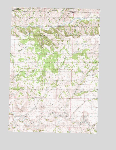
Ritter, OR USGS Topographic Map
Click on map above to begin viewing in our Map Viewer.

This topographic map contains these locations and features:
Feature Name Type Latitude Longitude GNIS ID View Map
Burn CanyonValleyN44.9890°W119.1603°1138972View Map
Deep CanyonValleyN44.9729°W119.2061°1140788View Map
Deer CreekStreamN44.9796°W119.2322°1140844View Map
Devils BackboneRidgeN44.9915°W119.1950°1140935View Map
Dickerson Ranch CemeteryCemeteryN44.8881°W119.1437°1152966View Map
Eightmile CreekStreamN44.8963°W119.1711°1141704View Map
Fisher CreekStreamN44.8896°W119.1630°1142177View Map
Iron Spring CreekStreamN44.9340°W119.1444°1144121View Map
Long CreekStreamN44.8874°W119.2355°1145398View Map
Monkey CreekStreamN44.9796°W119.2322°1146389View Map
Mud SpringSpringN44.9592°W119.2110°1146584View Map
Powell Hot SpringsSpringN44.8849°W119.1411°1153710View Map
RitterPopulated PlaceN44.8924°W119.1436°1148485View Map
Ritter CemeteryCemeteryN44.9111°W119.1480°1148487View Map
Ritter Grange (historical)BuildingN44.8940°W119.1939°1148488View Map
Ritter Hot SpringsSpringN44.8931°W119.1422°1155488View Map
Ritter Post OfficePost OfficeN44.8924°W119.1436°1165861View Map
Ritter School (historical)SchoolN44.8993°W119.1347°1148489View Map
Schoolcraft CreekStreamN44.9899°W119.1461°1149133View Map
Sixmile CreekStreamN44.8877°W119.2297°1149570View Map
Skull CreekStreamN44.9804°W119.2092°1149626View Map
Spring HollowValleyN44.9032°W119.2133°1150189View Map
Stony CreekStreamN44.9818°W119.1850°1150454View Map
Thompson CreekStreamN44.9143°W119.1608°1151098View Map
Threemile School (historical)SchoolN44.9331°W119.2239°1151194View Map
Twelvemile CreekStreamN44.8821°W119.1372°1151545View Map

Note: Coordinates in the location and feature list above are referenced to NAD83 datum.


Copyright (C) 2008-2024 Ryan Niemi / Sunset Dynamics ... All Rights Reserved