TopoQuest Logo
Do you find TopoQuest useful?
Help keep TopoQuest running and adding new maps/features by donating!
Bitcoin:  19c7KJd3qBynnjoSw5npx9KScwjBe4ifkT
Litecoin:  LXs6TkuXGGXo1vDsWCkWVdjQX94eUKd6ui
Home View Maps Find Maps Find Places Resources & Links


Smiths Bend, Texas Topographic Map

USGS Map Title: Smiths Bend, TX
USGS Map MRC: 31097G3
DRG (GeoTIFF) Download: o31097g3.tif


Neighboring USGS Topographic Map Quads:


  Allen Bend, TX  
31097H4
 

  Whitney, TX  
31097H3
 

  Peoria, TX  
31097H2
 

  Laguna Park, TX  
31097G4
 

  Smiths Bend, TX  
31097G3
 

  Aquilla, TX  
31097G2
 

  Valley Mills, TX  
31097F4
 

  China Springs, TX  
31097F3
 

  Gholson, TX  
31097F2


Map MRC Location:

N32°
W98°
N32°
W97°
H8 H7 H6 H5 H4 H3 H2 H1
G8 G7 G6 G5 G4 G3 G2 G1
F8 F7 F6 F5 F4 F3 F2 F1
E8 E7 E6 E5 E4 E3 E2 E1
D8 D7 D6 D5 D4 D3 D2 D1
C8 C7 C6 C5 C4 C3 C2 C1
B8 B7 B6 B5 B4 B3 B2 B1
A8 A7 A6 A5 A4 A3 A2 A1
N31°
W98°
N31°
W97°

Smiths Bend, TX USGS 1:24K Topographic Map Preview:
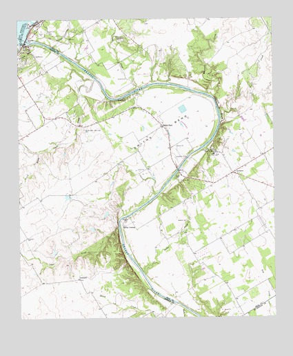
Smiths Bend, TX USGS Topographic Map
Click on map above to begin viewing in our Map Viewer.

This topographic map contains these locations and features:
Feature Name Type Latitude Longitude GNIS ID View Map
Burnett LakeReservoirN31.7702°W97.2870°1864782View Map
Burnett Lake DamDamN31.7702°W97.2870°1864781View Map
Cedar CreekStreamN31.7879°W97.3264°1373000View Map
Chalk BluffCliffN31.8379°W97.2770°1354257View Map
Coon CreekStreamN31.8496°W97.3378°1373196View Map
G J Roberts DamDamN31.8368°W97.2936°1861054View Map
G J Roberts LakeReservoirN31.8372°W97.2947°1861055View Map
GreenockPopulated PlaceN31.7663°W97.3456°1379858View Map
Iron CreekStreamN31.8463°W97.3161°1374231View Map
K Bar Lake Number 1ReservoirN31.7752°W97.3586°1863924View Map
K Bar Lake Number 1 DamDamN31.7752°W97.3586°1863923View Map
K Bar Lake Number 2ReservoirN31.7874°W97.3392°1863926View Map
K Bar Lake Number 2 DamDamN31.7868°W97.3386°1863925View Map
K Bar Lake Number 3ReservoirN31.7935°W97.3325°1863928View Map
K Bar Lake Number 3 DamDamN31.7935°W97.3320°1863927View Map
K Bar Lake Number 4ReservoirN31.8006°W97.3519°1863930View Map
K Bar Lake Number 4 DamDamN31.8018°W97.3503°1863929View Map
Latham Springs Bible CampLocaleN31.8196°W97.2797°1360976View Map
LebanonPopulated PlaceN31.8104°W97.2706°1380071View Map
Lebanon CemeteryCemeteryN31.7910°W97.2931°1361028View Map
Prairie Valley Bible CampLocaleN31.8663°W97.3250°1365743View Map
Riverside ParkParkN31.8729°W97.3647°1375763View Map
Sheek CreekStreamN31.7502°W97.2950°1368084View Map
Smiths BendPopulated PlaceN31.8302°W97.3045°1368511View Map
Smiths BendBendN31.8318°W97.3108°1368512View Map
Smiths Bend-Coon Creek CemeteryCemeteryN31.8288°W97.3431°1368513View Map
Snake CreekStreamN31.7677°W97.3136°1368539View Map
Soldiers Bluff ParkParkN31.8638°W97.3708°1376174View Map
Sosebees BluffCliffN31.8604°W97.3708°1376173View Map
South Prong Coon CreekStreamN31.8190°W97.3656°1376224View Map
Spivey CrossingPopulated PlaceN31.7885°W97.3245°1380582View Map
Tener CreekStreamN31.8332°W97.2761°1369703View Map
Whiterock CreekStreamN31.8432°W97.2825°1376768View Map
Whitney DamDamN31.8668°W97.3708°1371472View Map
Whitney DamDamN31.8502°W97.3670°1854274View Map

Note: Coordinates in the location and feature list above are referenced to NAD83 datum.


Copyright (C) 2008-2025 Ryan Niemi / Sunset Dynamics ... All Rights Reserved