TopoQuest Logo
Do you find TopoQuest useful?
Help keep TopoQuest running and adding new maps/features by donating!
Bitcoin:  19c7KJd3qBynnjoSw5npx9KScwjBe4ifkT
Litecoin:  LXs6TkuXGGXo1vDsWCkWVdjQX94eUKd6ui
Home View Maps Find Maps Find Places Resources & Links


Snowking Mountain, Washington Topographic Map

USGS Map Title: Snowking Mountain, WA
USGS Map MRC: 48121D3
DRG (GeoTIFF) Download: o48121d3.tif


Neighboring USGS Topographic Map Quads:


  Marblemount, WA  
48121E4
 

  Big Devil Peak, WA  
48121E3
 

  Eldorado Peak, WA  
48121E2
 

  Illabot Peaks, WA  
48121D4
 

  Snowking Mountain, WA  
48121D3
 

  Sonny Boy Lakes, WA  
48121D2
 

  Prairie Mountain, WA  
48121C4
 

  Huckleberry Mountain, WA  
48121C3
 

  Downey Mountain, WA  
48121C2


Map MRC Location:

N49°
W122°
N49°
W121°
H8 H7 H6 H5 H4 H3 H2 H1
G8 G7 G6 G5 G4 G3 G2 G1
F8 F7 F6 F5 F4 F3 F2 F1
E8 E7 E6 E5 E4 E3 E2 E1
D8 D7 D6 D5 D4 D3 D2 D1
C8 C7 C6 C5 C4 C3 C2 C1
B8 B7 B6 B5 B4 B3 B2 B1
A8 A7 A6 A5 A4 A3 A2 A1
N48°
W122°
N48°
W121°

Snowking Mountain, WA USGS 1:24K Topographic Map Preview:
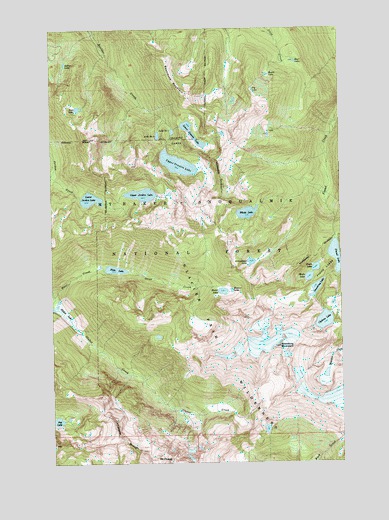
Snowking Mountain, WA USGS Topographic Map
Click on map above to begin viewing in our Map Viewer.

This topographic map contains these locations and features:
Feature Name Type Latitude Longitude GNIS ID View Map
Arrowhead LakeLakeN48.4325°W121.2901°1515959View Map
Basin LakeLakeN48.4864°W121.2819°1516177View Map
Bear LakeLakeN48.4902°W121.2701°1516268View Map
Buller LakeLakeN48.4899°W121.3697°1517081View Map
Cyclone LakeLakeN48.4155°W121.2587°1518443View Map
East Skagit DivisionCivilN48.4919°W121.3425°1939661View Map
Enjar LakeLakeN48.4242°W121.3024°1519349View Map
Fly LakeLakeN48.4821°W121.2887°1519665View Map
Foss LakeLakeN48.4771°W121.3642°1519713View Map
Found LakeLakeN48.4342°W121.2534°1519723View Map
Found LakesLakeN48.4301°W121.2579°1519724View Map
Granite LakesLakeN48.4679°W121.3221°1520223View Map
Hamar LakeLakeN48.4244°W121.2986°1520477View Map
Illabot LakeLakeN48.4204°W121.3738°1521139View Map
Jordan LakesLakeN48.4498°W121.3512°1529908View Map
Jordan LakesLakeN48.4522°W121.3368°1529449View Map
Jug LakeLakeN48.3873°W121.3745°1521491View Map
King LakeLakeN48.4113°W121.3306°1529818View Map
Lake Number 1LakeN48.4702°W121.3234°1533149View Map
Lake Number 2LakeN48.4692°W121.3297°1533151View Map
Lower Granite LakeLakeN48.4697°W121.3148°1522543View Map
Lower Jordan LakeLakeN48.4509°W121.3590°1522545View Map
Mount ChavalSummitN48.3773°W121.3304°1517642View Map
Neori LakeLakeN48.4309°W121.2620°1523622View Map
Otter CreekStreamN48.4221°W121.3732°1524095View Map
Razorback MountainSummitN48.4807°W121.3179°1524916View Map
Skaro LakeLakeN48.4281°W121.2651°1525855View Map
Slide LakeLakeN48.4307°W121.3488°1525939View Map
Snowking LakeLakeN48.4249°W121.2621°1526046View Map
Snowking MountainSummitN48.4082°W121.2779°1526047View Map
Upper Granite LakeLakeN48.4609°W121.3210°1527632View Map
Upper Jordan LakeLakeN48.4522°W121.3368°1527635View Map
Whale LakeLakeN48.4467°W121.2917°1528015View Map

Note: Coordinates in the location and feature list above are referenced to NAD83 datum.


Copyright (C) 2008-2024 Ryan Niemi / Sunset Dynamics ... All Rights Reserved